Šentvid pri Lukovici
Village in Upper Carniola, Slovenia
46°9′46.28″N 14°40′29.06″E / 46.1628556°N 14.6747389°E / 46.1628556; 14.6747389 Slovenia
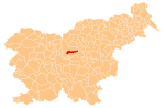
 (2002)
Šentvid pri Lukovici (pronounced [ʃɛnˈtʋiːt pɾi ˈluːkɔʋitsi] or [ʃənˈtʋiːt pɾi ˈluːkɔʋitsi]; German: Sankt Veit[2]) is a settlement in the Municipality of Lukovica in the eastern part of the Upper Carniola region of Slovenia.[3]
Name
The name of the settlement was changed from Šent Vid to Šentvid pri Lukovici in 1955.[4] In the past the German name was Sankt Veit.[2]
Church

The local church, which the settlement gets its name from, is dedicated to Saint Vitus (Slovene: sveti Vid).
References
- ^ Statistical Office of the Republic of Slovenia
- ^ a b Leksikon občin kraljestev in dežel zastopanih v državnem zboru, vol. 6: Kranjsko. 1906. Vienna: C. Kr. Dvorna in Državna Tiskarna, p. 22.
- ^ Lukovica municipal site
- ^ Spremembe naselij 1948–95. 1996. Database. Ljubljana: Geografski inštitut ZRC SAZU, DZS.
External links
 Media related to Šentvid pri Lukovici at Wikimedia Commons
- Šentvid pri Lukovici on Geopedia
- v
- t
- e
Municipality of Lukovica
Administrative seat: Lukovica pri Domžalah
- Janko Kersnik
- Janez Vesel (a.k.a. Jovan Koseski)
- Dragotin Lončar
- France Marolt
- Fran Maselj (a.k.a. Podlimbarski)
 | This article about the Municipality of Lukovica in Slovenia is a stub. You can help Wikipedia by expanding it. |
- v
- t
- e


