Angel's Perch

Angel's Perch
Custer County, Idaho, U.S.
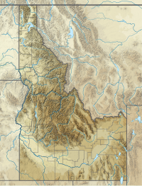
Angel's Perch, at 11,687 feet (3,562 m) above sea level is the 11th highest peak in the Pioneer Mountains of Idaho. The peak is located in Salmon-Challis National Forest and Custer County. It is the 32nd highest peak in Idaho and less than 2.3 mi (3.7 km) northwest of Standhope Peak.[2][3][4]
See also
 Idaho portal
 Mountains portal

References
- ^ a b "Angels Perch, Idaho". Peakbagger.com. Retrieved January 1, 2013.
- ^ "The 100 Highest Peaks". Idaho: A Climbing Guide. Retrieved January 1, 2013.
- ^ Sawtooth National Forest (Map) (1998 ed.). Sawtooth National Forest, U.S. Forest Service.
- ^ "Angels Perch". SummitPost.org. Retrieved January 1, 2013.
- v
- t
- e
- Cache Peak
- Graham Peak
- Mount Harrison
- Mount Independence
- Smoky Mountain
- Thunder Mountain
| Centennial Mountains |
|
|---|---|
| Clearwater Mountains |
|
- Black Pine Cone
- Black Pine Mountains High Point
- Black Pine Peak
- Steel Mountain
- Trinity Mountain
- Two Point Mountain
- Boulder Peak
- Cerro Ciento
- Easley Peak
- Glassford Peak
- Kent Peak
- Ryan Peak
| Selkirk Mountains |
|
|---|
- Bell Mountain
- Big Boy Peak
- Big Creek Peak
- Diamond Peak
- Flatiron Mountain
- Little Diamond Peak
- Nicholson Peak
- The Riddler
- Shoshone John Peak
- Borah Peak
- Donaldson Peak
- Leatherman Peak
- Little Regret Peak
- Lost River Peak
- Mount Breitenbach
- Mount Church
- Mount Idaho
- Mount McCaleb
- No Regret Peak
- USGS Peak
- Altair Peak
- Angel's Perch
- Brocky Peak
- Cobb Peak
- Devils Bedstead East
- Duncan's Peak
- Goat Mountain
- Hyndman Peak
- Old Hyndman Peak
- Pegasus Peak
- Pioneer Mountain
- Pyramid Peak
- Salzburger Spitzl
- Smiley Mountain
- Standhope Peak
- Alpine Peak
- Baron Peak
- Braxon Peak
- Cirque Lake Peak
- Dave's Peak
- Decker Peak
- El Capitan
- Elk Peak
- Grand Mogul
- Horstmann Peak
- Imogene Peak
- McDonald Peak
- McGowan Peak
- Merritt Peak
- Mickey's Spire
- Moolack Mountain
- Monte Verita
- Mount Carter
- Mount Cramer
- Mount Heyburn
- Mount Iowa
- Mount Limbert
- Mount Regan
- North Raker
- Packrat Peak
- Parks Peak (Blaine County)
- Payette Peak
- Sevy Peak
- Snowyside Peak
- Thompson Peak
- Warbonnet Peak
- Williams Peak (Custer County)
- Backdrop Peak
- Baker Peak
- Bald Mountain
- Bear Peak
- Big Peak
- Bromaghin Peak
- Buttercup Mountain
- Camas County Highpoint
- Carbonate Mountain
- Dollarhide Mountain
- Griffin Butte
- Kelly Mountain (Blaine County)
- Lower Titus Peak
- Mahoney Butte
- Norton Peak
- Paradise Peak
- Prairie Creek Peak
- Saviers Peak
- Skillern Peak
- Titus Peak
- Boardman Peak
- Iron Mountain
- Smoky Dome
- Snowbank Mountain
- Bible Back Mountain
- Blackmon Peak
- Calkins Peak
- Castle Peak
- Chinese Wall
- Croseus Peak
- D. O. Lee Peak
- Ebony Peak
- Fourth of July Peak (Custer County)
- Horton Peak
- Lonesome Lake Peak
- Lookout Mountain
- Merriam Peak
- Patterson Peak (Custer County)
- Peak 11,272
- Washington Peak
- Watson Peak (Custer County)
- White Cloud Peak 1
- White Cloud Peak 2
- White Cloud Peak 3
- White Cloud Peak 4
- White Cloud Peak 5
- White Cloud Peak 6
- White Cloud Peak 7
- White Cloud Peak 8
- White Cloud Peak 9
- White Cloud Peak 10
- Bear River Mountains
- Big Dick Point
- Blackfoot Mountains
- Brundage Mountain
- Caribou Mountains
- Chinese Peak
- Cotterel Mountains
- Devils Throne
- Devils Tooth
- Dirty Head
- Granite Peak
- Hoodoo Mountains
- Jim Sage Mountains
- Kings Peak
- The Ogre
- Owyhee Mountains
- Potato Hill
- Portneuf Range
- Puddin Mountain
- Ranger Peak
- Salmon River Mountains
- Seven Devils Mountains
- Shadow Butte
- She Devil
- Twin Imps
Municipalities and communities of Custer County, Idaho, United States | ||
|---|---|---|
County seat: Challis | ||
| Cities |  | |
| Unincorporated communities | ||
| Ghost towns | ||
| ||
State of Idaho | |
|---|---|
Boise (capital) | |
| Topics |
|
| Society | |
| Regions | |
| Larger cities | |
| Smaller cities | |
| Counties |
|
 Idaho portal Idaho portal | |
 | This Geographical stub article in Custer County, Idaho is a stub. You can help Wikipedia by expanding it. |
- v
- t
- e


