Antanamitarana
Place in Diana, Madagascar
12°23′S 49°18′E / 12.383°S 49.300°E / -12.383; 49.300 Madagascar
 (2016)[2]
202
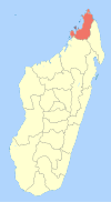
Antanamitarana is a rural municipality in Madagascar. It belongs to the district of Antsiranana II, which is a part of Diana Region. The population of the municipality was estimated to be approximately 6227 in 2016.
It is situated at 8 km South of Diego Suarez, on the National Road 6. The airport of Diego Suarez is in this municipality. 5 villages belong to this municipality: Maromagniry, Antafiamalama, Antanamitarana, Ambodimagnary and Ambodimanga.
-
 sunset
 -
 Western part of Fokontany Maromagniry
 -
 Catholic school of Maromagniry
 -
 School of EPP Ambodimanga, Antanamitarana
 -
 School of EPP Ambodimanga, Antanamitarana
References
- v
- t
- e
 Communes in the Diana Region of the Republic of Madagascar
- Ambalahonko
- Ambanja
- Ambaliha
- Ambodimanga
- Ambohimarina
- Ambohimena
- Ambohitrandriana
- Ankatafa
- Ankingameloko
- Anorotsangana
- Antafiambotry
- Antranokarany
- Antsakoamanondro
- Antsahabe (Ambanja)
- Antsatsaka
- Antsirabe
- Bemanevika Haut Sambirano
- Bemaneviky Ouest
- Benavony
- Djangoa
- Maevatanana, Diana
- Maherivaratra
- Marotolana
- Marovato

- Ambolobozobe
- Ambondrona
- Andrafiabe
- Andranofanjava
- Andranovondronina
- Anivorano Nord
- Ankarangona
- Anketrakabe
- Anivorano Nord
- Antanamitarana
- Antsahampano
- Antsalaka
- Antsiranana II
- Antsoha
- Bobakilandy
- Bobasakoa
- Joffreville
- Mahalina
- Mahavanona
- Mangaoka
- Mosorolava
- Ramena
- Sadjoavato
- Sakaramy
- Nosy Be
- Ambatozavavy
- Ampangorina
- Befotaka, Nosy Be
- Dzamandzar
5 districts; 51 communes

Wikimedia Commons has media related to Antanamitarana.
 | This Diana Region of Madagascar location article is a stub. You can help Wikipedia by expanding it. |
- v
- t
- e


