Arenas del Rey
Municipality in Andalusia, Spain

Flag

Seal
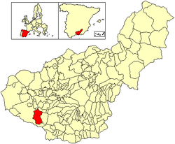
Location of Arenas del Rey
(2018)[1]
Arenas del Rey is a village located in the province of Granada, Spain. According to the 2006 census (INE), the city had a population of 1,231 inhabitants.[2]
The village is just north of the Sierras of Tejeda, Almijara and Alhama Natural Park.
Arenas del Rey was the worst affected village in the Andalusian earthquake of 25 December 1884. Almost 90% of the houses collapsed, and the rest were badly damaged. The whole village was a pile of rubble. The church and all other public buildings were destroyed. There were 135 deaths and 253 people were injured. The snowfall that followed caused up to three more deaths per day for over a week.[3]
-
 The church in Arenas del Rey after the earthquake

References
- v
- t
- e
Municipalities in the province of Granada
- Agrón
- Alamedilla
- Albolote
- Albondón
- Albuñán
- Albuñol
- Albuñuelas
- Aldeire
- Alfacar
- Algarinejo
- Alhama de Granada
- Alhendín
- Alicún de Ortega
- Almegíjar
- Almuñécar
- Alpujarra de la Sierra
- Alquife
- Arenas del Rey
- Armilla
- Atarfe
- Baza
- Beas de Granada
- Beas de Guadix
- Benalúa
- Benalúa de las Villas
- Benamaurel
- Bérchules
- Bubión
- Busquístar
- Cacín
- Cádiar
- Cájar
- La Calahorra
- Calicasas
- Campotéjar
- Cáñar
- Caniles
- Capileira
- Carataunas
- Cástaras
- Castilléjar
- Castril
- Cenes de la Vega
- Chauchina
- Chimeneas
- Churriana de la Vega
- Cijuela
- Cogollos de Guadix
- Cogollos Vega
- Colomera
- Cortes de Baza
- Cortes y Graena
- Cuevas del Campo
- Cúllar
- Cúllar Vega
- Darro
- Dehesas de Guadix
- Dehesas Viejas
- Deifontes
- Diezma
- Dílar
- Dólar
- Domingo Pérez de Granada
- Dúdar
- Dúrcal
- Escúzar
- Ferreira
- Fonelas
- Fornes
- Freila
- Fuente Vaqueros
- Las Gabias
- Galera
- Gobernador
- Gójar
- Gor
- Gorafe
- Granada
- Guadahortuna
- Guadix
- Los Guájares
- Gualchos
- Güéjar Sierra
- Güevéjar
- Huélago
- Huéneja
- Huéscar
- Huétor Santillán
- Huétor-Tájar
- Huétor Vega
- Íllora
- Ítrabo
- Iznalloz
- Játar
- Jayena
- Jérez del Marquesado
- Jete
- Jun
- Juviles
- Láchar
- Lanjarón
- Lanteira
- Lecrín
- Lentegí
- Lobras
- Loja
- Lugros
- Lújar
- La Malahá
- Maracena
- Marchal
- Moclín
- Molvízar
- Monachil
- Montefrío
- Montejícar
- Montillana
- Moraleda de Zafayona
- Morelábor
- Motril
- Murtas
- Nevada
- Nigüelas
- Nívar
- Ogíjares
- Orce
- Órgiva
- Otívar
- El Padul
- Pampaneira
- Pedro Martínez
- Peligros
- La Peza
- El Pinar
- Píñar
- Pinos Genil
- Pinos Puente
- Polícar
- Polopos
- Pórtugos
- Puebla de Don Fadrique
- Pulianas
- Purullena
- Quéntar
- Rubite
- Salar
- Salobreña
- Santa Cruz del Comercio
- Santa Fe
- Soportújar
- Sorvilán
- La Taha
- Torre-Cardela
- Torrenueva Costa
- Torvizcón
- Trevélez
- Turón
- Ugíjar
- Valderrubio
- El Valle
- Valle del Zalabí
- Válor
- Vegas del Genil
- Vélez de Benaudalla
- Ventas de Huelma
- Villa de Otura
- Villamena
- Villanueva Mesía
- Villanueva de las Torres
- Víznar
- Zafarraya
- Zagra
- La Zubia
- Zújar

Authority control databases | |
|---|---|
| International |
|
| National |
|
 | This article about a location in the province of Granada is a stub. You can help Wikipedia by expanding it. |
- v
- t
- e


