Bethany Memorial Airport
Airport

75K
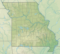
Location of airport in Missouri
Show map of Missouri
75K
75K (the United States)
Show map of the United States| Direction | Length | Surface | |
|---|---|---|---|
| ft | m | ||
| 3/21 | 2,255 | 687 | Asphalt |
| Aircraft operations | 82 |
|---|
Source: Federal Aviation Administration[1]
Bethany Memorial Airport (FAA LID: 75K) is a public use airport in Harrison County, Missouri.[1] It is owned by the city of Bethany and located two nautical miles (4 km) northeast of its central business district.[1]
Facilities and aircraft
Bethany Memorial Airport covers an area of 25 acres (10 ha) at an elevation of 1,035 feet (315 m) above mean sea level.[1] It has one runway designated 3/21 with an asphalt surface measuring 2,255 by 48 feet (687 x 15 m).[1] For the 12-month period ending June 30, 2011, the airport had 82 general aviation aircraft operations.[1]
See also
References
- ^ a b c d e f FAA Airport Form 5010 for 75K PDF. Federal Aviation Administration. Effective November 15, 2012.
External links
- Airport page at City of Bethany website
- "Bethany Memorial (75K)" (PDF). Archived from the original (PDF) on 2016-03-03. Retrieved 2014-03-15. at Missouri DOT Airport Directory
- Aerial image as of February 1996 from USGS The National Map
- Resources for this airport:
- FAA airport information for 75K
- AirNav airport information for 75K
- FlightAware airport information and live flight tracker
- SkyVector aeronautical chart for 75K


