Buôn Hồ
You can help expand this article with text translated from the corresponding article in Vietnamese. (October 2023) Click [show] for important translation instructions.
- View a machine-translated version of the Vietnamese article.
- Machine translation, like DeepL or Google Translate, is a useful starting point for translations, but translators must revise errors as necessary and confirm that the translation is accurate, rather than simply copy-pasting machine-translated text into the English Wikipedia.
- Do not translate text that appears unreliable or low-quality. If possible, verify the text with references provided in the foreign-language article.
- You must provide copyright attribution in the edit summary accompanying your translation by providing an interlanguage link to the source of your translation. A model attribution edit summary is
Content in this edit is translated from the existing Vietnamese Wikipedia article at [[:vi:Buôn Hồ]]; see its history for attribution. - You may also add the template
{{Translated|vi|Buôn Hồ}}to the talk page. - For more guidance, see Wikipedia:Translation.
Town in Đắk Lắk, Vietnam
Buôn Hồ Thị xã Buôn Hồ | |
|---|---|
Town (Class-4) | |
| Buôn Hồ town | |
 | |
 Seal | |
 Interactive map outlining Buôn Hồ | |
| Country |  Vietnam Vietnam |
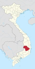
| Province | Đắk Lắk |
| Established | 23 December 2008 |
| Area | |
| • Total | 282.06 km2 (108.90 sq mi) |
| Population (2019) | |
| • Total | 127,920 |
| Time zone | UTC+7 (Indochina Time) |
| Website | www |
Buôn Hồ is a town (thị xã) of Đắk Lắk province in the Central Highlands of Vietnam. Until December 2008, the town was the southern portion of Krông Búk District.
Buôn Hồ is subdivided into seven wards (phường) and five communes (xã):
- Wards: Đạt Hiếu, An Lạc, An Bình, Thiện An, Đoàn Kết, Thống Nhất, Bình Tân
- Communes: Ea Siên, Ea Drông, Ea Blang, Bình Thuận, Cư Bao
As of December 2008, Buôn Hồ had a population of 101,554. The district covers an area of 282.06 km2.
Climate
| Climate data for Buôn Hồ, elevation 700 m (2,300 ft) | |||||||||||||
|---|---|---|---|---|---|---|---|---|---|---|---|---|---|
| Month | Jan | Feb | Mar | Apr | May | Jun | Jul | Aug | Sep | Oct | Nov | Dec | Year |
| Record high °C (°F) | 31.3 (88.3) | 34.2 (93.6) | 36.1 (97.0) | 36.6 (97.9) | 35.6 (96.1) | 32.9 (91.2) | 31.5 (88.7) | 31.5 (88.7) | 30.8 (87.4) | 30.0 (86.0) | 30.5 (86.9) | 29.8 (85.6) | 36.6 (97.9) |
| Mean daily maximum °C (°F) | 24.1 (75.4) | 26.8 (80.2) | 29.4 (84.9) | 30.9 (87.6) | 30.0 (86.0) | 28.2 (82.8) | 27.5 (81.5) | 27.1 (80.8) | 27.1 (80.8) | 26.3 (79.3) | 24.9 (76.8) | 23.3 (73.9) | 27.1 (80.8) |
| Daily mean °C (°F) | 18.8 (65.8) | 20.4 (68.7) | 22.6 (72.7) | 24.3 (75.7) | 24.3 (75.7) | 23.5 (74.3) | 22.9 (73.2) | 22.7 (72.9) | 22.6 (72.7) | 22.0 (71.6) | 20.8 (69.4) | 19.1 (66.4) | 22.0 (71.6) |
| Mean daily minimum °C (°F) | 16.0 (60.8) | 16.8 (62.2) | 18.5 (65.3) | 20.3 (68.5) | 20.9 (69.6) | 20.6 (69.1) | 20.2 (68.4) | 20.2 (68.4) | 20.1 (68.2) | 19.5 (67.1) | 18.5 (65.3) | 16.8 (62.2) | 19.0 (66.2) |
| Record low °C (°F) | 8.8 (47.8) | 11.1 (52.0) | 10.1 (50.2) | 15.8 (60.4) | 16.5 (61.7) | 18.0 (64.4) | 17.1 (62.8) | 17.7 (63.9) | 17.8 (64.0) | 13.8 (56.8) | 10.5 (50.9) | 8.5 (47.3) | 8.5 (47.3) |
| Average precipitation mm (inches) | 5.3 (0.21) | 6.2 (0.24) | 19.6 (0.77) | 88.6 (3.49) | 189.6 (7.46) | 204.4 (8.05) | 191.8 (7.55) | 261.4 (10.29) | 260.6 (10.26) | 190.5 (7.50) | 110.4 (4.35) | 29.6 (1.17) | 1,558.2 (61.35) |
| Average rainy days | 3.9 | 2.0 | 4.0 | 8.2 | 18.2 | 20.4 | 22.4 | 24.8 | 23.9 | 18.5 | 13.7 | 10.1 | 169.8 |
| Average relative humidity (%) | 84.4 | 79.8 | 76.4 | 76.1 | 81.6 | 86.4 | 88.3 | 89.8 | 89.6 | 89.3 | 88.9 | 88.1 | 84.9 |
| Mean monthly sunshine hours | 229.7 | 233.5 | 257.2 | 242.4 | 232.4 | 206.7 | 199.7 | 174.9 | 157.6 | 157.3 | 156.2 | 167.6 | 2,419.2 |
| Source: Vietnam Institute for Building Science and Technology[1] | |||||||||||||
References
- ^ "Vietnam Institute for Building Science and Technology" (PDF). Retrieved 16 August 2023.
- (in Vietnamese) Government Decree No. 07/NĐ-CP[permanent dead link] enacted on 23 December 2008 by the Government of Vietnam.
- v
- t
- e
Cities in Vietnam
| Special |
|
|---|---|
| Class-1 |
|
| Class-1 |
|---|
| Class-1 | |
|---|---|
| Class-2 | |
| Class-3 |
|
| ||
|---|---|---|
| Đắk Lắk province |
|  |
| Đắk Nông province | ||
| Gia Lai province | ||
| Kon Tum province | ||
| Lâm Đồng province | ||
※ denotes provincial seat. | ||
| ||
|---|---|---|
Capital: Buôn Ma Thuột | ||
| Buôn Ma Thuột |
|  |
| Buôn Hồ |
| |
| Buôn Đôn District | ||
| Cư Kuin District |
| |
| Cư M'gar District | ||
| Ea H'leo District | ||
| Ea Kar District | ||
| Ea Súp District |
| |
| Krông Ana District | ||
| Krông Bông District |
| |
| Krông Buk District |
| |
| Krông Năng District |
| |
| Krông Pắk District |
| |
| Lắk District |
| |
| M'Đrăk District | ||
12°51′16″N 108°16′13″E / 12.8544°N 108.2703°E / 12.8544; 108.2703
 | This article about a location in Đắk Lắk Province, Vietnam is a stub. You can help Wikipedia by expanding it. |
- v
- t
- e


