Bushehr County
County in Bushehr province, Iran
County in Bushehr, Iran
Bushehr County Persian: شهرستان بوشهر | |
|---|---|
County | |
 Location of Bushehr County in Bushehr province (left, purple) | |
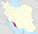
 Location of Bushehr province in Iran | |
| Coordinates: 29°01′N 50°58′E / 29.017°N 50.967°E / 29.017; 50.967[1] | |
| Country | Iran |
| Province | Bushehr |
| Capital | Bushehr |
| Districts | Central, Choghadak, Kharg |
| Area | |
| • Total | 1,386 km2 (535 sq mi) |
| Population (2016)[2] | |
| • Total | 298,594 |
| • Density | 220/km2 (560/sq mi) |
| Time zone | UTC+3:30 (IRST) |
| Bushehr County can be found at GEOnet Names Server, at this link, by opening the Advanced Search box, entering "9206090" in the "Unique Feature Id" form, and clicking on "Search Database". | |
Bushehr County (Persian: شهرستان بوشهر) is in Bushehr province, Iran. Its capital is the city of Bushehr.[3]
Demographics
Population
At the time of the 2006 National Census, the county's population was 216,087 in 53,173 households.[4] The following census in 2011 counted 258,906 people in 68,819 households.[5] At the 2016 census, the county's population was 298,594 in 85,523 households.[2]
In October 2018, the city of Choghadak and parts of Howmeh Rural District were separated from the Central District in the establishment of Choghadak District, which was divided into two rural districts and the city.[6]
Administrative divisions
Bushehr County's population history and administrative structure over three consecutive censuses are shown in the following table.
| Administrative Divisions | 2006[4] | 2011[5] | 2016[2] |
|---|---|---|---|
| Central District | 207,891 | 251,120 | 290,359 |
| Angali RD | 2,636 | 2,301 | 2,209 |
| Howmeh RD | 27,156 | 35,525 | 22,766 |
| Ali Shahr (city) | 23,178 | ||
| Bushehr (city) | 161,674 | 195,222 | 223,504 |
| Choghadak (city) | 16,425 | 18,072 | 18,702 |
| Choghadak District[a] | |||
| Chah Kutah RD | |||
| Doveyreh RD | |||
| Choghadak (city) | |||
| Kharg District | 8,196 | 7,722 | 8,193 |
| Kharg (city) | 8,196 | 7,722 | 8,193 |
| Total | 216,087 | 258,906 | 298,594 |
| RD = Rural District | |||
See also
![]() Media related to Bushehr County at Wikimedia Commons
Media related to Bushehr County at Wikimedia Commons
Notes
References
- ^ OpenStreetMap contributors (29 March 2023). "Bushehr County" (Map). OpenStreetMap. Retrieved 29 March 2023.
- ^ a b c "Census of the Islamic Republic of Iran, 1395 (2016)". AMAR (in Persian). The Statistical Center of Iran. p. 18. Archived from the original (Excel) on 3 August 2017. Retrieved 19 December 2022.
- ^ Habibi, Hassan (7 July 1369). "Approval of the organization and chain of citizenship of elements and units of country divisions of Bushehr province centered on Bushehr city". Lamtakam (in Persian). Ministry of Interior, Political Defense Commission of the Government Board. Archived from the original on 24 April 2024. Retrieved 24 April 2024.
- ^ a b "Census of the Islamic Republic of Iran, 1385 (2006)". AMAR (in Persian). The Statistical Center of Iran. p. 18. Archived from the original (Excel) on 20 September 2011. Retrieved 25 September 2022.
- ^ a b "Census of the Islamic Republic of Iran, 1390 (2011)". Syracuse University (in Persian). The Statistical Center of Iran. p. 18. Archived from the original (Excel) on 3 April 2023. Retrieved 19 December 2022.
- ^ a b Jahangiri, Ishaq (14 October 2018). "Approval letter regarding country divisions of Bushehr County, Bushehr province". Islamic Parliament Research Center of the Islamic Republic of Iran (in Persian). Ministry of Interior, Council of Ministers. Archived from the original on 28 October 2020. Retrieved 29 March 2023.
- v
- t
- e
Bushehr Province, Iran
| Asaluyeh County | |
|---|---|
| Bushehr County | |
| Dashtestan County | |
| Dashti County | |
| Deylam County | |
| Deyr County | |
| Ganaveh County | |
| Jam County | |
| Kangan County | |
| Tangestan County |
- Ghavam water tank (Ab Anbar of Ghavam)
- Khourmoj fire temple
- Boraazjan Castle
- Siraf
- Seensiz
- Rishahr
- Chehelkhaneh cave
- Bardak Siah Palace
- Saadat Mozaffari School
- Rais Ali Museum
- Bushehr anthropology Museum
- Gur-e-Dokhtar
 Bushehr County Bushehr County | |||||||||||||||||
|---|---|---|---|---|---|---|---|---|---|---|---|---|---|---|---|---|---|
| Capital | |||||||||||||||||
| Districts |
| ||||||||||||||||


