Campos Sales, Ceará
Municipality in Nordeste, Brazil
Campos Sales | |
|---|---|
Municipality | |
| Country |  Brazil Brazil |
| Region | Nordeste |
| State | Ceará |
| Mesoregion | Sul Cearense |
| Population (2020 [1]) | |
| • Total | 27,470 |
| Time zone | UTC−3 (BRT) |
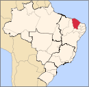
Campos Sales, Ceará is a municipality in the state of Ceará in the Northeast region of Brazil.[2][3][4][5]
Climate
| Climate data for Campos Sales (1981–2010) | |||||||||||||
|---|---|---|---|---|---|---|---|---|---|---|---|---|---|
| Month | Jan | Feb | Mar | Apr | May | Jun | Jul | Aug | Sep | Oct | Nov | Dec | Year |
| Mean daily maximum °C (°F) | 31.0 (87.8) | 30.1 (86.2) | 29.8 (85.6) | 29.5 (85.1) | 29.5 (85.1) | 29.5 (85.1) | 29.6 (85.3) | 31.0 (87.8) | 32.8 (91.0) | 33.8 (92.8) | 33.5 (92.3) | 32.6 (90.7) | 31.1 (88.0) |
| Daily mean °C (°F) | 25.4 (77.7) | 24.6 (76.3) | 24.2 (75.6) | 24.0 (75.2) | 23.7 (74.7) | 23.3 (73.9) | 23.4 (74.1) | 24.4 (75.9) | 26.0 (78.8) | 27.2 (81.0) | 27.3 (81.1) | 26.7 (80.1) | 25.0 (77.0) |
| Mean daily minimum °C (°F) | 20.9 (69.6) | 20.4 (68.7) | 20.2 (68.4) | 19.9 (67.8) | 19.2 (66.6) | 18.6 (65.5) | 18.6 (65.5) | 18.8 (65.8) | 19.9 (67.8) | 21.2 (70.2) | 21.6 (70.9) | 21.5 (70.7) | 20.1 (68.2) |
| Average precipitation mm (inches) | 99.0 (3.90) | 111.7 (4.40) | 137.6 (5.42) | 109.4 (4.31) | 35.0 (1.38) | 4.8 (0.19) | 5.4 (0.21) | 0.9 (0.04) | 2.1 (0.08) | 10.3 (0.41) | 19.8 (0.78) | 63.1 (2.48) | 599.1 (23.59) |
| Average precipitation days (≥ 1.0 mm) | 8 | 9 | 12 | 10 | 5 | 1 | 1 | 0 | 1 | 1 | 2 | 5 | 55 |
| Average relative humidity (%) | 68.1 | 75.7 | 79.5 | 80.1 | 72.9 | 65.6 | 60.1 | 53.1 | 46.4 | 45.6 | 50.4 | 56.6 | 62.8 |
| Mean monthly sunshine hours | 190.8 | 162.0 | 182.2 | 192.2 | 230.3 | 248.4 | 268.1 | 291.4 | 278.7 | 270.5 | 251.6 | 222.4 | 2,788.6 |
| Source: Instituto Nacional de Meteorologia[6] | |||||||||||||
See also
References
- ^ IBGE 2020
- ^ "Divisão Territorial do Brasil" (in Portuguese). Divisão Territorial do Brasil e Limites Territoriais, Instituto Brasileiro de Geografia e Estatística (IBGE). July 1, 2008. Retrieved December 17, 2009.
- ^ "Estimativas da população para 1º de julho de 2009" (PDF) (in Portuguese). Estimativas de População, Instituto Brasileiro de Geografia e Estatística (IBGE). August 14, 2009. Retrieved December 17, 2009.
- ^ "Ranking decrescente do IDH-M dos municípios do Brasil" (in Portuguese). Atlas do Desenvolvimento Humano, Programa das Nações Unidas para o Desenvolvimento (PNUD). 2000. Archived from the original on October 3, 2009. Retrieved December 17, 2009.
- ^ "Produto Interno Bruto dos Municípios 2002-2005" (PDF) (in Portuguese). Instituto Brasileiro de Geografia e Estatística (IBGE). December 19, 2007. Archived from the original (PDF) on October 2, 2008. Retrieved December 17, 2009.
- ^ "Normais Climatológicas Do Brasil 1981–2010" (in Portuguese). Instituto Nacional de Meteorologia. Retrieved 21 May 2024.
- v
- t
- e

Capital: Fortaleza
Centro-Sul Cearense | |||||||
|---|---|---|---|---|---|---|---|
| |||||||
Jaguaribe | |||||||||
|---|---|---|---|---|---|---|---|---|---|
| |||||||||
Metropolitana de Fortaleza | |||||
|---|---|---|---|---|---|
| |||||
Noroeste Cearense | |||||||||||||||
|---|---|---|---|---|---|---|---|---|---|---|---|---|---|---|---|
| |||||||||||||||
Norte Cearense | |||||||||||||||||
|---|---|---|---|---|---|---|---|---|---|---|---|---|---|---|---|---|---|
| |||||||||||||||||
Sertoes Cearenses | |||||||||
|---|---|---|---|---|---|---|---|---|---|
| |||||||||
Sul Cearense | |||||||||||
|---|---|---|---|---|---|---|---|---|---|---|---|
| |||||||||||
7°04′26″S 40°22′33″W / 7.07389°S 40.37583°W / -7.07389; -40.37583
 | This Ceará, Brazil location article is a stub. You can help Wikipedia by expanding it. |
- v
- t
- e


