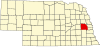
Cedar Bluffs, Nebraska
Village in Saunders County, Nebraska, United States
Village in Nebraska, United States
41°23′50″N 96°36′35″W / 41.39722°N 96.60972°W / 41.39722; -96.60972 (2020)
68015
Cedar Bluffs is a village in Saunders County, Nebraska, United States. The population was 615 at the 2020 census. Cedar Bluffs was a point on the Mormon, Oregon, and California Trails.
History
Cedar Bluffs was established in 1886 when the Chicago & North Western Railroad was extended to that point.[3] It was named from a prominent river bluff covered with cedar trees.[4][5]
Geography
According to the United States Census Bureau, the village has a total area of 0.39 square miles (1.01 km2), all land.[6]
Demographics
| Census | Pop. | Note | %± |
|---|---|---|---|
| 1890 | 181 | — | |
| 1900 | 371 | 105.0% | |
| 1910 | 500 | 34.8% | |
| 1920 | 516 | 3.2% | |
| 1930 | 517 | 0.2% | |
| 1940 | 504 | −2.5% | |
| 1950 | 505 | 0.2% | |
| 1960 | 585 | 15.8% | |
| 1970 | 616 | 5.3% | |
| 1980 | 632 | 2.6% | |
| 1990 | 591 | −6.5% | |
| 2000 | 615 | 4.1% | |
| 2010 | 610 | −0.8% | |
| 2020 | 615 | 0.8% | |
| U.S. Decennial Census[7] | |||
2010 census
As of the census[8] of 2010, there were 610 people, 231 households, and 165 families living in the village. The population density was 1,564.1 inhabitants per square mile (603.9/km2). There were 254 housing units at an average density of 651.3 per square mile (251.5/km2). The racial makeup of the village was 96.6% White, 0.8% Native American, 0.2% Asian, 0.8% from other races, and 1.6% from two or more races. Hispanic or Latino of any race were 1.8% of the population.
There were 231 households, of which 36.8% had children under the age of 18 living with them, 55.8% were married couples living together, 10.0% had a female householder with no husband present, 5.6% had a male householder with no wife present, and 28.6% were non-families. 23.4% of all households were made up of individuals, and 12.6% had someone living alone who was 65 years of age or older. The average household size was 2.64 and the average family size was 3.10.
The median age in the village was 39 years. 26.6% of residents were under the age of 18; 8.5% were between the ages of 18 and 24; 22.2% were from 25 to 44; 26.7% were from 45 to 64; and 16.1% were 65 years of age or older. The gender makeup of the village was 51.5% male and 48.5% female.
2000 census
As of the census of 2000, there were 615 people, 247 households, and 171 families living in the village. The population density was 1,545.7 inhabitants per square mile (596.8/km2). There were 260 housing units at an average density of 653.5 per square mile (252.3/km2). The racial makeup of the village was 99.02% White, 0.16% African American, 0.49% Native American, and 0.33% from two or more races. Hispanic or Latino of any race were 0.16% of the population.
There were 247 households, out of which 32.4% had children under the age of 18 living with them, 54.7% were married couples living together, 10.5% had a female householder with no husband present, and 30.4% were non-families. 26.7% of all households were made up of individuals, and 10.9% had someone living alone who was 65 years of age or older. The average household size was 2.49 and the average family size was 2.98.
In the village, the population was spread out, with 29.8% under the age of 18, 5.0% from 18 to 24, 25.9% from 25 to 44, 22.8% from 45 to 64, and 16.6% who were 65 years of age or older. The median age was 38 years. For every 100 females, there were 103.6 males. For every 100 females age 18 and over, there were 103.8 males.
As of 2000 the median income for a household in the village was $35,526, and the median income for a family was $39,271. Males had a median income of $30,455 versus $20,227 for females. The per capita income for the village was $14,738. About 4.0% of families and 6.6% of the population were below the poverty line, including 6.5% of those under age 18 and 5.7% of those age 65 or over.
See also
 Nebraska portal

References
- ^ "ArcGIS REST Services Directory". United States Census Bureau. Retrieved September 18, 2022.
- ^ a b U.S. Geological Survey Geographic Names Information System: Cedar Bluffs, Nebraska
- ^ "Cedar Bluffs, Saunders County". Center for Advanced Land Management Information Technologies. University of Nebraska. Retrieved August 23, 2014.
- ^ Fitzpatrick, Lillian L. (1960). Nebraska Place-Names. University of Nebraska Press. p. 126. ISBN 0-8032-5060-6. A 1925 edition is available for download at University of Nebraska—Lincoln Digital Commons.
- ^ Chicago and North Western Railway Company (1908). A History of the Origin of the Place Names Connected with the Chicago & North Western and Chicago, St. Paul, Minneapolis & Omaha Railways. p. 54.
- ^ "US Gazetteer files 2010". United States Census Bureau. Archived from the original on January 25, 2012. Retrieved June 24, 2012.
- ^ United States Census Bureau. "Census of Population and Housing". Retrieved October 19, 2013.
- ^ "U.S. Census website". United States Census Bureau. Retrieved June 24, 2012.
External links
![]() Media related to Cedar Bluffs, Nebraska at Wikimedia Commons
Media related to Cedar Bluffs, Nebraska at Wikimedia Commons
- v
- t
- e
Municipalities and communities of Saunders County, Nebraska, United States
County seat: Wahoo
communities
- Nebraska portal
- United States portal
Metropolitan area of Omaha–Council Bluffs | ||||||
|---|---|---|---|---|---|---|
| Primary cities |
|  | ||||
| Cities over 10,000 (per 2010 census) |
| |||||
| Cities of 5,000 to 10,000 (per 2010 census) |
| |||||
| Cities of 1,000 to 5,000 (per 2010 census) |
| |||||
| Census-designated places |
| |||||
| Cities and villages of fewer than 1,000 (per 2010 census) |
| |||||
| Counties |
| |||||
Authority control databases | |
|---|---|
| International |
|
| National |
|


