Darden, Tennessee
Census-designated place in Tennessee, United States
35°38′17″N 88°13′01″W / 35.63806°N 88.21694°W / 35.63806; -88.21694 (2020)[2]
38328
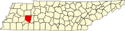
Darden is an unincorporated community and census-designated place (CDP) in Henderson County, Tennessee, United States.[3] As of the 2010 census, its population was 399.[4] The ZIP code is 38328.[5]
Demographics
| Census | Pop. | Note | %± |
|---|---|---|---|
| 2020 | 364 | — | |
| U.S. Decennial Census[6] | |||
Notes
- ^ "ArcGIS REST Services Directory". United States Census Bureau. Retrieved October 15, 2022.
- ^ "Census Population API". United States Census Bureau. Retrieved October 15, 2022.
- ^ a b "Darden, Tennessee". Geographic Names Information System. United States Geological Survey, United States Department of the Interior.
- ^ "U.S. Census website". United States Census Bureau. Retrieved May 14, 2011.
- ^ United States Postal Service (2012). "USPS - Look Up a ZIP Code". Retrieved February 15, 2012.
- ^ "Census of Population and Housing". Census.gov. Retrieved June 4, 2016.
- v
- t
- e
Municipalities and communities of Henderson County, Tennessee, United States
County seat: Lexington
- Chesterfield
- Darden
- Huron
- Luray
- Wildersville
communities
‡This populated place also has portions in an adjacent county or counties
- Tennessee portal
- United States portal
 | This Henderson County, Tennessee geography–related article is a stub. You can help Wikipedia by expanding it. |
- v
- t
- e


