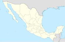
Engineer Manuel Moreno Torres National Airport


| Direction | Length | Surface | |
|---|---|---|---|
| m | ft | ||
| 03/21 | 2,000 | 6,562 | Asphalt |
| Total Passengers | N/A |
|---|
Matehuala Airfield (Spanish: Aeropuerto de Matehuala), officially Aeropuerto Nacional Ingeniero Manuel Moreno Torres (Engineer Manuel Moreno Torres National Airport) (IATA: MTH, ICAO: MM67) is an airfield located in Matehuala, San Luis Potosí, Mexico. It handles domestic air traffic for the city of Matehuala, serving flight training and general aviation activities. It is operated by Patronato de la Aeropista Municipal de Matehuala. The airport does not provide scheduled passenger public services. The nearest airport serving commercial flights is San Luis Potosí International Airport.
The airport is situated at an elevation of 1,550 metres (5,090 ft) above mean sea level, located within the Matehuala urban area. It features a single asphalt runway, designated as 03/21, measuring 2,000 by 30 metres (6,562 by 98 ft). Adjacent facilities include a small apron and several hangars.[2]
See also
- List of the busiest airports in Mexico
- List of airports in Mexico
- List of airports by ICAO code: M
- List of busiest airports in North America
- List of the busiest airports in Latin America
- Transportation in Mexico
- Tourism in Mexico
- San Luis Potosí International Airport
References
External links
- Aeronautical chart and airport information for MM67 at SkyVector
- Current weather for MM67 at NOAA/NWS
- v
- t
- e
- Campeche
- Chetumal
- Ciudad del Carmen
- Ciudad Juárez
- Ciudad Obregón
- Ciudad Victoria
- Ciudad Constitución
- Colima
- Ensenada
- Guasave Airfield
- Guaymas
- Guerrero Negro
- Isla de Cedros
- Ixtepec
- La Paz
- Los Mochis
- Matamoros
- Mexicali
- Minatitlán/Coatzacoalcos
- Nuevo Laredo
- Palenque
- Piedras Negras
- Poza Rica
- Puerto Escondido
- Puerto Peñasco
- Reynosa
- Tapachula
- Tepic
- Toluca/Mexico City
- Villahermosa
- Acapulco-Pie de la Cuesta Air Force Base
- Atlangatepec Air Force Station
- Celaya
- Chichen Itza
- Chilpancingo Airfield
- Ciudad Acuña
- Ciudad Mante Airfield
- Cuernavaca
- El Fuerte Airfield
- Isla Mujeres Airfield
- Holbox Airstrip
- Lagos de Moreno Airfield
- Lázaro Cárdenas
- Matehuala Airfield
- Monclova
- Monterrey-Del Norte
- Navojoa Airfield
- Nogales
- Nuevo Casas Grandes Airfield
- Pachuca
- Pátzcuaro Airfield
- Saltillo
- San Felipe
- Santa Gertrudis Air Force Base
- Tamuín
- Tehuacán
- Tuxtla Gutierrez Air Force Base
- Xalapa
- Zapopan Air Force Base
- Busiest airports in Mexico
- List of airports in Mexico
- List of airports by ICAO code: M
- Busiest airports in North America
- Busiest airports in Latin America
- List of airports in Baja California
- List of airports in Baja California Sur
- Airfields and airstrips
- Mexican Air Force
- Mexican Naval Aviation
- Transportation in Mexico
- Tourism in Mexico
- List of airlines of Mexico
- Airline destinations: Mexico


