Farmakas
Village in Nicosia District, Cyprus
Farmakas Φαρμακάς | |
|---|---|
village | |
| 34°54′43″N 33°8′10″E / 34.91194°N 33.13611°E / 34.91194; 33.13611 | |
| Country |  Cyprus Cyprus |
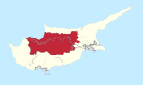
| District | Nicosia District |
| Elevation | 3,219 ft (981 m) |
| Population (2001)[1] | |
| • Total | 507 |
| Time zone | UTC+2 (EET) |
| • Summer (DST) | UTC+3 (EEST) |
| Website | farmakas.org |
Farmakas (Greek: Φαρμακάς) is a village in the Nicosia District of Cyprus, located around 5 km east of the village of Palaichori Oreinis.


It is a fragment of a fully developed oceanic crust, consisting of plutonic, intrusive and volcanic rocks and chemical sediments. The stratigraphic completeness of the ophiolite makes it unique. It was created during the complex process of sea-floor spreading and formation of oceanic crust and was emerged and placed in its present position through complicated tectonic processes related to the collision of the Eurasian plate to the north and the African plate to the south.
The Troodos Ophiolite has a very significant role for the water budget of the island. Most of the rocks, especially the gabbros and the sheeted dykes are good aquifers due to fracturing. The perennial rivers running radially are feeding the main aquifers in the periphery of the Troodos and the plains.[2]
See also
References
- v
- t
- e
- Agia
- Agia Eirini
- Agia Marina
- Agia Marina (Skylloura)
- Agia Varvara
- Agioi Iliofotoi
- Agioi Trimithias
- Agios Epifanios Oreinis
- Agios Epifanios Soleas
- Agios Georgios
- Agios Georgios Lefkas
- Agios Ioannis (Selemani)
- Agios Ioannis Malountas
- Agios Nikolaos Lefkas
- Agios Sozomenos
- Agios Theodoros, Nicosia
- Agios Theodoros Tilliria
- Agios Vasileios
- Agrokipia
- Akaki
- Alampra
- Alevga
- Alithinou
- Alona
- Ammadies
- Ambelikou
- Analiontas
- Anageia
- Angolemi
- Anthoupolis
- Apliki
- Arediou
- Argaki
- Askas
- Astromeritis
- Avlona
- Beykeuy
- Deneia
- Dyo Potamoi
- Elia
- Epicho
- Episkopeio
- Ergates
- Evrychou
- Exometochi
- Farmakas
- Fikardou
- Flasou
- Fterikoudi
- Fyllia
- Galata
- Galini
- Gerakies
- Gerolakkos
- Gönyeli
- Gourri
- Hamitköy
- Haspolat
- Kakopetria
- Kaliana
- Kalo Chorio Kapouti
- Kalo Chorio Oreinis
- Kalo Chorio Soleas
- Kalopanagiotis
- Kalyvakia
- Kampi
- Kampia
- Kampos
- Kanlıköy
- Kannavia
- Kapedes
- Karavostasi
- Kataliontas
- Kato Deftera
- Katokopia
- Kato Koutrafas
- Kato Moni
- Kato Pyrgos
- Kato Zodeia
- Katydata
- Kazivera
- Trachonas
- Klirou
- Kokkina
- Kokkinotrimithia
- Korakou
- Kotsiatis
- Kourou Monastiri
- Kyra
- Lagoudera
- Lazanias
- Lefka
- Linou
- Livadia
- Louroujina
- Loutros
- Lympia
- Lythrodontas
- Malounta
- Mammari
- Mansoura
- Margi
- Margo
- Masari
- Mathiatis
- Meniko
- Mylikouri
- Mitsero
- Mora
- Mosfileri
- Moutoullas
- Neo Chorio
- Nikitari
- Nikitas
- Nisou
- Oikos
- Orounta
- Ortaköy
- Pachyammos
- Palaichori Morphou
- Palaichori Oreinis
- Palaikythro
- Paliometocho
- Pano Deftera
- Pano Koutrafas
- Pano Pyrgos
- Pano Zodeia
- Pedoulas
- Pentageia
- Pera
- Pera Chorio
- Peristerona
- Peristeronari
- Petra
- Pigenia
- Platanistasa
- Politiko
- Polystypos
- Potami
- Potamia
- Prastio
- Psimolofou
- Pyrogi
- Saranti
- Selladi tou Appi
- Sia
- Sinaoros
- Skouriotissa
- Skylloura
- Spilia
- Syrianochori
- Temvria
- Trachoni
- Tsakistra
- Tseri
- Tymbou
- Variseia
- Voni
- Vroisha
- Vyzakia
- Xerovounos
- Xyliatos
- Yeniceköy
External links
- Official Farmakas Website
- Official Website by the Cyprus Tourism Organisation
- Troodos (General Area) Museums
- Farmakas Water official website Archived 2018-08-04 at the Wayback Machine
- Awarded "EDEN - European Destinations of Excellence" non traditional tourist destination 2007


