Gördes
District and municipality in Manisa, Turkey
38°55′58″N 28°17′25″E / 38.93278°N 28.29028°E / 38.93278; 28.29028 (2022)[1]
45750
Gördes is a municipality and district of Manisa Province, Turkey.[2] Its area is 902 km2,[3] and its population is 26,458 (2022).[1] The town lies at an elevation of 670 m (2,198 ft).
History
Gördes has been held by the Persians, Macedonians, Roman and Byzantine empires, and in 1071AD passed to the Turks. From 1867 until 1922, Gördes was part of the Aidin Vilayet of the Ottoman Empire.
Composition
There are 64 neighbourhoods in Gördes District:[4]
- Adnan Menderes
- Akpınar
- Atatürk
- Balıklı
- Bayat
- Beğel
- Beğenler
- Benlieli
- Beşeylül
- Börez
- Boyalı
- Çağlayan
- Çatalarmut
- Çiçekli
- Çiğiller
- Cuma
- Dalkara
- Dargıl
- Deliçoban
- Dereçiftlik
- Dikilitaş
- Divan
- Doğanpınar
- Dutluca
- Efendili
- Evciler
- Fundacık
- Gülpınar
- Güneşli
- Hüseynibaba
- Kabakoz
- Kalemoğlu
- Karaağaç
- Karakeçili
- Karayağcı
- Karayakup
- Kaşıkçı
- Kayacık
- Kılcanlar
- Kıranköy
- Kıymık
- Kızıldam
- Kobaklar
- Korubaşı
- Köseler
- Kürekçi
- Kuşlukköy
- Kuyucakkarapınar
- Malaz
- Malkoca
- Nakıpağa
- Oğulduruk
- Pınarbaşı
- Şahinkaya
- Salur
- Sarıaliler
- Şeyhyayla
- Tepeköy
- Tüpüler
- Ulgar
- Uzunçam
- Yakaköy
- Yeniköy
- Yeşilyurt
Economy
Gördes is one of the handmade Turkish carpet production centers in Manisa. Gördes carpets have different pattern and styles. See: Ghiordes knot.
The main source of income is tobacco and poppy production and wheat, barley is grown. In recent years production of cherries, strawberries has begun production. Other crops include potatoes, peas, tomatoes and cucumbers and wine.
In addition, olive, quince and persimmon cultivation are also carried out in Gördes.[5]
The area has mining with Coal and Zeolite being the main deposits but kaolin, nickel-iron, titanium beds are also available. In addition, feldspar, marble, kyanite, chalcedony, Chromium, quartz and boron are among the minerals mined in the region.
References
- ^ a b "Address-based population registration system (ADNKS) results dated 31 December 2022, Favorite Reports" (XLS). TÜİK. Retrieved 12 July 2023.
- ^ Büyükşehir İlçe Belediyesi, Turkey Civil Administration Departments Inventory. Retrieved 12 July 2023.
- ^ "İl ve İlçe Yüz ölçümleri". General Directorate of Mapping. Retrieved 12 July 2023.
- ^ Mahalle, Turkey Civil Administration Departments Inventory. Retrieved 19 September 2023.
- ^ Gazete, Banka (23 November 2021). "Manisa Büyükşehir Belediyesinden üreticilere destek". Gazete Banka. p. https://gazetebanka.com/. Retrieved 23 November 2021.
External links
- District municipality's official website (in Turkish)
- Road map of Gördes and environs
- Various images of Gördes, Manisa
- v
- t
- e
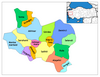
Gördes in Manisa Province of Turkey

| Istanbul | |
|---|---|
| West Marmara | |
| Aegean | |
| East Marmara | |
| West Anatolia | |
| Mediterranean | |
| Central Anatolia | |
| West Black Sea | |
| East Black Sea | |
| Northeast Anatolia | |
| Central East Anatolia | |
| Southeast Anatolia | |
Metropolitan municipalities are bolded.
 | This article about an Aegean Region of Turkey location is a stub. You can help Wikipedia by expanding it. |
- v
- t
- e


