Hart, County Durham
Human settlement in England
- Hartlepool
- County Durham
- North East
- Hartlepool
- List of places
- UK
- England
- County Durham
Hart is a village and civil parish in County Durham, England, northwest of Hartlepool.
History
Evidence of occupation in Hart can be seen from 6000 BC, with farming first appearing around 3500 BC.[2] By 1000 BC the area was more extensively settled, including farming buildings and field systems.[2] Activity increased around 650 AD with the establishment of St Hilda's Monastery in Hartlepool. The monastery was destroyed by Vikings in the 9th and 10th centuries, whose lords continued to inhabit Hart.[3]
Robert de Brus I gained control of the area in around 1119, with control passing to the Clifford family in 1306 following Robert de Brus VII's attempt on the Scottish throne.[4]
In 1587 the parish suffered from the plague, and it was noted in the parish register that "89 corpses were buried, whereof tenne were strangers". In 1652 John Pasmore was buried "on Black Monday 29 March. There was a star appeared in the South-east, ye sun eclipsed."[5]
In 1596 Ellen Thompson was condemned as a witch and buried under the stile of St Mary Magdalene church (the mother church of St Hilda's) at the east entrance to the churchyard.[6] Another woman, known as Old Mother Midnight of Elwick, may have been buried in the same place in 1641. Other Hart women accused of witchcraft include Helen de Inferno (1454) and Alison Lawe (1582).[7]
The Jesuit Thomas Ellerker was born in Hart in 1738.[8]
In May 2021, the parish council alongside the parish councils of the villages of Elwick, Dalton Piercy and Greatham all issued individual votes of no confidence in Hartlepool Borough Council, and expressed their desire to re-join County Durham.[9]
Manor house and church
In the late 1100s the de Brus family build the manor house and chapel; the latter remains as the basis of the St Mary Magdalene Church.[10] Following Robert Brus VII's attempt on the Scottish throne in 1306 the manor farm is one of the assets seized by the English authorities and given to the Clifford family.[11] The Cliffords hold ownership until 1586, when it is sold to John Lord Lumley, and it is sold to Sir George Pocock in 1770.[11] In 1830 the estate passes to William Henry, Duke of Cleveland, and is subsequently inherited by Frederick Aclom Milbank, whose family own the manor until at least 1928.[12] Only a little of the original manor and its associated buildings can still be seen,[13] including an 18th-century outbuilding wall and a section of 14th-century wall, which is a scheduled monument.[14]
The Norman-era St Mary Magdalene Church is Grade I listed[15] and has undergone significant modification since it was built, including the carving of St George and the Dragon on the south exterior wall.[16] The church is part of the Durham Diocese and is (current to 2017) a Church of England parish church.[17]
Bog
Just outside the village is Hart Bog, which is on the List of Sites of Special Scientific Interest in Cleveland.
Climate
Climate in this area has small differences between highs and lows and there is adequate rainfall year-round. The Köppen Climate Classification subtype for this climate is "Cfb" (Marine West Coast Climate/Oceanic climate).[18]
| Climate data for Hart | |||||||||||||
|---|---|---|---|---|---|---|---|---|---|---|---|---|---|
| Month | Jan | Feb | Mar | Apr | May | Jun | Jul | Aug | Sep | Oct | Nov | Dec | Year |
| Mean daily maximum °C (°F) | 7 (45) | 8 (46) | 10 (50) | 12 (54) | 15 (59) | 18 (64) | 21 (70) | 20 (68) | 17 (63) | 14 (57) | 10 (50) | 7 (45) | 13 (55) |
| Mean daily minimum °C (°F) | 3 (37) | 2 (36) | 3 (37) | 5 (41) | 7 (45) | 10 (50) | 12 (54) | 12 (54) | 10 (50) | 7 (45) | 4 (39) | 2 (36) | 6 (43) |
| Average precipitation days | 18 | 15 | 15 | 16 | 14 | 15 | 14 | 14 | 14 | 17 | 17 | 16 | 185 |
| Source: Weatherbase[19] | |||||||||||||
- Images of Hart Village
-
 Holme Farm
 -
 The White Hart Public House
 -
 Stepped sides of buildings in Hart Village
 -
 Burns Close
 -
 Parting of the ways
 -
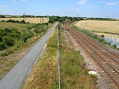 Hart village "station", former site


References
- ^ "Civil Parish population 2011". Retrieved 22 July 2015.
- ^ a b Horsley, Kevin (2009). "The Heritage of Hart Project 2009: A Historic Environment Survey of Hart, Hartlepool" (PDF). Tees Archaeology. p. 4. Retrieved 7 November 2017.
- ^ Horsley, Kevin (October 2009). "The Heritage of Hart Project 2009: A Historic Environment Survey of Hart, Hartlepool" (PDF). Tees Archaeology. p. 5. Retrieved 7 November 2017.
- ^ Horsley, Kevin (October 2009). "The Heritage of Hart Project 2009: A Historic Environment Survey of Hart, Hartlepool" (PDF). Tees Archaeology. p. 7. Retrieved 7 November 2017.
- ^ Willam Page (1928). "'Parishes: Hart', A History of the County of Durham: Volume 3 (1928), pp. 254-263". British History Online. Retrieved 9 March 2008.
- ^ "Surrounding Hartlepool are many picturesque villages ..." Destination Hartlepool. Archived from the original on 7 February 2012. Retrieved 9 March 2008.
- ^ "Hartlepool's own cast of Hogwarts characters". www.hartlepoolmail.co.uk. Retrieved 8 November 2017.
- ^ Thompson Cooper, 'Ellerker, Thomas (1738–1795)', rev. Robert Brown, Oxford Dictionary of National Biography, Oxford University Press, 2004 accessed 2 May 2011
- ^ Nic Marko (10 May 2021), Four Hartlepool villages have 'no confidence' in borough council and want to join Durham, Hartlepool: Hartlepool Mail
- ^ Horsley, Kevin (October 2009). "The Heritage of Hart Project 2009: A Historic Environment Survey of Hart, Hartlepool" (PDF). Tees Archaeology. pp. 5–6. Retrieved 7 November 2017.
- ^ a b Horsley, Kevin (October 2009). "The Heritage of Hart Project 2009: A Historic Environment Survey of Hart, Hartlepool" (PDF). Tees Archaeology. p. 6. Retrieved 7 November 2017.
- ^ Horsley, Kevin (October 2009). "The Heritage of Hart Project 2009: A Historic Environment Survey of Hart, Hartlepool" (PDF). Tees Archaeology. p. 7. Retrieved 7 November 2017.
- ^ Horsley, Kevin (October 2009). "The Heritage of Hart Project 2009: A Historic Environment Survey of Hart, Hartlepool" (PDF). Tees Archaeology. p. 7. Retrieved 7 November 2017.
- ^ Horsley, Kevin (October 2009). "The Heritage of Hart Project 2009: A Historic Environment Survey of Hart, Hartlepool" (PDF). Tees Archaeology. pp. 25–26. Retrieved 7 November 2017.
- ^ Historic England. "CHURCH OF ST MARY MAGDALENE, Hart (1249898)". National Heritage List for England. Retrieved 7 November 2017.
- ^ Horsley, Kevin (October 2009). "The Heritage of Hart Project 2009: A Historic Environment Survey of Hart, Hartlepool" (PDF). Tees Archaeology. p. 29. Retrieved 7 November 2017.
- ^ "About | Hart Village Church". hartchurch.org.uk. Retrieved 7 November 2017.
- ^ Climate Summary for Hart, England
- ^ "Weatherbase.com". Weatherbase. 2013. Retrieved on July 12, 2013.
External links
![]() Media related to Hart, County Durham at Wikimedia Commons
Media related to Hart, County Durham at Wikimedia Commons
- v
- t
- e
- including Stockton-on-Tees (north of the river)
- Parishes
- Archdeacon Newton
- Barmpton
- Bishopton
- Brafferton
- Coatham Mundeville
- Denton
- East and West Newbiggin
- Great Burdon
- Great Stainton
- Heighington
- High Coniscliffe
- Houghton le Side
- Hurworth
- Killerby
- Little Stainton
- Low Coniscliffe and Merrybent
- Middleton St. George
- Morton Palms
- Neasham
- Piercebridge
- Sadberge
- Summerhouse
- Walworth
- Whessoe
- Unparished areas
- The former Darlington County Borough
- Towns
- Barnard Castle
- Bishop Auckland
- Chilton
- Ferryhill
- Great Aycliffe
- Greater Willington
- Peterlee
- Seaham
- Sedgefield
- Shildon
- Spennymoor
- Stanley
- Tow Law
- Parishes
- Barforth
- Barningham
- Bearpark
- Belmont
- Bishop Middleham
- Bolam
- Boldron
- Bournmoor
- Bowes
- Bradbury and the Isle
- Brancepeth
- Brandon and Byshottles
- Brignall
- Burnhope
- Cassop-cum-Quarrington
- Castle Eden
- City of Durham
- Cleatlam
- Cockfield
- Cornforth
- Cornsay
- Cotherstone
- Coxhoe
- Croxdale and Hett
- Dalton-le-Dale
- Dene Valley
- Easington Colliery
- Easington Village
- Edmondbyers
- Edmondsley
- Eggleston
- Egglestone Abbey
- Eldon
- Esh
- Etherley
- Evenwood and Barony
- Fishburn
- Forest and Frith
- Framwellgate Moor
- Gainford
- Gilmonby
- Great Lumley
- Greencroft
- Hamsterley
- Hamsterley Common
- Haswell
- Hawthorn
- Headlam
- Healeyfield
- Hedleyhope
- Hilton
- Holwick
- Hope
- Horden
- Hunderthwaite
- Hunstanworth
- Hutton Henry and Station Town
- Hutton Magna
- Ingleton
- Kelloe
- Kimblesworth and Plawsworth
- Lanchester
- Langleydale and Shotton
- Langton
- Lartington
- Little Lumley
- Lunedale
- Lynesack and Softley
- Marwood
- Mickleton
- Middleton in Teesdale
- Middridge
- Monk Hesleden
- Mordon
- Morton Tinmouth
- Muggleswick
- Murton
- Nesbitt
- Newbiggin
- North Lodge
- Ouston
- Ovington
- Pelton
- Pittington
- Raby with Keverstone
- Rokeby
- Romaldkirk
- Sacriston
- Satley
- Scargill
- Seaton with Slingley
- Shadforth
- Sheraton with Hulam
- Sherburn Village
- Shincliffe
- Shotton
- South Bedburn
- South Hetton
- Staindrop
- Stanhope
- Startforth
- Streatlam and Stainton
- Thornley
- Toft Hill
- Trimdon
- Trimdon Foundry
- Urpeth
- Waldridge
- Wackerfield
- Weather Hill Wood
- West Auckland
- West Rainton and Leamside
- Westwick
- Wheatley Hill
- Whorlton
- Windlestone
- Wingate
- Winston
- Witton Gilbert
- Witton-le-Wear
- Wolsingham
- Wolsingham Park Moor
- Woodland
- Wycliffe with Thorpe
- Unparished areas
- The former Chester le Street Urban District
- Consett
- Parts of the former Durham Municipal Borough
- Parts of the former Bishop Auckland Urban District
- Crook and Willington Urban District
- Stanley Urban District
- Towns
- Headland
- Parishes
- Brierton
- Claxton
- Dalton Piercy
- Elwick
- Greatham
- Hart
- Newton Bewley
- Wynyard
- Unparished areas
- Part of the former Hartlepool County Borough
- Towns
- Billingham
- Parishes
- Aislaby
- Carlton
- Egglescliffe
- Elton
- Grindon and Thorpe Thewles
- Longnewton
- Newsham
- Preston-on-Tees
- Redmarshall
- Stillington and Whitton
- Wolviston
- Wynyard
- Unparished areas
- Part of the former Teesside County Borough
- For further information about the above parishes, see List of civil parishes in County Durham.
- For the part of Stockton-on-Tees (borough) south of the River Tees, see List of civil parishes in North Yorkshire.
| |||||
|---|---|---|---|---|---|
| Towns, villages & areas | |||||
| History | |||||
| Governance |
| ||||
| Buildings | |||||
| Retail, Culture, Leisure & Tourism | |||||
| Services | |||||
| Transport |
| ||||
| Sport |
| ||||
| SSSIs | |||||
| Miscellaneous |
| ||||
 Category Category | |||||
Authority control databases | |
|---|---|
| International |
|
| National |
|


