Isojoki
You can help expand this article with text translated from the corresponding article in Finnish. (June 2023) Click [show] for important translation instructions.
- Machine translation, like DeepL or Google Translate, is a useful starting point for translations, but translators must revise errors as necessary and confirm that the translation is accurate, rather than simply copy-pasting machine-translated text into the English Wikipedia.
- Do not translate text that appears unreliable or low-quality. If possible, verify the text with references provided in the foreign-language article.
- You must provide copyright attribution in the edit summary accompanying your translation by providing an interlanguage link to the source of your translation. A model attribution edit summary is
Content in this edit is translated from the existing Finnish Wikipedia article at [[:fi:Isojoki]]; see its history for attribution. - You may also add the template
{{Translated|fi|Isojoki}}to the talk page. - For more guidance, see Wikipedia:Translation.
Municipality in South Ostrobothnia, Finland
Isojoki Storå | |
|---|---|
Municipality | |
| Isojoen kunta Storå kommun | |
 Isojoki church and bell tower | |
 Coat of arms | |
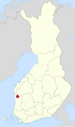 Location of Isojoki in Finland | |
| Coordinates: 62°06′50″N 21°57′30″E / 62.11389°N 21.95833°E / 62.11389; 21.95833 | |
| Country |  Finland Finland |
| Region | South Ostrobothnia |
| Sub-region | Suupohja sub-region |
| Charter | 1855 |
| Government | |
| • Municipal manager | Juha Herrala |
| Area (2018-01-01)[1] | |
| • Total | 647.43 km2 (249.97 sq mi) |
| • Land | 642.4 km2 (248.0 sq mi) |
| • Water | 5.05 km2 (1.95 sq mi) |
| • Rank | 134th largest in Finland |
| Population (2023-12-31)[2] | |
| • Total | 1,814 |
| • Rank | 265th largest in Finland |
| • Density | 2.82/km2 (7.3/sq mi) |
| Population by native language | |
| • Finnish | 94.8% (official) |
| • Swedish | 0.8% |
| • Others | 4.4% |
| Population by age | |
| • 0 to 14 | 11.3% |
| • 15 to 64 | 55.1% |
| • 65 or older | 33.7% |
| Time zone | UTC+02:00 (EET) |
| • Summer (DST) | UTC+03:00 (EEST) |
| Website | www.isojoki.fi |
Isojoki (Swedish: Storå; lit. "Big River") is a municipality of Finland. It is part of the South Ostrobothnia region. The city of Pori is located 83 kilometres (52 mi) south of Isojoki. The population of Isojoki is 1,814 (31 December 2023)[2] and the municipality covers an area of 642.4 km2 (248.0 sq mi) of which 5.05 km2 (1.95 sq mi) is inland water (1 January 2018).[1] The population density is 2.82/km2 (7.3/sq mi). The municipality is unilingually Finnish and neighbour municipalities are Honkajoki, Karijoki, Kauhajoki, Kristinestad, Merikarvia and Siikainen.
Although the area isn't very high, one of the highest hills of southern Finland is located here (Lauhanvuori). Many Finns from this area immigrated to Minnesota, in the USA, as well as Michigan.[citation needed]
Industry: Wood, potato, machinery.
Tourism: Lauhanvuori National Park (hotel, viewtower, big smoke sauna, historical nature with many relics from ice-age)
Nature: Mostly Forest, swamp and agriculture
References
- ^ a b "Area of Finnish Municipalities 1.1.2018" (PDF). National Land Survey of Finland. Retrieved 30 January 2018.
- ^ a b c "Population growth biggest in nearly 70 years". Population structure. Statistics Finland. 26 April 2024. ISSN 1797-5395. Retrieved 29 April 2024.
- ^ "Population according to age (1-year) and sex by area and the regional division of each statistical reference year, 2003–2020". StatFin. Statistics Finland. Retrieved 2 May 2021.
- ^ a b "Luettelo kuntien ja seurakuntien tuloveroprosenteista vuonna 2023". Tax Administration of Finland. 14 November 2022. Retrieved 7 May 2023.
External links
![]() Media related to Isojoki at Wikimedia Commons
Media related to Isojoki at Wikimedia Commons
- Municipality of Isojoki – Official website
Places adjacent to Isojoki | ||||||||||||||||
|---|---|---|---|---|---|---|---|---|---|---|---|---|---|---|---|---|
| ||||||||||||||||


- v
- t
- e

- Alahärmä
- Jalasjärvi
- Jurva
- Kortesjärvi
- Lehtimäki
- Nurmo
- Peräseinäjoki
- Seinäjoen maalaiskunta
- Töysä
- Ylihärmä
- Ylistaro
| Authority control databases: Geographic |
|
|---|
 | This Western Finland location article is a stub. You can help Wikipedia by expanding it. |
- v
- t
- e


