Jug Fork, Mississippi
Unincorporated community in Mississippi, United States
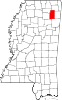
34°25′35″N 88°47′21″W / 34.42639°N 88.78917°W / 34.42639; -88.78917Jug Fork is an unincorporated community on the Lee-Union County line in northeast Mississippi, United States.
Jug Fork is approximately 5.5 miles (8.9 km) south-southwest of Blue Springs and approximately 7 miles (11 km) west-northwest of Ellistown. The Lee County side is part of the Tupelo Micropolitan Statistical Area.
References
 Mississippi portal

- ^ U.S. Geological Survey Geographic Names Information System: Jug Fork, Mississippi
- v
- t
- e
Municipalities and communities of Lee County, Mississippi, United States
County seat: Tupelo
communities
- Barrett Ridge
- Belden
- Brewer
- Eggville
- Jug Fork
‡This populated place also has portions in an adjacent county or counties
- Mississippi portal
- United States portal
Municipalities and communities of Union County, Mississippi, United States | ||
|---|---|---|
County seat: New Albany | ||
| City |  | |
| Towns | ||
| Village | ||
| Unincorporated communities | ||
| Footnotes | ‡This populated place also has portions in an adjacent county or counties | |
| ||
 | This Lee County, Mississippi state location article is a stub. You can help Wikipedia by expanding it. |
- v
- t
- e
| This Union County, Mississippi state location article is a stub. You can help Wikipedia by expanding it. |
- v
- t
- e


