Kem (river)
River in Russia
| Kem | |
|---|---|
 | |
| Location | |
| Country | Russia |
| Physical characteristics | |
| Source | |
| • location | Lake Lower Kuyto |
| • elevation | 100 m (330 ft) |
| Mouth | White Sea |
• coordinates | 64°57′03″N 34°40′29″E / 64.9508°N 34.6746°E / 64.9508; 34.6746 |
| Length | 191 km (119 mi) |
| Basin size | 27,700 km2 (10,700 sq mi) |
| Discharge | |
| • average | 275 m3/s (9,700 cu ft/s) |
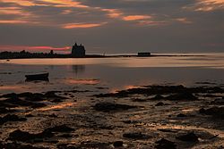
The Kem (Russian: Кемь, Finnish: Kemijoki) is a river in Republic of Karelia, Russia. It starts from Lake Lower Kuyto and flows through a number of lakes into the White Sea. It is 191 kilometres (119 mi) long, and has a drainage basin of 27,700 square kilometres (10,700 sq mi).[1] There is a cascade of 5 hydroelectric power plants. The town of Kem is located in the mouth of the Kem. Tributaries: Chirka-Kem, Okhta, Kepa, Shomba.[2]
See also
- Kem (Yenisei)
References
- v
- t
- e

- Iokanga
- Kem
- Malaya Belaya
- Mezen
- Nautsiyoki
- Niva
- Northern Dvina
- Onega
- Pechora
- Usa
- Ponoy
- Varzuga
- Voronya
- Kuma
- Sulak
- Terek
- Malka
- Sunzha
- Ural
- Ilek
- Sakmara
- Volga
- Aktay
- Anish
- Bolshaya Kokshaga
- Bolshoy Cheremshan
- Bolshoy Irgiz
- Bezdna
- Chapayevka
- Dubna
- Ilet
- Kama
- Kashinka
- Kazanka
- Kerzhenets
- Kostroma
- Kotorosl
- Kudma
- Malaya Kokshaga
- Maly Irgiz
- Medveditsa
- Mologa
- Nerl
- Nyomda
- Oka
- Rutka
- Samara
- Selizharovka
- Sheksna
- Shosha
- Sogozha
- Sok
- Suda
- Sura
- Sviyaga
- Tereshka
- Tsivil
- Tvertsa
- Unzha
- Uzola
- Vetluga
- Vazuza
- Yeruslan
- Alazeya
- Amguema
- Anabar
- Bolshaya Kuonamka
- Malaya Kuonamka
- Suolama
- Udya
- Bogdashkina
- Chaun
- Chegitun
- Chondon
- Buor-Yuryakh
- Nuchcha
- Gusinaya
- Indigirka
- Allaikha
- Badyarikha
- Bolshaya Ercha
- Byoryolyokh
- Chibagalakh
- Druzhina
- Elgi
- Khastakh
- Kuydusun
- Kyuyente
- Moma
- Nera
- Selennyakh
- Shandrin
- Shangina
- Uyandina
- Ioniveyem
- Khatanga
- Kheta
- Kotuy
- Khroma
- Kolyma
- Anyuy
- Ayan-Yuryakh
- Bakhapcha
- Balygychan
- Beryozovka
- Buyunda
- Debin
- Korkodon
- Kulu
- Omolon
- Popovka
- Ozhogina
- Sededema
- Seymchan
- Sugoy
- Taskan
- Tenka
- Yasachnaya
- Zyryanka
- Kyuyol-Yuryakh
- Lena
- Aldan
- Batamay
- Begidyan
- Belyanka
- Biryuk
- Bolshoy Patom
- Buotama
- Byosyuke
- Chaya
- Chechuy
- Cherendey
- Chuya
- Derba
- Dzhardzhan
- Dyanyshka
- Eyekit
- Ichera
- Ilga
- Khanchaly
- Khoruongka
- Kenkeme
- Kirenga
- Kuta
- Kyuelenke
- Kyundyudey
- Linde
- Lungkha
- Lyapiske
- Lyutenge
- Markha
- Markhachan
- Menda
- Menkere
- Molodo
- Motorchuna
- Muna
- Myla
- Namana
- Natara
- Nuora
- Nyuya
- Olyokma
- Peleduy
- Pilyuda
- Sinyaya
- Sitte
- Sobolokh-Mayan
- Suola
- Tamma
- Tayura
- Tikyan
- Tuolba
- Tutura
- Tympylykan
- Tyugyuene
- Uel-Siktyakh
- Undyulyung
- Ura
- Vilyuy
- Vitim
- Nadym
- Ob
- Aley
- Barnaulka
- Biya
- Chaya
- Chulym
- Irtysh
- Kazym
- Kasmala
- Katun
- Ket
- Kievsky Yogan
- Parabel
- Sob
- Synya
- Tom
- Tromyogan
- Tym
- Vasyugan
- Vakh
- Vatinsky Yogan
- Olenyok
- Omoloy
- Palyavaam
- Pegtymel
- Pur
- Pyasina
- Sellyakh
- Sundrun
- Maly Khomus-Yuryakh
- Taz
- Khudosey
- Tolka
- Uele
- Volchya
- Yana
- Yenisey
- Abakan
- Angara
- Bakhta
- Bazaikha
- Bolshaya Kheta
- Bolshoy Pit
- Kacha
- Kan
- Kem
- Khantayka
- Khemchik
- Kureyka
- Mana
- Nizhnyaya Tunguska
- Podkamennaya Tunguska
- Sym
- Tanama
- Turukhan
- Yeloguy
 Russia portal
 Category


 | This Republic of Karelia location article is a stub. You can help Wikipedia by expanding it. |
- v
- t
- e
 | This article related to a river in Russia is a stub. You can help Wikipedia by expanding it. |
- v
- t
- e


