Kiyawa
LGA and town in Jigawa State, Nigeria
11°47′05″N 9°36′30″E / 11.78472°N 9.60833°E / 11.78472; 9.60833
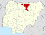
Kiyawa is a town and local government area in Jigawa State, Nigeria.
Geography
Kiyawa is located at 11°47′05″N 09°36′30″E / 11.78472°N 9.60833°E / 11.78472; 9.60833 and has an estimated population of 17,704. It is situated on the road running between kano and Azare with Dutse (30 km west), Jemma (35 km east), and Azare (65 km east).
History
In 1801 the Hausa ruler Yakubu was killed attempting to storm the Zamfara fortress located here.
Climate
The climate has two distinct seasons: a scorching, oppressive rainy season with predominantly cloudy skies, and a scorching, partly cloudy dry season with temperatures ranging from 55°F to 104°F.[1]
Positive trends indicate warmer weather, while horizontal trends indicate colder weather in Kiyawa due to climate change.[2]
References
- v
- t
- e
 Jigawa State
State capital: Dutse
- Auyo
- Babura
- Biriniwa
- Birnin Kudu
- Buji
- Dutse
- Gagarawa
- Garki
- Gumel
- Guri
- Gwaram
- Gwiwa
- Hadejia
- Jahun
- Kafin Hausa
- Kazaure
- Kiri Kasama
- Kiyawa
- Kaugama
- Maigatari
- Malam Madori
- Miga
- Ringim
- Roni
- Sule Tankarkar
- Taura
- Yankwashi
 | This Jigawa State, Nigeria location article is a stub. You can help Wikipedia by expanding it. |
- v
- t
- e


