Laren, North Holland
Town and municipality in North Holland, Netherlands

Flag

Coat of arms

Location in North Holland
(January 2021)[4]
1250–1252

Laren (Dutch pronunciation: [ˈlaːrə(n)] ⓘ) is a town and municipality in the province of North Holland, Netherlands. Located in the Gooi region, it is the oldest town in the area. Together with its neighbor Blaricum, Laren is one of the most affluent towns in the Netherlands.[5]
Nationally, Laren is well known for its history as a late 19th-century art colony, preserved in the museum Singer Laren, its retirement home for elderly artists Rosa Spier Huis, as well as its wide array of shops. Laren is part of the Amsterdam metropolitan area, situated east of Amsterdam.
Government
The municipal council of Laren consists of 15 seats, which since 2022 are divided as follows:
Demographics
In 2007, Laren had the following demographic data:
- Birth rate: 7.29 per 1,000
- Death rate: 17.94 per 1,000
- NGR: -1.07% per year[6]
In August 2017, there were 11,135 inhabitants in Laren. The municipality has a population density of 897/km2 (2,320/sq mi).
Notable residents
The arts
- Johan Briedé [nl] (1885-1980) artist, illustrated H. G. Wells' books
- Maurits Cornelis Escher (1898–1972), graphic artist, illustrator and printmaker, lived in Rosa Spier Huis from 1970
- Barthold Fles (1902–1989) a Dutch-American literary agent, author and translator; lived in Rosa Spier Huis from 1986
- Maarten Krabbé (1908 in Laren – 2005) a Dutch painter and art educator
- Hannie Lips (1924 – 2012 in Laren) a broadcaster and TV announcer[7]
- Anton Mauve (1838-1888), painter, Hague School & Laren School, lived in Laren 1886/1888
- Johnny de Mol (born 1979 in Laren) a Dutch actor and presenter[8]
- Albert Neuhuys (1844-1914), painter Laren School
- Roberto Vander (born 1950 in Laren) a Dutch-Chilean actor and singer[9]
- Saar de Swart (1861-1951) a Dutch sculptor
Public service
- Jan van den Brink (1915 in Laren – 2006) a Dutch politician and businessman
- Gerard Croiset (1909 in Laren – 1980) a Dutch parapsychologist, psychometrist and psychic
- Paul Joan George Kapteyn (born 1928 in Laren) a judge at the European Court of Justice
- Pim van Lommel (born 1943 in Laren) a Dutch cardiologist, author and researcher into near-death studies
- Maria Montessori (1870-1952) an Italian physician and education reformer, lived in Laren 1936/1939
- Roelof Nelissen (1931–2019) a Dutch politician and businessman; lived in Laren
- Mona Louise Parsons (1901–1976) a Canadian actress, nurse and member of an informal Dutch resistance network
- Elbert Roest (born 1954) a Dutch historian, politician, former teacher and former mayor of Laren
- Henk Zanoli (1923 in Laren – 2015) a lawyer and member of the Dutch resistance in WWII
Sport
- Willemien Aardenburg (born 1966 in Laren) a former Dutch field hockey player, team bronze medallist the 1988 Summer Olympics
- Thomas Boerma (born 1981 in Laren) a field hockey player, competed at the 2008 Summer Olympics
- Jacobine Veenhoven (born 1984 in Laren) a Dutch female rower, team bronze medallist at the 2012 Summer Olympics
- Marcel van der Westen (born 1976 in Laren) a retired Dutch hurdler
Gallery
-
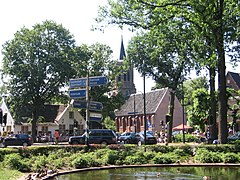 Town centre
 -
 De Hervormde Kerk
 -
 Laren
Laren -
 Laren, basilica: de Sint Jansbasiliek
 -
 The Coeswaerde


References
- ^ "Burgemeester N. Mol" (in Dutch). Gemeente Laren. Retrieved 25 April 2020.
- ^ "Kerncijfers wijken en buurten 2020" [Key figures for neighbourhoods 2020]. StatLine (in Dutch). CBS. 24 July 2020. Retrieved 19 September 2020.
- ^ "Postcodetool for 1251NA". Actueel Hoogtebestand Nederland (in Dutch). Het Waterschapshuis. Archived from the original on 21 September 2013. Retrieved 18 March 2014.
- ^ "Bevolkingsontwikkeling; regio per maand" [Population growth; regions per month]. CBS Statline (in Dutch). CBS. 1 January 2021. Retrieved 2 January 2022.
- ^ "Vermogen van huishoudens opnieuw gestegen". CBS (in Dutch). 2019-11-18. Retrieved 2020-04-21.
- ^ Statline.cbs.nl, Laren page.
- ^ IMDb Database retrieved 31 January 2020
- ^ IMDb Database retrieved 31 January 2020
- ^ IMDb Database retrieved 31 January 2020
External links
 Media related to Laren, North Holland at Wikimedia Commons
- Official website


- v
- t
- e
Municipalities of North Holland
- Aalsmeer
- Alkmaar
- Amstelveen
- Amsterdam
- Bergen
- Beverwijk
- Blaricum
- Bloemendaal
- Castricum
- Den Helder
- Diemen
- Dijk en Waard
- Drechterland
- Edam-Volendam
- Enkhuizen
- Gooise Meren
- Haarlem
- Haarlemmermeer
- Heemskerk
- Heemstede
- Heiloo
- Hilversum
- Hollands Kroon
- Hoorn
- Huizen
- Koggenland
- Landsmeer
- Laren
- Medemblik
- Oostzaan
- Opmeer
- Ouder-Amstel
- Purmerend
- Schagen
- Stede Broec
- Texel
- Uitgeest
- Uithoorn
- Velsen
- Waterland
- Wijdemeren
- Wormerland
- Zaanstad
- Zandvoort

- See also
- Netherlands
- Provinces
- Municipalities
Authority control databases | |
|---|---|
| International |
|
| National |
|
| Geographic |
|
| Other |
|
 | This North Holland location article is a stub. You can help Wikipedia by expanding it. |
- v
- t
- e


