Lemele
Village in Overijssel, Netherlands
52°27′8″N 6°24′53″E / 52.45222°N 6.41472°E / 52.45222; 6.41472 (2021)[1]
8148[1]
Lemele is a village in the Dutch province of Overijssel. It is a part of the municipality of Ommen, and lies about 20 km northwest of Almelo.
History
Lemele is an esdorp which developed on the foot of the Lemelerberg [nl], a remnant of the Last Glacial Period.[3] It was first mentioned between 1381 and 1383 as Lemelo, and means "clay near open forest".[4] In 1840, it was home to 258 people.[5] In 1863, it formed a short-lived municipality with Archem.[3]
Notable people
- Peter Schulting (born 1987), cyclist[6]
Gallery
-
 Church of Lemele
 -
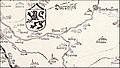 A map from 1559 showing the Lemelerberg
 -
 Old picture of farm and sheep pen


References
- ^ a b c "Kerncijfers wijken en buurten 2021". Central Bureau of Statistics. Retrieved 16 March 2022.
two entries
- ^ "Postcodetool for 8148NA". Actueel Hoogtebestand Nederland (in Dutch). Het Waterschapshuis. Retrieved 16 March 2022.
- ^ a b Ronald Stenvert & Jan ten Hove (1998). "Lemele" (in Dutch). Zwolle: Waanders. ISBN 90 400 9200 1. Retrieved 16 March 2022.
- ^ "Lemele - (geografische naam)". Etymologiebank (in Dutch). Retrieved 16 March 2022.
- ^ "Lemele". Plaatsengids (in Dutch). Retrieved 16 March 2022.
- ^ "Peter Schulting". Pro cycling stats. Retrieved 16 March 2022.
Wikimedia Commons has media related to Lemele.
 | This Overijssel location article is a stub. You can help Wikipedia by expanding it. |
- v
- t
- e


