Liberty Hill, South Carolina
Unincorporated community in South Carolina, United States
34°28′42″N 80°48′06″W / 34.47833°N 80.80167°W / 34.47833; -80.8016729074
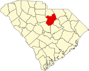
Liberty Hill is a scattered unincorporated community in Kershaw County, South Carolina, United States.[1] The community is located along and either side of the junction of South Carolina Highway 97 and South Carolina Highway 522, 19.5 miles (31.4 km) northwest of Camden. Liberty Hill has a post office with ZIP code 29074, which opened on January 19, 1818.[2][3] There is also a fire lookout tower there, and a church, and a few houses spread along the main road, but otherwise no businesses or services.
Parts of the community are included in the Liberty Hill Historic District, which is listed on the National Register of Historic Places.[4]
References
- ^ a b "Liberty Hill". Geographic Names Information System. United States Geological Survey, United States Department of the Interior.
- ^ United States Postal Service. "USPS - Look Up a ZIP Code". Retrieved October 23, 2016.
- ^ "Postmaster Finder - Post Offices by ZIP Code". United States Postal Service. Retrieved October 23, 2016.
- ^ "National Register Information System". National Register of Historic Places. National Park Service. July 9, 2010.
- v
- t
- e
Municipalities and communities of Kershaw County, South Carolina, United States
County seat: Camden
communities
- South Carolina portal
- United States portal
 | This South Carolina state location article is a stub. You can help Wikipedia by expanding it. |
- v
- t
- e


