List of lakes of Yell County, Arkansas
Map all coordinates using OpenStreetMap
Download coordinates as:
- KML
- GPX (all coordinates)
- GPX (primary coordinates)
- GPX (secondary coordinates)
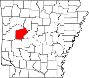
There are at least 26 named lakes and reservoirs in Yell County, Arkansas.

Lakes
- Buckman Lake, 35°04′33″N 093°28′14″W / 35.07583°N 93.47056°W / 35.07583; -93.47056 (Buckman Lake), el. 338 feet (103 m) [1]
- Cowger Lake, 35°03′09″N 093°24′36″W / 35.05250°N 93.41000°W / 35.05250; -93.41000 (Cowger Lake), el. 325 feet (99 m) [2]
- Gibson Lake, 35°07′48″N 093°07′34″W / 35.13000°N 93.12611°W / 35.13000; -93.12611 (Gibson Lake), el. 295 feet (90 m) [3]
- Horseshoe Lake, 35°03′38″N 093°27′04″W / 35.06056°N 93.45111°W / 35.06056; -93.45111 (Horseshoe Lake), el. 325 feet (99 m) [4]
- Keeland Lake, 35°02′48″N 093°12′15″W / 35.04667°N 93.20417°W / 35.04667; -93.20417 (Keeland Lake), el. 292 feet (89 m) [5]
- Luther Lake, 35°07′51″N 093°05′28″W / 35.13083°N 93.09111°W / 35.13083; -93.09111 (Luther Lake), el. 285 feet (87 m) [6]
- Mason Lake, 35°03′56″N 093°27′23″W / 35.06556°N 93.45639°W / 35.06556; -93.45639 (Mason Lake), el. 325 feet (99 m) [7]
- Open Slough, 35°08′50″N 093°07′15″W / 35.14722°N 93.12083°W / 35.14722; -93.12083 (Open Slough), el. 302 feet (92 m) [8]
- Peeler Lake, 35°04′09″N 093°19′51″W / 35.06917°N 93.33083°W / 35.06917; -93.33083 (Peeler Lake), el. 312 feet (95 m) [9]
- Peter George Lake, 35°06′14″N 093°18′14″W / 35.10389°N 93.30389°W / 35.10389; -93.30389 (Peter George Lake), el. 322 feet (98 m) [10]
- Rose Lake, 35°03′45″N 093°05′12″W / 35.06250°N 93.08667°W / 35.06250; -93.08667 (Rose Lake), el. 299 feet (91 m) [11]
- Surrounded Ridges Lake, 35°05′20″N 093°18′21″W / 35.08889°N 93.30583°W / 35.08889; -93.30583 (Surrounded Ridges Lake), el. 308 feet (94 m) [12]
Reservoirs
- Bailey Branch Lake, 35°02′12″N 093°26′57″W / 35.03667°N 93.44917°W / 35.03667; -93.44917 (Bailey Branch Lake), el. 344 feet (105 m) [13]
- Blue Mountain Lake, 35°05′59″N 093°42′02″W / 35.09972°N 93.70056°W / 35.09972; -93.70056 (Blue Mountain Lake), el. 384 feet (117 m) [14]
- Bogs Lake, 35°08′01″N 093°17′47″W / 35.13361°N 93.29639°W / 35.13361; -93.29639 (Bogs Lake), el. 338 feet (103 m) [15]
- Cedar-Piney Lake, 35°06′50″N 093°29′11″W / 35.11389°N 93.48639°W / 35.11389; -93.48639 (Cedar-Piney Lake), el. 387 feet (118 m) [16]
- Chambers Lake, 35°02′37″N 093°27′49″W / 35.04361°N 93.46361°W / 35.04361; -93.46361 (Chambers Lake), el. 427 feet (130 m) [17]
- Harris Fish Farm Reservoir, 35°06′07″N 093°21′22″W / 35.10194°N 93.35611°W / 35.10194; -93.35611 (Harris Fish Farm Reservoir), el. 351 feet (107 m) [18]
- Kingfisher Lake, 35°05′44″N 093°06′20″W / 35.09556°N 93.10556°W / 35.09556; -93.10556 (Kingfisher Lake), el. 315 feet (96 m) [19]
- Lake Ola, 35°01′54″N 092°14′01″W / 35.03167°N 92.23361°W / 35.03167; -92.23361 (Lake Ola), el. 361 feet (110 m) [20]
- Lake Ola-dale, 35°01′48″N 093°14′10″W / 35.03000°N 93.23611°W / 35.03000; -93.23611 (Lake Ola-dale), el. 390 feet (120 m) [21]
- Mockingbird Hill Lake, 35°06′27″N 093°13′05″W / 35.10750°N 93.21806°W / 35.10750; -93.21806 (Mockingbird Hill Lake), el. 354 feet (108 m) [22]
- Nimrod Lake, 34°57′03″N 093°14′37″W / 34.95083°N 93.24361°W / 34.95083; -93.24361 (Nimrod Lake), el. 341 feet (104 m) [23]
- Pullen Pond, 35°05′12″N 093°08′06″W / 35.08667°N 93.13500°W / 35.08667; -93.13500 (Pullen Pond), el. 302 feet (92 m) [24]
- Schoonover Lake, 35°05′15″N 093°12′12″W / 35.08750°N 93.20333°W / 35.08750; -93.20333 (Schoonover Lake), el. 348 feet (106 m) [25]
- Spring Lake, 35°09′14″N 093°25′39″W / 35.15389°N 93.42750°W / 35.15389; -93.42750 (Spring Lake), el. 512 feet (156 m) [26]
See also
Notes
- ^ "Buckman Lake". Geographic Names Information System. United States Geological Survey, United States Department of the Interior.
- ^ "Cowger Lake". Geographic Names Information System. United States Geological Survey, United States Department of the Interior.
- ^ "Gibson Lake". Geographic Names Information System. United States Geological Survey, United States Department of the Interior.
- ^ "Horseshoe Lake". Geographic Names Information System. United States Geological Survey, United States Department of the Interior.
- ^ "Keeland Lake". Geographic Names Information System. United States Geological Survey, United States Department of the Interior.
- ^ "Luther Lake". Geographic Names Information System. United States Geological Survey, United States Department of the Interior.
- ^ "Mason Lake". Geographic Names Information System. United States Geological Survey, United States Department of the Interior.
- ^ "Open Slough". Geographic Names Information System. United States Geological Survey, United States Department of the Interior.
- ^ "Peeler Lake". Geographic Names Information System. United States Geological Survey, United States Department of the Interior.
- ^ "Peter George Lake". Geographic Names Information System. United States Geological Survey, United States Department of the Interior.
- ^ "Rose Lake". Geographic Names Information System. United States Geological Survey, United States Department of the Interior.
- ^ "Surrounded Ridges Lake". Geographic Names Information System. United States Geological Survey, United States Department of the Interior.
- ^ "Bailey Branch Lake". Geographic Names Information System. United States Geological Survey, United States Department of the Interior.
- ^ "Blue Mountain Lake". Geographic Names Information System. United States Geological Survey, United States Department of the Interior.
- ^ "Bogs Lake". Geographic Names Information System. United States Geological Survey, United States Department of the Interior.
- ^ "Cedar-Piney Lake". Geographic Names Information System. United States Geological Survey, United States Department of the Interior.
- ^ "Chambers Lake". Geographic Names Information System. United States Geological Survey, United States Department of the Interior.
- ^ "Harris Fish Farm Reservoir". Geographic Names Information System. United States Geological Survey, United States Department of the Interior.
- ^ "Kingfisher Lake". Geographic Names Information System. United States Geological Survey, United States Department of the Interior.
- ^ "Lake Ola". Geographic Names Information System. United States Geological Survey, United States Department of the Interior.
- ^ "Lake Ola-dale". Geographic Names Information System. United States Geological Survey, United States Department of the Interior.
- ^ "Mockingbird Hill Lake". Geographic Names Information System. United States Geological Survey, United States Department of the Interior.
- ^ "Nimrod Lake". Geographic Names Information System. United States Geological Survey, United States Department of the Interior.
- ^ "Pullen Pond". Geographic Names Information System. United States Geological Survey, United States Department of the Interior.
- ^ "Schoonover Lake". Geographic Names Information System. United States Geological Survey, United States Department of the Interior.
- ^ "Spring Lake". Geographic Names Information System. United States Geological Survey, United States Department of the Interior.
- v
- t
- e
Municipalities and communities of Yell County, Arkansas, United States
County seats: Danville and Dardanelle
communities
‡This populated place also has portions in an adjacent county or counties
- Arkansas portal
- United States portal


