Mackenzie County
Specialized municipality in Alberta, Canada

Logo

High Level
Rainbow Lake

La Crete
Fort Vermilion
Zama City
Chateh
Fox Lake

Location within Alberta
- Municipal district
January 1, 1995
Mackenzie County Council
- Jacquie Bateman
- Peter F. Braun
- Cameron Cardinal
- David Driedger
- Eric Jorgensen
- Joshua Knelsen
- Anthony Peters
- Ernest Peters
- Walter Sarapuk
- Lisa Wardley
(2021)[4]
(2021)[4]
Mackenzie County is a specialized municipality in northern Alberta, Canada. It is located in Census Division 17, along the Mackenzie Highway. The municipal office is located in the hamlet of Fort Vermilion.
History
Originally Improvement District No. 23, the Municipal District of Mackenzie No. 23 incorporated as a municipal district on January 1, 1995.[1] It subsequently changed its status to specialized municipality on June 23, 1999 "to address concerns about municipal government and management in a municipality that serves a number of unique communities within a very large territory."[1] The Municipal District of Mackenzie No. 23 changed its name to Mackenzie County on March 8, 2007.[1]
Geography

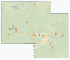
Mackenzie County is in the northwest corner of the province of Alberta.[5] It borders the province of British Columbia to the west; the Northwest Territories to the north; Improvement District No. 24 (Wood Buffalo National Park) and the Regional Municipality of Wood Buffalo to the east; and Northern Sunrise County, the Paddle Prairie Metis Settlement, and the County of Northern Lights to the south.[5] The Peace River meanders eastward through the southeast portion of Mackenzie County.[5] Some of its water bodies include Bistcho Lake, Eva Lake, Margaret Lake, Wadlin Lake, Wentzel Lake, and Zama Lake.[5] Land formations include Bootis Hill in the northwest, the Caribou Mountains in the northeast, Buffalo Head Hills in the south, Cameron Hills in the north, and Mount Watt northwest of the Town of High Level.[5]
Communities and localities
| The following urban municipalities are surrounded by Mackenzie County.[6]
| The following hamlets are within Mackenzie County.[6]
|
The following localities are within Mackenzie County.[7]
- Localities
|
|
The following settlements are within Mackenzie County.[5]
- Settlements
|
|
First Nations have the following Indian reserves within Mackenzie County.[5]
- Indian reserves
Demographics
In the 2021 Census of Population conducted by Statistics Canada, Mackenzie County had a population of 12,804 living in 3,516 of its 3,756 total private dwellings, a change of 14.6% from its 2016 population of 11,171. With a land area of 79,629.26 km2 (30,745.03 sq mi), it had a population density of 0.2/km2 (0.4/sq mi) in 2021.[4]
The population of Mackenzie County according to its 2018 municipal census is 12,514,[14] a change of 6.5% from its 2015 municipal census population of 11,750.[15]
In the 2016 Census of Population conducted by Statistics Canada, Mackenzie County had a population of 11,171 living in 3,088 of its 3,567 total private dwellings, a change of 2.2% from its 2011 population of 10,927. With a land area of 80,458.19 km2 (31,065.08 sq mi), it had a population density of 0.1/km2 (0.4/sq mi) in 2016.[13]
Attractions
Mackenzie County is home to Caribou Mountains Wildland Provincial Park and Hay-Zama Lakes Wildland Provincial Park.[5] It is also adjacent to Wood Buffalo National Park to the east.[5]
See also
References
- ^ a b c d e "Location and History Profile – Mackenzie County" (PDF). Alberta Municipal Affairs. October 15, 2021. Retrieved October 17, 2021.
- ^ "Councillors". www.mackenziecounty.com. Retrieved 2019-06-14.
- ^ "Municipal Officials Search". Alberta Municipal Affairs. May 9, 2019. Retrieved October 1, 2021.
- ^ a b c d "Population and dwelling counts: Canada, provinces and territories, and census subdivisions (municipalities)". Statistics Canada. February 9, 2022. Retrieved February 9, 2022.
- ^ a b c d e f g h i 2021 Provincial Base Map: Municipalities (PDF) (Map). Alberta Environment and Parks. July 26, 2021. Retrieved October 17, 2021.
- ^ a b "Specialized and Rural Municipalities and Their Communities" (PDF). Alberta Municipal Affairs. June 3, 2024. Retrieved June 14, 2024.
- ^ "Standard Geographical Classification (SGC) 2006, Economic Regions: 4817095 - Mackenzie No. 23, geographical codes and localities, 2006". Statistics Canada. 2010-03-05. Retrieved 2012-08-11.
- ^ Geo-Administrative Areas (Hamlet, Locality and Townsite Culture Points) (Geodatabase layer) (Map). AltaLIS. October 26, 2020. Retrieved October 2, 2021.
{{cite map}}: CS1 maint: date and year (link) - ^ "Table 10: Population and Dwelling Counts, for Census Divisions, Census Subdivisions (Municipalities) and Designated Places, 1991 and 1996 Censuses – 100% Data". 96 Census. Vol. A National Overview – Population and Dwelling Counts. Ottawa: Statistics Canada. 1997. pp. 136–146. ISBN 0-660-59283-5.
- ^ "Population and Dwelling Counts, for Canada, Provinces and Territories, and Census Divisions, 2001 and 1996 Censuses - 100% Data (Alberta)". Statistics Canada. Retrieved 2013-02-16.
- ^ "Population and dwelling counts, for Canada, provinces and territories, and census subdivisions (municipalities), 2006 and 2001 censuses - 100% data (Alberta)". Statistics Canada. 2010-01-06. Retrieved 2013-02-16.
- ^ "Population and dwelling counts, for Canada, provinces and territories, and census subdivisions (municipalities), 2011 and 2006 censuses (Alberta)". Statistics Canada. February 8, 2012. Retrieved February 8, 2012.
- ^ a b "Population and dwelling counts, for Canada, provinces and territories, and census subdivisions (municipalities), 2016 and 2011 censuses – 100% data (Alberta)". Statistics Canada. February 8, 2017. Retrieved February 8, 2017.
- ^ 2018 Municipal Affairs Population List (PDF). Alberta Municipal Affairs. December 2018. ISBN 978-1-4601-4254-7. Retrieved December 20, 2018.
- ^ "Request for Decision: 2015 Census Results" (PDF). Mackenzie County. August 26, 2015. Retrieved August 21, 2015.
External links
- Official website


- v
- t
- e
Subdivisions of Alberta
service areas
municipalities
| Municipal districts |
|
|---|---|
| Improvement districts | |
| Special areas |
municipalities
- Crowsnest Pass, Municipality of
- Jasper, Municipality of
- Lac La Biche County
- Mackenzie County
- Strathcona County
- Wood Buffalo, Regional Municipality of
 Category
 Canada portal
 WikiProject


| |
|---|---|
| Towns | |
| Hamlets | |
| Métis settlements | |
| Municipal districts |
|
| Specialized municipalities |
|
| Improvement districts |
|
| Indian reserves |
|
| National parks | |
| Provincial parks | |
| Other topics | |


