Manyberries
Hamlet in Alberta, Canada
49°24′06″N 110°41′38″W / 49.40167°N 110.69389°W / 49.40167; -110.69389 (1991)[1]
Manyberries is a hamlet in Alberta, Canada within the County of Forty Mile No. 8.[2] It is located approximately 85 km (53 mi) south of Medicine Hat, at the eastern end of Highway 61 (the Red Coat Trail).
Climate
Manyberries experiences a semi-arid climate (Köppen climate classification BSk). Winters are long, cold and dry, while summers are relatively short but very warm. Precipitation is low, with an annual average of 353 mm, and is concentrated in the warmer months. Manyberries is the sunniest spot in Canada, receiving an average of 2,567 hours of sunshine per year.
| Climate data for Manyberries (Onefour Research Farm), 1971–2000 normals, extremes 1928–present | |||||||||||||
|---|---|---|---|---|---|---|---|---|---|---|---|---|---|
| Month | Jan | Feb | Mar | Apr | May | Jun | Jul | Aug | Sep | Oct | Nov | Dec | Year |
| Record high °C (°F) | 18.5 (65.3) | 21.0 (69.8) | 24.7 (76.5) | 32.2 (90.0) | 34.4 (93.9) | 40.6 (105.1) | 40.9 (105.6) | 40.6 (105.1) | 36.1 (97.0) | 32.8 (91.0) | 22.6 (72.7) | 17.2 (63.0) | 40.9 (105.6) |
| Mean daily maximum °C (°F) | −4.7 (23.5) | −2.3 (27.9) | 4.1 (39.4) | 12.3 (54.1) | 18.3 (64.9) | 23.3 (73.9) | 26.9 (80.4) | 26.1 (79.0) | 19.5 (67.1) | 13.3 (55.9) | 2.8 (37.0) | −2.9 (26.8) | 11.4 (52.5) |
| Daily mean °C (°F) | −10.5 (13.1) | −8.1 (17.4) | −1.8 (28.8) | 5.7 (42.3) | 11.5 (52.7) | 16.2 (61.2) | 19.2 (66.6) | 18.5 (65.3) | 12.0 (53.6) | 6.0 (42.8) | −3.2 (26.2) | −8.7 (16.3) | 4.7 (40.5) |
| Mean daily minimum °C (°F) | −16.2 (2.8) | −13.9 (7.0) | −7.7 (18.1) | −1 (30) | 4.7 (40.5) | 9.0 (48.2) | 11.5 (52.7) | 10.8 (51.4) | 4.6 (40.3) | −1.3 (29.7) | −9.2 (15.4) | −14.5 (5.9) | −1.9 (28.6) |
| Record low °C (°F) | −42.8 (−45.0) | −42.8 (−45.0) | −35.6 (−32.1) | −26.1 (−15.0) | −13.3 (8.1) | −1.7 (28.9) | 1.1 (34.0) | −1 (30) | −12.2 (10.0) | −24 (−11) | −35 (−31) | −41.1 (−42.0) | −42.8 (−45.0) |
| Average precipitation mm (inches) | 22.6 (0.89) | 19.0 (0.75) | 22.5 (0.89) | 28.7 (1.13) | 52.8 (2.08) | 48.3 (1.90) | 34.2 (1.35) | 38.6 (1.52) | 34.3 (1.35) | 14.7 (0.58) | 17.1 (0.67) | 20.3 (0.80) | 353.0 (13.90) |
| Average rainfall mm (inches) | 0.1 (0.00) | 0.1 (0.00) | 2.4 (0.09) | 16.4 (0.65) | 49.4 (1.94) | 48.3 (1.90) | 34.2 (1.35) | 38.6 (1.52) | 33.0 (1.30) | 7.7 (0.30) | 1.4 (0.06) | 0.5 (0.02) | 232.1 (9.14) |
| Average snowfall cm (inches) | 22.5 (8.9) | 18.9 (7.4) | 20.1 (7.9) | 12.2 (4.8) | 3.4 (1.3) | 0 (0) | 0 (0) | 0 (0) | 1.3 (0.5) | 7.0 (2.8) | 15.7 (6.2) | 19.7 (7.8) | 120.9 (47.6) |
| Average precipitation days (≥ 0.2 mm) | 8.9 | 7.0 | 7.2 | 8.4 | 11.6 | 10.7 | 9.6 | 9.1 | 7.8 | 4.9 | 7.0 | 8.7 | 100.8 |
| Average rainy days (≥ 0.2 mm) | 0.05 | 0.10 | 1.1 | 5.5 | 11.2 | 10.7 | 9.6 | 9.1 | 7.4 | 3.2 | 0.95 | 0.30 | 59.0 |
| Average snowy days (≥ 0.2 cm) | 8.9 | 6.9 | 6.2 | 3.1 | 0.45 | 0 | 0 | 0 | 0.35 | 1.8 | 6.1 | 8.4 | 42.1 |
| Mean monthly sunshine hours | 102.8 | 130.1 | 172.2 | 235.2 | 289.2 | 319.9 | 361.2 | 318.2 | 231.8 | 193.6 | 122.3 | 90.3 | 2,566.8 |
| Percent possible sunshine | 38.0 | 45.5 | 46.8 | 57.3 | 61.0 | 66.1 | 73.9 | 71.3 | 61.1 | 57.7 | 44.4 | 35.1 | 54.9 |
| Source: Environment Canada[3][4] | |||||||||||||
Demographics
Manyberries recorded a population of 96 in the 1991 Census of Population conducted by Statistics Canada.[1]
Services
Manyberries has a community hall, a curling rink, a park with playground equipment, and a hotel with lounge. Manyberries still has its original Canadian Pacific railway station and a section house, which are both private residences, and are located beside the former Stirling-Weyburn branch line. CPR abandoned the branch line from just east of Stirling to Consul, Saskatchewan in the late 1980s. The tracks were pulled shortly after in early 1990s from Manyberries to Consul. The hamlet also has two oilfield services company that service the nearby Manyberries oilfield.[citation needed]
-
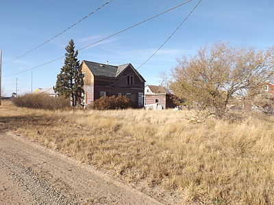 Deserted house

See also
References
- ^ a b "91 Census: Unincorporated Places — Population and Dwelling Counts" (PDF). Statistics Canada. June 1993. Retrieved September 25, 2021.
- ^ "Specialized and Rural Municipalities and Their Communities" (PDF). Alberta Municipal Affairs. June 3, 2024. Retrieved June 14, 2024.
- ^ "Manyberries CDA, Alberta". Canadian Climate Normals 1971–2000 (in English and French). Environment Canada. Retrieved November 23, 2016.
- ^ "Onefour, Alberta". Canadian Climate Data (in English and French). Environment Canada. Retrieved November 23, 2016.
Places adjacent to Manyberries | ||||||||||||||||
|---|---|---|---|---|---|---|---|---|---|---|---|---|---|---|---|---|
| ||||||||||||||||


- v
- t
- e
Subdivisions of Alberta
service areas
- Abee
- Acadia Valley
- Aetna
- Alcomdale
- Alder Flats
- Aldersyde
- Alhambra
- Altario
- Antler Lake
- Anzac
- Ardley
- Ardmore
- Ardrossan
- Armena
- Ashmont
- Atmore
- Balzac
- Beauvallon
- Beaver Crossing
- Beaver Lake
- Beaver Mines
- Beaverdam
- Beazer
- Bellis
- Benalto
- Benchlands
- Bezanson
- Bindloss
- Bircham
- Blackfoot
- Blackie
- Blue Ridge
- Bluesky
- Bluffton
- Bodo
- Botha
- Bottrel
- Bow City
- Bragg Creek
- Brant
- Breynat
- Brosseau
- Brownfield
- Brownvale
- Bruce
- Brule
- Buck Creek
- Buck Lake
- Buford
- Burdett
- Busby
- Byemoor
- Cadogan
- Cadomin
- Cadotte Lake
- Calahoo
- Calling Lake
- Campsie
- Canyon Creek
- Carbondale
- Cardiff
- Carseland
- Carvel
- Carway
- Caslan
- Cassils
- Cayley
- Cereal
- Cessford
- Chancellor
- Cheadle
- Cherhill
- Cherry Grove
- Chin
- Chinook
- Chisholm
- Clairmont
- Clandonald
- Cleardale
- Cluny
- Cochrane Lake
- Colinton
- Collingwood Cove
- Compeer
- Condor
- Conklin
- Conrich
- Craigmyle
- Cynthia
- Dalemead
- Dalroy
- Dapp
- De Winton
- Dead Man's Flats
- Deadwood
- DeBolt
- Del Bonita
- Delacour
- Demmitt
- Derwent
- Desert Blume
- Dewberry
- Diamond City
- Dickson
- Dimsdale
- Dixonville
- Donatville
- Dorothy
- Duffield
- Duhamel
- Dunmore
- Duvernay
- Eaglesham
- Edwand
- Egremont
- Ellscott
- Elmworth
- Enchant
- Endiang
- Enilda
- Ensign
- Entwistle
- Erskine
- Etzikom
- Evansburg
- Exshaw
- Fabyan
- Fairview
- Fallis
- Falun
- Faust
- Fawcett
- Ferintosh
- Flatbush
- Fleet
- Fort Assiniboine
- Fort Chipewyan
- Fort Kent
- Fort McKay
- Fort Vermilion
- Gadsby
- Gainford
- Gasoline Valley
- Galahad
- Gem
- Gleichen
- Glenevis
- Goodfare
- Goose Lake
- Grande Cache
- Granum
- Grassland
- Grassy Lake
- Green Court
- Greenshields
- Gregoire Lake Estates
- Grouard
- Grovedale
- Gunn
- Guy
- Gwynne
- Hairy Hill
- Half Moon Lake
- Harvie Heights
- Hastings Lake
- Haynes
- Hays
- Hayter
- Heinsburg
- Heritage Pointe
- Herronton
- Hesketh
- Hilda
- Hilliard
- Hoadley
- Huallen
- Huxley
- Hylo
- Iddesleigh
- Indus
- Iron River
- Iron Springs
- Irvine
- Islay
- Janet
- Janvier South
- Jarvie
- Jean Cote
- Jenner
- Joffre
- Johnson's Addition
- Josephburg
- Joussard
- Kathyrn
- Kavanagh
- Keephills
- Kelsey
- Keoma
- Kimball
- Kingman
- Kinsella
- Kinuso
- Kirkcaldy
- Kirriemuir
- La Corey
- La Crete
- La Glace
- Lac des Arcs
- Lac La Biche
- Lafond
- Lake Louise
- Lake Newell Resort
- Lamoureux
- Landry Heights
- Langdon
- Lavoy
- Leavitt
- Leedale
- Leslieville
- Lindbergh
- Linn Valley
- Little Buffalo
- Little Smoky
- Lodgepole
- Long Lake
- Looma
- Lottie Lake
- Lousana
- Lowland Heights
- Lundbreck
- Lyalta
- Madden
- Mallaig
- Manola
- Manyberries
- Marie Reine
- Markerville
- Marlboro
- Marten Beach
- Maskwacis
- McLaughlin
- Meanook
- Mearns
- Meeting Creek
- Metiskow
- Michichi
- Millarville
- Minburn
- Mirror
- Monarch
- Monitor
- Moon River Estates
- Morecambe
- Morningside
- Mossleigh
- Mountain View
- Mulhurst Bay
- Musidora
- Namaka
- Namao
- Neerlandia
- Nestow
- Nevis
- New Brigden
- New Dayton
- New Norway
- New Sarepta
- Newbrook
- Nightingale
- Nisku
- Niton Junction
- Nordegg
- North Cooking Lake
- North Star
- Notikewin
- Ohaton
- Opal
- Orion
- Orton
- Parkland
- Patricia
- Peers
- Pelican Point
- Peoria
- Perryvale
- Pibroch
- Pickardville
- Pincher Station
- Pine Sands
- Plamondon
- Poplar Ridge
- Priddis
- Priddis Greens
- Purple Springs
- Queenstown
- Radway
- Rainier
- Ranfurly
- Red Earth Creek
- Red Willow
- Reno
- Ribstone
- Rich Valley
- Richdale
- Ridgevalley
- Rivercourse
- Riverview
- Rivière Qui Barre
- Robb
- Rochester
- Rochfort Bridge
- Rocky Rapids
- Rolling Hills
- Rolly View
- Rosebud
- Round Hill
- Rowley
- Rumsey
- Sandy Lake
- Sangudo
- Saprae Creek
- Scandia
- Schuler
- Sedalia
- Seven Persons
- Shaughnessy
- Shouldice
- Sibbald
- Skiff
- Smith
- South Cooking Lake
- Spedden
- Spring Coulee
- Springbrook
- Spruce View
- St. Edouard
- St. Isidore
- St. Lina
- St. Michael
- St. Vincent
- Star
- Streamstown
- Strome
- Suffield
- Sunnybrook
- Sunnynook
- Sunnyslope
- Swalwell
- Tangent
- Tawatinaw
- Teepee Creek
- Tees
- Telfordville
- Therien
- Thorhild
- Thunder Lake
- Tilley
- Tillicum Beach
- Tomahawk
- Torrington
- Travers
- Tulliby Lake
- Turin
- Twin Butte
- Valhalla Centre
- Veinerville
- Venice
- Village at Pigeon Lake
- Villeneuve
- Vimy
- Violet Grove
- Wabamun
- Wabasca
- Wagner
- Walsh
- Wandering River
- Wanham
- Wardlow
- Warspite
- Waterton Park
- Watino
- Wedgewood
- Welling
- Welling Station
- Westerose
- Whitelaw
- Whitford
- Widewater
- Wildwood
- Willingdon
- Wimborne
- Winfield
- Withrow
- Woking
- Woodhouse
- Woolford
- Worsley
- Wostok
- Wrentham
- Zama City
 Category
 Canada portal
 WikiProject


Authority control databases | |
|---|---|
| International |
|
| National |
|
49°24′06″N 110°41′38″W / 49.40167°N 110.69389°W / 49.40167; -110.69389


