Mazraat el-Chouf
Municipality in Mount Lebanon
Mazraat el-Chouf مزرعة الشوف | |
|---|---|
Municipality | |
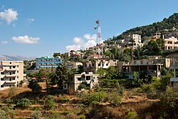 Neighborhood in Mazraat el-Chouf, 2009 | |
| 33°38′46″N 35°34′58″E / 33.64611°N 35.58278°E / 33.64611; 35.58278 | |
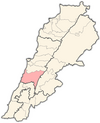
| Country |  Lebanon Lebanon |
| Governorate | Mount Lebanon |
| District | Chouf |
| Area | |
| • Total | 1.36 km2 (0.53 sq mi) |
| Elevation | 950 m (3,120 ft) |
| Time zone | UTC+2 (EET) |
| • Summer (DST) | UTC+3 (EEST) |
| Dialing code | +961 |
Mazraat el-Chouf (Arabic: مزرعة الشوف; also spelled Mazra'at al-Shuf) is a municipality in the Chouf District of the Mount Lebanon Governorate in Lebanon. It is located 50 kilometers southeast of Beirut. Its average elevation is 950 meters above sea level and its total land area is 1,359 hectares.[1] Mazraat el-Chouf had 4,330 registered voters in 2010 and the inhabitants are predominantly Druze and Maronites.[2]
References
- v
- t
- e

Capital: Beitedine
- Ain Qani
- Ain W Zain
- Ain Zhalta
- Ainbal
- Ammatour
- Baadarâne
- Baakleen
- Bakaata
- Barja
- Barouk
- Batloun
- Beitedine
- Beykoun
- El Bireh
- Bourjein et Marjiyat
- Boutmeh
- Brih
- Bsaba
- Dahr El Maghara
- Damour
- Daraya
- Deir el Qamar
- Dibbiyeh
- El Foûâra
- Haret Jandal
- Gharife
- Jahlieh
- Jdaideh
- Jieh
- Joun
- Kahlouniye
- Kfarfakoud
- Kfar Nabrakh
- Mazraat el-Chouf
- Mazraat el Daher
- Maasser
- Moukhtara
- Mtolleh
- Na'ameh
- Niha
- Rmeileh
- Serjbel
- Shheem
- Symkanieh
- Zaarourieh
 | This Lebanon location article is a stub. You can help Wikipedia by expanding it. |
- v
- t
- e


