Moddergat
Village in Friesland, Netherlands

Flag

Coat of arms
Blabberpoepert
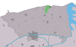
Location in the former Dongeradeel municipality
53°24′7″N 6°4′57″E / 53.40194°N 6.08250°E / 53.40194; 6.08250
 Netherlands
 Friesland
 (2021)[1]
9142[1]
Moddergat is a fishing village in Noardeast-Fryslân in the province of Friesland, the Netherlands. It had a population of around 221 in January 2017.[3] Before 2019, the village was part of the Dongeradeel municipality.[4]
The name of the village means 'mud hole' in Dutch and in West Frisian.[5] Moddergat is twinned with Peazens, and they are often referred to as "Peazens-Moddergat".[6][4]
In 1883, 17 of the 22 ships of Moddergat were lost at sea during a storm killing 83 fishermen. In 1958, a monument was placed on the sea dike in their honour.[7]
In 2004, NCRV television organized a competition for most beautiful place in the Netherlands. Moddergat came in second after Weerribben-Wieden National Park.[4]
History
The village was first mentioned in 1718 as Modde gat, and is supposed to mean "muddy pool".[8] The village of Peazens was founded first on the new dike along the Wadden Sea. Moddergat was founded later from Peazens, and used to consist of two hamlets: De Kamp and De Oere. The Reformed Church was built in 1912 with a wooden tower.[6]
In 1840, Moddergat was home to 220 people. Moddergat used to belong to the municipality of Westdongeradeel and Peazens to Oostdongeradeel. In 1983, the municipalities merged.[4]
Activities
Museum 't Fiskershúske consists of four fishermen's houses, the oldest of which is from 1794, and gives a display of the life and history of the fishers in Moddergat.[9]
Moddergat is one of the starting points for wadlopen (mudflat hiking). At low tide, it is possible to walk to the island of Schiermonnikoog.[10] Mudflat hiking is potentially dangerous, and is only allowed under the supervision of a licensed guide.[11]
Gallery
-
![Boethuisje [nl], place to leave the fishing nets](//upload.wikimedia.org/wikipedia/commons/thumb/6/6d/Boethuisje_De_Oere_Moddergat.jpg/90px-Boethuisje_De_Oere_Moddergat.jpg) Boethuisje [nl], place to leave the fishing nets
Boethuisje [nl], place to leave the fishing nets -
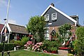 House in Moddergat
 -
 Fisher's monument
 -
 Sunset on the Wadden Sea
![Boethuisje [nl], place to leave the fishing nets](http://upload.wikimedia.org/wikipedia/commons/thumb/6/6d/Boethuisje_De_Oere_Moddergat.jpg/90px-Boethuisje_De_Oere_Moddergat.jpg)


References
- ^ a b c "Kerncijfers wijken en buurten 2021". Central Bureau of Statistics. Retrieved 31 March 2022.
two entries
- ^ "Postcodetool for 9142DL". Actueel Hoogtebestand Nederland (in Dutch). Het Waterschapshuis. Retrieved 31 March 2022.
- ^ Aantal inwoners per woonplaats in Dongeradeel op 1 januari 2017 Archived 2017-10-21 at the Wayback Machine - Dongeradeel
- ^ a b c d "Paesens-Moddergat". Plaatsengids (in Dutch). Retrieved 31 March 2022.
- ^ "Translate Moddergat nl->en". Google. Retrieved 31 March 2022.
- ^ a b Ronald Stenvert & Sabine Broekhoven (2000). "Paesens-Moddergat" (in Dutch). Zwolle: Waanders. ISBN 90 400 9476 4. Retrieved 31 March 2022.
- ^ "Monument omgekomen zeelieden 1883, De Oere, Moddergat". Online Begraafplaatsen (in Dutch). Retrieved 31 March 2022.
- ^ "Moddergat - (geografische naam)". Etymologiebank (in Dutch). Retrieved 31 March 2022.
- ^ "t Fiskershúske". Museum.nl (in Dutch). Retrieved 31 March 2022.
- ^ "Wadlopen bij Paesens-Moddergat". Wadlopen Moddergat (in Dutch). Retrieved 31 March 2022.
- ^ "Verordening van 13 december 1995, houdende regels met betrekking tot het wadlopen (Wadloopverordening 1996)" [1996 law for mudflat hiking] (PDF). Waddenzee (in Dutch). 13 December 1995. Retrieved 31 March 2022.
External links
![]() Media related to Moddergat at Wikimedia Commons
Media related to Moddergat at Wikimedia Commons
- v
- t
- e
Populated places in the municipality of Noardeast-Fryslân
- Former municipalities: Dongeradeel
- Ferwerderadiel
- Kollumerland en Nieuwkruisland
- Aalsum
- Anjum
- Augsbuurt
- Blije
- Bornwird
- Brantgum
- Burdaard
- Burum
- Ee
- Engwierum
- Ferwert
- Foudgum
- Ginnum
- Hallum
- Hantum
- Hantumhuizen
- Hegebeintum
- Hiaure
- Holwerd
- Jannum
- Jislum
- Jouswier
- Kollum
- Kollumerpomp
- Kollumerzwaag
- Lichtaard
- Lioessens
- Marrum
- Metslawier
- Moddergat
- Morra
- Munnekezijl
- Nes
- Niawier
- Oosternijkerk
- Oostmahorn
- Oostrum
- Oudwoude
- Paesens
- Raard
- Reitsum
- Ternaard
- Triemen
- Veenklooster
- Waaxens
- Wânswert
- Warfstermolen
- Westergeest
- Wetsens
- Wierum
- Zwagerbosch
- Bartlehiem (partially)
- Betterwird
- Hantumeruitburen
- Westernijtsjerk


