Muskeg Lake Cree Nation
Indian reserve in Saskatchewan, Canada
- Asimakaniseekan Askiy 102A
- Asimakaniseekan Askiy 102B
- Lake Pitihkwakew 102B
- Muskeg Lake 102B
- Muskeg Lake 102D
- Muskeg Lake 102E
- Muskeg Lake 102F
- Muskeg Lake 102G
The Muskeg Lake Cree Nation (Cree: ᒪᐢᑫᑯ ᓵᑲᐦᐃᑲᐣ, maskêko-sâkahikan[2]) is a Cree First Nation band government in Marcelin, Saskatchewan, Canada.
The Muskeg Lake Cree Nation is affiliated with the Saskatoon Tribal Council, along with six other First Nations.
Noted people from this reserve include World War II servicewoman Mary Greyeyes, the first indigenous woman to join the Canadian Forces.[3]
Reserves
This table is incomplete; you can help by expanding it.
Muskeg Lake Cree Nation has reserved for itself 15 reserves:[1]
| Reserve | Location | Map | Size | Pop. | Refs. |
|---|---|---|---|---|---|
| Asimakaniseekan Askiy 102A | In the city of Saskatoon |  | 14.3 ha | [4][5] | |
| Asimakaniseekan Askiy 102B | In the city of Saskatoon |  | 0.2 ha | [6][7] | |
| Lake Pitihkwakew 102B | 35 km northwest of Blaine Lake |  | 1115 ha | [8][9] | |
| Muskeg Lake 102 | 93 km north of Saskatoon |  | 7245.4 ha | 274 | [10][11][12][13] |
| Muskeg Lake 102B | 67 km northeast of North Battleford |  | 969.6 ha | 0 | [14][15][16] |
| Muskeg Lake 102C | |||||
| Muskeg Lake 102D | 43 km southwest of Shellbrook |  | 131.2 | 0 | [17][18][19] |
| Muskeg Lake 102E | 49 km south of Shellbrook |  | 162 ha | 0 | [20][21][22] |
| Muskeg Lake 102F | 41 km southwest of Shellbrook |  | 13.9 ha | 20 | [23][24][25] |
| Muskeg Lake 102G | 27 km north of Blaine Lake |  | 128.8 ha | 0 | [26][27][28] |
| Muskeg Lake 102H | |||||
| Muskeg Lake 102J | |||||
| Muskeg Lake 102K | |||||
| Muskeg Lake 102L | |||||
| Muskeg Lake 102M |
See also
References
- ^ a b "First Nation Detail". Crown–Indigenous Relations and Northern Affairs Canada. Government of Canada. 14 November 2008. Retrieved 28 December 2019.
- ^ Ogg, Arden (19 August 2015). "Cree Place Names Project". Cree Literacy Network. Retrieved 21 October 2021.
- ^ "Mary Greyeyes Reid". www.thecanadianencyclopedia.ca. The Canadian Encyclopedia. Retrieved 5 November 2018.
- ^ "Reserve/Settlement/Village Detail". Crown–Indigenous Relations and Northern Affairs Canada. Government of Canada. 14 November 2008. Retrieved 12 August 2019.
- ^ "Canada Lands Survey System – CLSS Map Browser". Natural Resources Canada. 13 December 2013. Retrieved 9 October 2019.
- ^ "Reserve/Settlement/Village Detail". Crown–Indigenous Relations and Northern Affairs Canada. Government of Canada. 14 November 2008. Retrieved 12 August 2019.
- ^ "Canada Lands Survey System – CLSS Map Browser". Natural Resources Canada. 13 December 2013. Retrieved 9 October 2019.
- ^ "Reserve/Settlement/Village Detail". Crown–Indigenous Relations and Northern Affairs Canada. Government of Canada. 14 November 2008. Retrieved 12 August 2019.
- ^ "Canada Lands Survey System - CLSS Map Browser". Natural Resources Canada. 13 December 2013. Retrieved 9 October 2019.
- ^ "Reserve/Settlement/Village Detail". Crown–Indigenous Relations and Northern Affairs Canada. Government of Canada. 14 November 2008. Retrieved 12 August 2019.
- ^ "Census Profile, 2016 Census". Statistics Canada. 8 February 2017. Retrieved 10 August 2019.
- ^ "Canada Lands Survey System - CLSS Map Browser". Natural Resources Canada. 13 December 2013. Retrieved 9 October 2019.
- ^ "The Community Well-Being index". Indigenous Services Canada. 24 May 2019. Retrieved 9 October 2019.
- ^ "Reserve/Settlement/Village Detail". Crown–Indigenous Relations and Northern Affairs Canada. Government of Canada. 14 November 2008. Retrieved 12 August 2019.
- ^ "Census Profile, 2016 Census". Statistics Canada. 8 February 2017. Retrieved 10 August 2019.
- ^ "Canada Lands Survey System - CLSS Map Browser". Natural Resources Canada. 13 December 2013. Retrieved 9 October 2019.
- ^ "Reserve/Settlement/Village Detail". Indigenous and Northern Affairs Canada. Government of Canada. 14 November 2008. Retrieved 12 August 2019.
- ^ "Census Profile, 2016 Census". Statistics Canada. 8 February 2017. Retrieved 10 August 2019.
- ^ "Canada Lands Survey System - CLSS Map Browser". Natural Resources Canada. 13 December 2013. Retrieved 9 October 2019.
External links
- Official website
- v
- t
- e
- Kinistin
- Mistawasis
- Muskeg Lake
- Muskoday
- One Arrow
- Whitecap
- Yellow Quill
- SDC Development Corporation
- Cress Housing
- Urban First Nation Services
- STC Health & Family Services
| ||
|---|---|---|
| Cities | 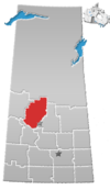 | |
| Towns | ||
| Villages | ||
| Resort villages | ||
| Rural municipalities | ||
| Crown colonies | ||
| First Nations | ||
| Indian reserves |
| |
| Unorganized areas | ||
| Unincorporated communities | ||
 | This First Nations in Canada-related article is a stub. You can help Wikipedia by expanding it. |
- v
- t
- e


