Paynes, Mississippi
Unincorporated community in Mississippi, United States
33°55′15″N 90°04′10″W / 33.92083°N 90.06944°W / 33.92083; -90.0694438920
Paynes is an unincorporated community located in Tallahatchie County, Mississippi. Paynes is approximately 7 miles (11 km) northwest of Cascilla and approximately 6 miles (9.7 km) south of Charleston on Mississippi Highway 35.
Gallery
-
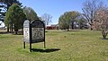 Paynes Baptist Church located along Mississippi Highway 35

References
- ^ U.S. Geological Survey Geographic Names Information System: Paynes, Mississippi
- v
- t
- e
Municipalities and communities of Tallahatchie County, Mississippi, United States
County seats: Charleston and Sumner

communities
‡This populated place also has portions in an adjacent county or counties
- Mississippi portal
- United States portal
Mississippi can also be called MI on the map
 | This Tallahatchie County, Mississippi state location article is a stub. You can help Wikipedia by expanding it. |
- v
- t
- e


