Porlezza
Comune in Lombardy, Italy
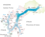
Location of Porlezza

46°2′N 9°8′E / 46.033°N 9.133°E / 46.033; 9.133
(31 March 2017)[2]
22018

Porlezza is a comune (municipality) on Lake Lugano in the Province of Como in the Italian region Lombardy, located about 60 kilometres (37 mi) north of Milan and about 25 kilometres (16 mi) north of Como.
Porlezza borders the following municipalities: Bene Lario, Carlazzo, Claino con Osteno, Corrido, Lenno, Ossuccio, Ponna, Val Rezzo, Valsolda.
Between 1873 and 1939, Porlezza was linked to Menaggio, on Lake Como, by the Menaggio–Porlezza railway, a steam hauled narrow gauge line built as part of a multi-modal transport link between Menaggio and Luino, on Lake Maggiore.[3]
References
- ^ "Superficie di Comuni Province e Regioni italiane al 9 ottobre 2011". Italian National Institute of Statistics. Retrieved 16 March 2019.
- ^ All demographics and other statistics: Italian statistical institute Istat.
- ^ "The Menaggio - Porlezza Railway 1884-1966 - Construction". Richard Marshall. Archived from the original on 2013-01-11. Retrieved 2012-09-21.
External links
Wikimedia Commons has media related to Porlezza.
- Porlezza - Lake Lugano
- v
- t
- e
Lake Lugano (Lago di Lugano, Ceresio)
- Switzerland
- Canton Ticino (District of Lugano, District of Mendrisio)
- Agno
- Barbengo
- Bissone
- Brusimpiano
- Brusino Arsizio
- Campione d'Italia
- Capolago
- Caprino
- Carabietta
- Caslano
- Cassarate
- Castagnola
- Claino con Osteno
- Collina d'Oro
- Gandria
- Lavena Ponte Tresa
- Lugano
- Magliaso
- Maroggia
- Melano
- Melide
- Morcote
- Muzzano
- Paradiso
- Ponte Tresa
- Porlezza
- Porto Ceresio
- Riva San Vitale
- Valsolda
- Vico Morcote
Authority control databases | |
|---|---|
| International |
|
| National |
|
 | This article on a location in the Province of Como is a stub. You can help Wikipedia by expanding it. |
- v
- t
- e


