Puebla de Yeltes
Municipality in Castile and León, Spain
Seal
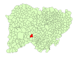
Location in Salamanca
(2018)[2]
37606
Puebla de Yeltes is a village and municipality in the province of Salamanca, western Spain, part of the autonomous community of Castile-Leon. It is located 65 kilometres (40 mi) from the provincial capital city of Salamanca and has a population of 151 people.[3]
Geography
The municipality covers an area of 37 km2 (14 sq mi). It lies 979 metres (3,212 ft) above sea level and the postal code is 37606.
Economy
- The basis of the economy is agriculture.
Culture
References
- v
- t
- e
Municipalities in the province of Salamanca
- Abusejo
- Agallas
- Ahigal de Villarino
- Ahigal de los Aceiteros
- Alaraz
- Alba de Tormes
- Alba de Yeltes
- Alconada
- Aldea del Obispo
- Aldeacipreste
- Aldeadávila de la Ribera
- Aldealengua
- Aldeanueva de Figueroa
- Aldeanueva de la Sierra
- Aldearrodrigo
- Aldearrubia
- Aldeaseca de Alba
- Aldeaseca de la Frontera
- Aldeatejada
- Aldeavieja de Tormes
- Aldehuela de Yeltes
- Aldehuela de la Bóveda
- Almenara de Tormes
- Almendra
- Anaya de Alba
- Arabayona de Mógica
- Arapiles
- Arcediano
- Armenteros
- Añover de Tormes
- Babilafuente
- Barbadillo
- Barbalos
- Barceo
- Barruecopardo
- Bañobárez
- Beleña
- Bermellar
- Berrocal de Huebra
- Berrocal de Salvatierra
- Boada
- Bogajo
- Brincones
- Buenamadre
- Buenavista
- Béjar
- Bóveda del Río Almar
- Cabeza del Caballo
- Cabezabellosa de la Calzada
- Cabrerizos
- Cabrillas
- Calvarrasa de Abajo
- Calvarrasa de Arriba
- Calzada de Don Diego
- Calzada de Valdunciel
- Campillo de Azaba
- Candelario
- Canillas de Abajo
- Cantagallo
- Cantalapiedra
- Cantalpino
- Cantaracillo
- Carbajosa de la Sagrada
- Carpio de Azaba
- Carrascal de Barregas
- Carrascal del Obispo
- Casafranca
- Casillas de Flores
- Castellanos de Moriscos
- Castellanos de Villiquera
- Castillejo de Martín Viejo
- Castraz
- Cepeda
- Cereceda de la Sierra
- Cerezal de Peñahorcada
- Cerralbo
- Cespedosa de Tormes
- Chagarcía Medianero
- Cilleros de la Bastida
- Cipérez
- Ciudad Rodrigo
- Coca de Alba
- Colmenar de Montemayor
- Cordovilla
- Cristóbal de la Sierra
- Dios le Guarde
- Doñinos de Ledesma
- Doñinos de Salamanca
- Éjeme
- El Arco
- El Bodón
- El Cabaco
- El Campo de Peñaranda
- El Cerro
- El Cubo de Don Sancho
- El Manzano
- El Maíllo
- El Milano
- El Payo
- El Pedroso de la Armuña
- El Pino de Tormes
- El Sahugo
- El Tejado
- El Tornadizo
- Encina de San Silvestre
- Encinas de Abajo
- Encinas de Arriba
- Encinasola de los Comendadores
- Endrinal
- Escurial de la Sierra
- Espadaña
- Espeja
- Espino de la Orbada
- Florida de Liébana
- Forfoleda
- Frades de la Sierra
- Fresnedoso
- Fresno Alhándiga
- Fuenteguinaldo
- Fuenteliante
- Fuenterroble de Salvatierra
- Fuentes de Béjar
- Fuentes de Oñoro
- Gajates
- Galindo y Perahuy
- Galinduste
- Galisancho
- Gallegos de Argañán
- Gallegos de Solmirón
- Garcibuey
- Garcihernández
- Garcirrey
- Gejuelo del Barro
- Golpejas
- Gomecello
- Guadramiro
- Guijo de Ávila
- Guijuelo
- Herguijuela de Ciudad Rodrigo
- Herguijuela de la Sierra
- Herguijuela del Campo
- Hinojosa de Duero
- Horcajo Medianero
- Horcajo de Montemayor
- Huerta
- Iruelos
- Ituero de Azaba
- Juzbado
- La Alameda de Gardón
- La Alamedilla
- La Alberca
- La Alberguería de Argañán
- La Atalaya
- La Bastida
- La Bouza
- La Cabeza de Béjar
- La Calzada de Béjar
- La Encina
- La Fregeneda
- La Fuente de San Esteban
- La Hoya
- La Mata de Ledesma
- La Maya
- La Orbada
- La Peña
- La Redonda
- La Rinconada de la Sierra
- La Sagrada
- La Sierpe
- La Tala
- La Vellés
- La Vídola
- La Zarza de Pumareda
- Lagunilla
- Larrodrigo
- Las Casas del Conde
- Las Veguillas
- Ledesma
- Ledrada
- Linares de Riofrío
- Los Santos
- Lumbrales
- Machacón
- Macotera
- Madroñal
- Malpartida
- Mancera de Abajo
- Martiago
- Martinamor
- Martín de Yeltes
- Masueco
- Matilla de los Caños del Río
- Membribe de la Sierra
- Mieza
- Miranda de Azán
- Miranda del Castañar
- Mogarraz
- Molinillo
- Monforte de la Sierra
- Monleras
- Monleón
- Monsagro
- Montejo
- Montemayor del Río
- Monterrubio de Armuña
- Monterrubio de la Sierra
- Morasverdes
- Morille
- Moriscos
- Moronta
- Moríñigo
- Mozárbez
- Narros de Matalayegua
- Nava de Béjar
- Nava de Francia
- Nava de Sotrobal
- Navacarros
- Navales
- Navalmoral de Béjar
- Navamorales
- Navarredonda de la Rinconada
- Navasfrías
- Negrilla de Palencia
- Olmedo de Camaces
- Pajares de la Laguna
- Palacios del Arzobispo
- Palaciosrubios
- Palencia de Negrilla
- Parada de Arriba
- Parada de Rubiales
- Paradinas de San Juan
- Pastores
- Pedraza de Alba
- Pedrosillo de Alba
- Pedrosillo de los Aires
- Pedrosillo el Ralo
- Pelabravo
- Pelarrodríguez
- Pelayos
- Peralejos de Abajo
- Peralejos de Arriba
- Pereña de la Ribera
- Peromingo
- Peñacaballera
- Peñaparda
- Peñaranda de Bracamonte
- Peñarandilla
- Pinedas
- Pitiegua
- Pizarral
- Poveda de las Cintas
- Pozos de Hinojo
- Puebla de Azaba
- Puebla de San Medel
- Puebla de Yeltes
- Puente del Congosto
- Puertas
- Puerto Seguro
- Puerto de Béjar
- Retortillo
- Robleda
- Robliza de Cojos
- Rollán
- Rágama
- Saelices el Chico
- Salamanca
- Saldeana
- Salmoral
- Salvatierra de Tormes
- San Cristóbal de la Cuesta
- San Esteban de la Sierra
- San Felices de los Gallegos
- San Martín del Castañar
- San Miguel de Valero
- San Miguel del Robledo
- San Morales
- San Muñoz
- San Pedro de Rozados
- San Pedro del Valle
- San Pelayo de Guareña
- Sanchotello
- Sanchón de la Ribera
- Sanchón de la Sagrada
- Sancti-Spíritus
- Sando
- Santa Marta de Tormes
- Santa María de Sando
- Santiago de la Puebla
- Santibáñez de Béjar
- Santibáñez de la Sierra
- Santiz
- Sardón de los Frailes
- Saucelle
- Sepulcro-Hilario
- Sequeros
- Serradilla del Arroyo
- Serradilla del Llano
- Sieteiglesias de Tormes
- Sobradillo
- Sorihuela
- Sotoserrano
- Tabera de Abajo
- Tamames
- Tarazona de Guareña
- Tardáguila
- Tejeda y Segoyuela
- Tenebrón
- Terradillos
- Topas
- Tordillos
- Torresmenudas
- Trabanca
- Tremedal de Tormes
- Valdecarros
- Valdefuentes de Sangusín
- Valdehijaderos
- Valdelacasa
- Valdelageve
- Valdelosa
- Valdemierque
- Valderrodrigo
- Valdunciel
- Valero
- Vallejera de Riofrío
- Valsalabroso
- Valverde de Valdelacasa
- Valverdón
- Vecinos
- Vega de Tirados
- Ventosa del Río Almar
- Villaflores
- Villagonzalo de Tormes
- Villalba de los Llanos
- Villamayor
- Villanueva del Conde
- Villar de Argañán
- Villar de Ciervo
- Villar de Gallimazo
- Villar de Peralonso
- Villar de Samaniego
- Villar de la Yegua
- Villares de Yeltes
- Villares de la Reina
- Villarino de los Aires
- Villarmayor
- Villarmuerto
- Villasbuenas
- Villasdardo
- Villaseco de los Gamitos
- Villaseco de los Reyes
- Villasrubias
- Villaverde de Guareña
- Villavieja de Yeltes
- Villoria
- Villoruela
- Vilvestre
- Vitigudino
- Yecla de Yeltes
- Zamarra
- Zamayón
- Zarapicos
- Zorita de la Frontera

 | This article about a location in the province of Salamanca, Spain, is a stub. You can help Wikipedia by expanding it. |
- v
- t
- e


