Saddle Lake 125
Indian reserve in Saddle Lake
Saddle Lake Cree Nation 125 | |
|---|---|
Indian reserve | |
| Saddle Lake Indian Reserve No. 125 | |
 Boundaries of Saddle Lake 125 | |
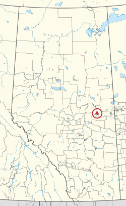 Location in Alberta | |
| First Nation | Saddle Lake |
| Treaty | 6 |
| Country | Canada |
| Province | Alberta |
| Municipal districts | Smoky Lake St. Paul |
| Area | |
| • Total | 25,780.6 ha (63,705.2 acres) |
| Website | https://slcn125.ca |
Saddle Lake 125 is an Indian reserve of the Saddle Lake Cree Nation in Alberta, located between Smoky Lake County and the County of St. Paul No. 19.[3] It is 24 kilometres west of St. Paul.[1]
Uniquely in Alberta, the Saddle Lake Cree Nation did not give permission for Statistics Canada to enter Saddle Lake 125 during the 2016 Canadian Census, and the reserve went unenumerated.[2]
References
- ^ a b "Reserve/Settlement/Village Detail". Crown–Indigenous Relations and Northern Affairs Canada. Government of Canada. Retrieved August 12, 2019.
- ^ a b "Census Profile, 2016 Census". Statistics Canada. February 8, 2017. Retrieved 2019-08-10.
- ^ Government of Alberta (May 25, 2019). Municipal Boundaries (Map). AltaLIS.
- v
- t
- e

Cultural areas: Plains, Subarctic
- Algic / Algonquian
- Athapascan / Dene
- Siouan
- Nakoda
band governments
| Athabasca Tribal Council (Fort McMurray) | |
|---|---|
| Blackfoot Confederacy (Standoff) | |
| Confederacy of Treaty 6 First Nations (Enoch) | |
| Kee Tas Kee Now Tribal Council (Atikameg) | |
| Lesser Slave Lake Indian Regional Council (Slave Lake) | |
| North Peace Tribal Council (High Level) | |
| Stoney Nakoda - Tsuut'ina Tribal Council (Tsuut'ina) | |
| Tribal Chiefs Ventures (Beaver Lake Cree) | |
| Western Cree Tribal Council (Valleyview) | |
| Yellowhead Tribal Council (Morinville) | |
| Unaffiliated | |
| Not federally recognized |
|
| Not headquartered in Alberta |
|
| Terminated |
|


53°58′15″N 111°41′15″W / 53.9709°N 111.6874°W / 53.9709; -111.6874 (Saddle Lake Cree Nation 125 - SLCN125)
 | This article about an Indian reserve in Alberta is a stub. You can help Wikipedia by expanding it. |
- v
- t
- e


