San Marcos, El Salvador
You can help expand this article with text translated from the corresponding article in Spanish. (December 2008) Click [show] for important translation instructions.
- View a machine-translated version of the Spanish article.
- Machine translation, like DeepL or Google Translate, is a useful starting point for translations, but translators must revise errors as necessary and confirm that the translation is accurate, rather than simply copy-pasting machine-translated text into the English Wikipedia.
- Do not translate text that appears unreliable or low-quality. If possible, verify the text with references provided in the foreign-language article.
- You must provide copyright attribution in the edit summary accompanying your translation by providing an interlanguage link to the source of your translation. A model attribution edit summary is
Content in this edit is translated from the existing Spanish Wikipedia article at [[:es:San Marcos (El Salvador)]]; see its history for attribution. - You may also add the template
{{Translated|es|San Marcos (El Salvador)}}to the talk page. - For more guidance, see Wikipedia:Translation.
Municipality in San Salvador Department, El Salvador
13°35′N 89°13′W / 13.583°N 89.217°W / 13.583; -89.217 El Salvador
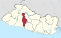
 (2007)
San Marcos is a municipality in El Salvador. It is located in a small valley, 5 miles (8 km) southeast of downtown San Salvador. It has a population of 63,209.[1] San Marcos is one of the 14 municipalities which make up the Metropolitan Area of San Salvador, also known as Greater San Salvador.
Geography
The city's geography is characterized by numerous small hills, as well as its proximity to Mount San Jacinto to the north and Planes de Renderos hills to the south. Most of San Marcos is a residential suburb with many middle-income and low-income dwellings. The city is the main gateway for air travelers because it is bordered by the Comalapa Highway (RN-5 (Autopista Comalapa)), the freeway that connects El Salvador International Airport with San Salvador.
Economy
Not much commerce exists outside the municipal public market and the southeast bus station, however, there is a significant textile industry in the San Marcos Free Trade Zone, and logistic/distribution companies along the Comalapa Highway. The city's per capita GDP(PPP) is US $5,480 and it has a Human Development Index of 0.759 as of 2002.[2]

References
- v
- t
- e
 San Salvador Department
Capital: San Salvador
- Aguilares
- Apopa
- Ayutuxtepeque
- Cuscatancingo
- Delgado
- El Paisnal
- Guazapa
- Ilopango
- Mejicanos
- Nejapa
- Panchimalco
- Rosario de Mora
- San Marcos
- San Martín
- San Salvador
- Santiago Texacuangos
- Santo Tomás
- Soyapango
- Tonacatepeque
- Cerro Cinotepeque
- Cerrón Grande Reservoir
- Guazapa Volcano
- Lake Ilopango
- Casa Presidencial
- Cemetery of Distinguished Citizens
- Estadio Cuscatlán
- Estadio Jorge "Mágico" González
- Estadio Las Delicias
- Estadio Nacional de El Salvador
- Estadio Universitario UES
- Gimnasio Nacional José Adolfo Pineda
- Government Center Tower
- Iglesia El Carmen
- Ilopango International Airport
- Lifestyle Center La Gran Via
- Monumento al Divino Salvador del Mundo
- Museo de la Palabra y la Imagen
- National Palace
- Plaza Gerardo Barrios
- San Salvador Cathedral
- San Salvador Historic Downtown
- Teatro Nacional de El Salvador
- World Trade Center San Salvador


