Sankt Eriksplan metro station
Stockholm Metro station
59°20′23″N 18°02′13″E / 59.33972°N 18.03694°E / 59.33972; 18.03694| Preceding station |  Stockholm metro Stockholm metro | Following station | ||
|---|---|---|---|---|
| Fridhemsplan towards Åkeshov | Line 17 | Odenplan towards Skarpnäck | ||
| Fridhemsplan towards Alvik | Line 18 | Odenplan towards Farsta strand | ||
| Fridhemsplan towards Hässelby strand | Line 19 | Odenplan towards Hagsätra | ||
Location | |
|---|---|
 |
Sankt Eriksplan (often abbreviated as S:t Eriksplan) is a station on the Green line of the Stockholm metro. It is entirely underground, and is located in the district of Vasastaden, which is in the borough of Norrmalm in central Stockholm. The station has a single island platform, some 8 metres (26 ft) below street level, and is accessed via a pair of ticket halls. One ticket hall is under Sankt Eriksplan itself, and the other under the intersection of Torsgatan [sv] and Sankt Eriksgatan [sv]. Both ticket halls are linked to the surface by entrance pavilions containing stairs and lifts.[3][4] The distance to Slussen is 4.1 km (2.5 mi).[1]
The station was inaugurated on 26 October 1952 as a part of the section of line between Hötorget and Vällingby.[3]
Gallery
-
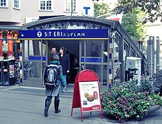 One of the entrances, 2009
 -
 Another entrance, 2016
 -
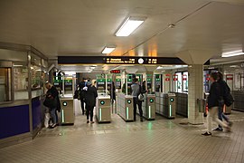 Ticket barriers, 2016
 -
 On the platform, 2012


References
- ^ a b Alfredsson, Björn; Berndt, Roland; Harlén, Hans (2000). Stockholm under: 50 år – 100 stationer (in Swedish). Stockholm: Bromberg. p. 49. ISBN 91-7608-832-4. SELIBR 7652820.
- ^ "Fakta om SL och regionen 2019" (PDF) (in Swedish). Storstockholms Lokaltrafik. p. 51. Archived (PDF) from the original on 27 December 2020. Retrieved 1 April 2021.
- ^ a b Schwandl, Robert. "Stockholm". urbanrail. Archived from the original on 23 April 2019. Retrieved 7 May 2019.
- ^ "S:t Eriksplan". Google maps. Retrieved 14 March 2022.
External links
Wikimedia Commons has media related to S:t Eriksplan Metro station.
- v
- t
- e

| Shared stations | |
|---|---|
| 17 | |
| 18 |
|
| 19 |


| Authority control databases: Geographic |
|
|---|
 | This article about a Swedish railway station is a stub. You can help Wikipedia by expanding it. |
- v
- t
- e
 | This Stockholm Metro article is a stub. You can help Wikipedia by expanding it. |
- v
- t
- e


