Timeline of the 1996 Atlantic hurricane season
Timeline of Atlantic tropical cyclones in 1996
| Timeline of the 1996 Atlantic hurricane season | |||||||
|---|---|---|---|---|---|---|---|
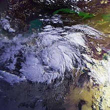
 Season summary map | |||||||
| Season boundaries | |||||||
| First system formed | June 17, 1996 | ||||||
| Last system dissipated | November 26, 1996 | ||||||
| Strongest system | |||||||
| Name | Edouard | ||||||
| Maximum winds | 145 mph (230 km/h) (1-minute sustained) | ||||||
| Lowest pressure | 933 mbar (hPa; 27.55 inHg) | ||||||
| Longest lasting system | |||||||
| Name | Fran | ||||||
| Duration | 15.5 days | ||||||
| |||||||
| Other years 1994, 1995, 1996, 1997, 1998 | |||||||
The 1996 Atlantic hurricane season had 13 named storms, of which 9 became hurricanes and 6 became major hurricanes (hurricanes that are classified as Category 3 or higher).[1] These major hurricanes were Bertha, Edouard, Fran, Hortense, Isidore, and Lili.[2][3][4][5][6][7] This timeline documents all the storm formations, strengthening, weakening, landfalls, extratropical transitions, as well as dissipation. The timeline also includes information that was not operationally released, meaning that information from post-storm reviews by the National Hurricane Center, such as information on a storm that was not operationally warned on, has been included. The season officially began on June 1, 1996, and ended on November 30 that same year.
The season's most destructive storms were Hurricane Cesar, Hurricane Fran, and Hurricane Hortense. Hurricane Cesar (later known as Hurricane Douglas in the Eastern Pacific basin) was the deadliest storm of the season; it killed at least 51 people and caused severe damage in northern Colombia and southern Central America.[8] Hurricane Fran caused $3.2 billion (1996 USD) worth of damage in the United States, mostly in North Carolina, and killed 26 people.[4] Hurricane Hortense dropped torrential rainfall on southwestern Puerto Rico and the eastern Dominican Republic, killing 21 people and leaving behind $127 million (1996 USD) in damage.[5] All three storms had their names retired by the World Meteorological Organization in the spring of 1997,[9] and were replaced with Cristobal, Fay, and Hanna for the 2002 season, respectively.
By convention, meteorologists use one time zone when issuing forecasts and making observations: Coordinated Universal Time (UTC), and also use the 24-hour clock (where 00:00 = midnight UTC).[10] The National Hurricane Center uses both UTC and the time zone where the center of the tropical cyclone is currently located. The time zones utilized (east to west) prior to 2020 were: Atlantic, Eastern, and Central.[nb 1][11] In this timeline, all information is listed by UTC first with the respective regional time included in parentheses. Additionally, figures for maximum sustained winds and position estimates are rounded to the nearest 5 units (knots, miles, or kilometers), following the convention used in the National Hurricane Center's products. Direct wind observations are rounded to the nearest whole number. Atmospheric pressures are listed to the nearest millibar and nearest hundredth of an inch of mercury.
Timeline of storms

June
- June 1
- The 1996 Atlantic hurricane season officially begins.[12]
- June 17

- 18:00 UTC (2:00 pm EDT) at 26°48′N 77°48′W / 26.8°N 77.8°W / 26.8; -77.8 (The season's first tropical depression develops.) – The first tropical depression of the season forms near eastern Grand Bahama.[13]
- June 19
- 00:00 UTC (8:00 pm EDT, June 18) at 31°30′N 78°42′W / 31.5°N 78.7°W / 31.5; -78.7 (The season's first tropical depression becomes Tropical Storm Arthur.) – The tropical depression strengthens into Tropical Storm Arthur about 245 miles (400 km) south-southwest of Cape Lookout, North Carolina.[13]
- 12:00 UTC (8:00 am EDT) at 33°12′N 78°06′W / 33.2°N 78.1°W / 33.2; -78.1 (Tropical Storm Arthur reaches its maximum winds.) – Tropical Storm Arthur reaches peak winds of 45 mph (75 km/h) about 130 miles (215 km) southwest of Cape Lookout, North Carolina.[nb 2][13]
- June 20
- 00:00 UTC (8:00 pm EDT, June 19) at 34°42′N 76°24′W / 34.7°N 76.4°W / 34.7; -76.4 (Tropical Storm Arthur makes landfall on the Outer Banks of North Carolina.) – Tropical Storm Arthur makes landfall near Cape Lookout, North Carolina with winds of 40 mph (65 km/h) and a barometric pressure of 1,005 mbar (29.68 inHg).[13]
- 12:00 UTC (8:00 am EDT) at 36°24′N 74°06′W / 36.4°N 74.1°W / 36.4; -74.1 (Tropical Storm Arthur weakens into a tropical depression.) – Tropical Storm Arthur weakens into a tropical depression about 115 miles (185 km) northeast of Cape Hatteras, North Carolina.[13]
- June 21
- 06:00 UTC (2:00 am EDT) at 37°18′N 66°30′W / 37.3°N 66.5°W / 37.3; -66.5 (Tropical Depression Arthur reaches its minimum pressure.) – Tropical Depression Arthur reaches a minimum barometric pressure of 1,002 mbar (29.59 inHg) about 355 miles (575 km) north-northwest of Bermuda.[13]
- 12:00 UTC (8:00 am EDT) at 37°30′N 62°00′W / 37.5°N 62.0°W / 37.5; -62.0 (Tropical Depression Arthur becomes extratropical.) – Tropical Depression Arthur transitions into an extratropical gale about 405 miles (650 km) north-northeast of Bermuda.[13]
July
- July 5
- 00:00 UTC (8:00 pm AST, July 4) at 9°48′N 34°00′W / 9.8°N 34.0°W / 9.8; -34.0 (The season's second tropical depression forms.) – The second tropical depression of the season forms about 790 miles (1,270 km) southwest of Cape Verde.[2]
- 12:00 UTC (8:00 am AST) at 11°00′N 39°00′W / 11.0°N 39.0°W / 11.0; -39.0 (The season's second tropical depression becomes Tropical Storm Bertha.) – The tropical depression strengthens into Tropical Storm Bertha about 1,070 miles (1,725 km) west-southwest of Cape Verde.[2]
- July 7

- 18:00 UTC (2:00 pm AST) at 16°30′N 58°24′W / 16.5°N 58.4°W / 16.5; -58.4 (Tropical Storm Bertha reaches Category 1 intensity.) – Tropical Storm Bertha strengthens into a Category 1 hurricane about 220 miles (350 km) east of Antigua.[2]
- July 9
- 06:00 UTC (2:00 am EDT) at 20°18′N 67°42′W / 20.3°N 67.7°W / 20.3; -67.7 (Hurricane Bertha rapidly strengthens into a Category 3 major hurricane and simultaneously reaches its peak intensity.) – Hurricane Bertha rapidly strengthens to Category 3 intensity, skipping Category 2 status, about 140 miles (220 km/h) north of Puerto Rico, making it the first major hurricane of the season. It simultaneously reaches peak winds of 115 mph (185 km/h) and a minimum barometric pressure of 960 mbar (28.35 inHg).[2]
- 18:00 UTC (2:00 pm EDT) at 22°30′N 71°06′W / 22.5°N 71.1°W / 22.5; -71.1 (Hurricane Bertha weakens to Category 2 intensity.) – Hurricane Bertha weakens to Category 2 intensity about 70 miles (110 km) northeast of the Turks and Caicos Islands.[2]
- July 10
- 06:00 UTC (2:00 am EDT) at 24°30′N 74°00′W / 24.5°N 74.0°W / 24.5; -74.0 (Hurricane Bertha weakens to Category 1 intensity.) – Hurricane Bertha weakens to Category 1 intensity about 40 miles (65 km) northeast of San Salvador Island.[2]
- July 12
- 12:00 UTC (8:00 am EDT) at 32°12′N 78°24′W / 32.2°N 78.4°W / 32.2; -78.4 (Hurricane Bertha regains Category 2 intensity.) – Hurricane Bertha regains Category 2 intensity about 100 miles (155 km) east-southeast of Charleston, South Carolina.[2]
- 20:00 UTC (4:00 pm EDT) at 34°18′N 77°48′W / 34.3°N 77.8°W / 34.3; -77.8 (Hurricane Bertha makes landfall between Wrightsville and Topsail Beaches in North Carolina.) – Hurricane Bertha makes landfall between Wrightsville and Topsail Beaches in North Carolina with winds of 105 mph (165 km/h) and a barometric pressure of 974 mbar (28.76 inHg).[2]
- July 13
- 00:00 UTC (8:00 pm EDT, July 12) at 35°00′N 77°36′W / 35.0°N 77.6°W / 35.0; -77.6 (Hurricane Bertha weakens to Category 1 intensity.) – Hurricane Bertha weakens back to Category 1 intensity inland over eastern North Carolina.[2]
- 06:00 UTC (2:00 am EDT) at 36°42′N 77°00′W / 36.7°N 77.0°W / 36.7; -77.0 (Hurricane Bertha weakens into a tropical storm.) – Hurricane Bertha weakens into a tropical storm about 40 miles (65 km) southwest of Newport News, Virginia.[2]
- July 14
- 12:00 UTC (8:00 am EDT) at 46°00′N 66°00′W / 46.0°N 66.0°W / 46.0; -66.0 (Tropical Storm Bertha transitions into an extratropical cyclone.) – Tropical Storm Bertha becomes extratropical over the Canadian province of New Brunswick.[2]
- July 24
- 18:00 UTC (2:00 pm EDT) at 11°48′N 62°36′W / 11.8°N 62.6°W / 11.8; -62.6 (The season's third tropical depression develops.) – The third tropical depression of the season forms just north of Isla Margarita.[8]
- July 25
- 12:00 UTC (8:00 am EDT) at 12°06′N 68°06′W / 12.1°N 68.1°W / 12.1; -68.1 (The season's third tropical depression becomes Tropical Storm Cesar.) – The tropical depression strengthens into Tropical Storm Cesar near Curaçao.[8]
- July 27
- 12:00 UTC (8:00 am EDT) at 11°36′N 79°30′W / 11.6°N 79.5°W / 11.6; -79.5 (Tropical Storm Cesar reaches Category 1 intensity.) – Tropical Storm Cesar strengthens into a Category 1 hurricane over the southwestern Caribbean Sea.[8]
- July 28
- 04:00 UTC (12:00 am EDT) at 12°12′N 83°54′W / 12.2°N 83.9°W / 12.2; -83.9 (Hurricane Cesar makes landfall in Nicaragua near Bluefields, and simultaneously reaches its peak intensity.) – Hurricane Cesar makes landfall just north of Bluefields, Nicaragua. It simultaneously reaches peak winds of 85 mph (140 km/h) and a minimum barometric pressure of 985 mbar (29.09 inHg).[8]
- 12:00 UTC (8:00 am EDT) at 12°42′N 86°12′W / 12.7°N 86.2°W / 12.7; -86.2 (Hurricane Cesar weakens into a tropical storm.) – Hurricane Cesar weakens into a tropical storm inland over Nicaragua.[8]
- July 29
- 00:00 UTC (7:00 pm CDT, July 28) at 13°00′N 89°42′W / 13.0°N 89.7°W / 13.0; -89.7 (Tropical Storm Cesar exits the Atlantic basin and becomes Tropical Storm Douglas in the Eastern Pacific.) – Tropical Storm Cesar completes its trek across Nicaragua and becomes Tropical Storm Douglas in the Eastern Pacific basin.[8][14]
August
- August 19
- 06:00 UTC (2:00 am EDT) at 17°18′N 80°12′W / 17.3°N 80.2°W / 17.3; -80.2 (The season's fourth tropical depression develops.) – The fourth tropical depression of the season forms over the western Caribbean Sea.[15]
- Just after 12:00 UTC (8:00 am EDT) near 17°48′N 81°42′W / 17.8°N 81.7°W / 17.8; -81.7 (The season's fourth tropical depression becomes Tropical Storm Dolly.) – The aforementioned tropical depression strengthens into Tropical Storm Dolly over the western Caribbean Sea.[15]
- 18:00 UTC (2:00 pm AST) at 12°24′N 19°54′W / 12.4°N 19.9°W / 12.4; -19.9 (The season's fifth tropical depression develops.) – Another tropical depression, the fifth of the season, forms about 345 miles (555 km) southeast of Cape Verde.[3]
- August 20
- 17:30 UTC (12:30 CDT) at 19°06′N 87°42′W / 19.1°N 87.7°W / 19.1; -87.7 (Tropical Storm Dolly reaches Category 1 intensity and simultaneously makes its first landfall.) – Tropical Storm Dolly strengthens into a Category 1 hurricane as it makes its first landfall near Punta Herrero, Quintana Roo with winds of 75 mph (120 km/h) and a barometric pressure of 999 mbar (29.50 inHg).[15]
- August 21
- 00:00 UTC (7:00 pm CDT, August 20) at 19°12′N 88°42′W / 19.2°N 88.7°W / 19.2; -88.7 (Hurricane Dolly weakens into a tropical storm.) – Hurricane Dolly weakens into a tropical storm inland about 50 miles (85 km) north-northwest of Chetumal.[15]
- 12:00 UTC (7:00 am CDT) at 19°24′N 90°06′W / 19.4°N 90.1°W / 19.4; -90.1 (Tropical Storm Dolly weakens into a tropical depression.) – Tropical Storm Dolly weakens into a tropical depression inland over the Yucatan Peninsula.[15]
- August 22
- 00:00 UTC (7:00 pm CDT, August 21) at 19°42′N 91°24′W / 19.7°N 91.4°W / 19.7; -91.4 (Tropical Depression Dolly regains tropical storm status.) – Tropical Depression Dolly restrengthens into a tropical storm over the Bay of Campeche.[15]
- 06:00 UTC (2:00 am AST) at 13°12′N 31°36′W / 13.2°N 31.6°W / 13.2; -31.6 (The season's fifth tropical depression becomes Tropical Storm Edouard.) – The fifth tropical depression of the season strengthens into Tropical Storm Edouard about 545 miles (880 km) west-southwest of Cape Verde.[3]
- August 23
- 12:00 UTC (7:00 am CDT) at 21°36′N 97°42′W / 21.6°N 97.7°W / 21.6; -97.7 (Tropical Storm Dolly regains Category 1 intensity, and simultaneously makes its second landfall at peak intensity.) – Tropical Storm Dolly restrengthens into a Category 1 hurricane as it makes its second landfall midway between Tampico, Tamaulipas, and Tuxpan, Veracruz. It simultaneously reaches peak winds of 80 mph (130 km/h) and a minimum barometric pressure of 989 mbar (29.21 inHg).[15]
- 12:00 UTC (8:00 am AST) at 13°54′N 38°18′W / 13.9°N 38.3°W / 13.9; -38.3 (Tropical Storm Edouard reaches Category 1 intensity.) – Tropical Storm Edouard strengthens into a Category 1 hurricane about 980 miles (1,575 km) west of Cape Verde.[3]
- 12:00 UTC (8:00 am AST) at 14°00′N 21°00′W / 14.0°N 21.0°W / 14.0; -21.0 (The season's sixth tropical depression develops.) – The sixth tropical depression of the season forms about 200 miles (325 km) southeast of Cape Verde.[4]
- 18:00 UTC (1:00 pm CDT) at 21°36′N 99°18′W / 21.6°N 99.3°W / 21.6; -99.3 (Hurricane Dolly weakens into a tropical storm.) – Hurricane Dolly weakens into a tropical storm inland over central Mexico.[15]
- August 24
- 00:00 UTC (7:00 pm CDT, August 23) at 21°36′N 100°54′W / 21.6°N 100.9°W / 21.6; -100.9 (Tropical Storm Dolly weakens into a tropical depression.) – Tropical Storm Dolly weakens into a tropical depression inland over central Mexico.[15]

- 12:00 UTC (8:00 am AST) at 14°24′N 43°36′W / 14.4°N 43.6°W / 14.4; -43.6 (Hurricane Edouard reaches Category 2 intensity.) – Hurricane Edouard strengthens to Category 2 intensity about 1,330 miles (2,140 km) west of Cape Verde.[3]
- 18:00 UTC (12:00 pm MDT) at 21°42′N 105°42′W / 21.7°N 105.7°W / 21.7; -105.7 (Tropical Depression Dolly enters the Eastern Pacific basin, and dissipates 12 hours later as it continues westward.) – Tropical Depression Dolly completes its trek across Mexico and enters the Eastern Pacific basin; it dissipates 12 hours later.[15]
- 18:00 UTC (2:00 pm AST) at 14°36′N 44°42′W / 14.6°N 44.7°W / 14.6; -44.7 (Hurricane Edouard strengthens into a Category 3 major hurricane.) – Hurricane Edouard strengthens to Category 3 intensity about 1,405 miles (2,260 km) west of Cape Verde, making it the second major hurricane of the season.[3]
- August 25
- 00:00 UTC (8:00 pm AST, August 24) at 15°00′N 45°48′W / 15.0°N 45.8°W / 15.0; -45.8 (Hurricane Edouard reaches Category 4 intensity.) – Hurricane Edouard strengthens to Category 4 intensity about 1,475 miles (2,370 km) west of Cape Verde.[3]
- 06:00 UTC (2:00 am AST) at 15°24′N 47°00′W / 15.4°N 47.0°W / 15.4; -47.0 (Hurricane Edouard, the strongest storm of the season, reaches its peak intensity.) – Hurricane Edouard reaches peak winds of 145 mph (230 km/h) and a minimum barometric pressure of 933 mbar (27.55 inHg) about 1,550 miles (2,490 km) west of Cape Verde, making it the strongest storm of the season.[3]
- August 26
- 00:00 UTC (8:00 pm AST, August 25) at 12°42′N 23°00′W / 12.7°N 23.0°W / 12.7; -23.0 (The season's seventh tropical depression develops.) – The seventh tropical depression of the season forms about 185 miles (295 km) south-southeast of Cape Verde.[16]
- August 27
- 12:00 UTC (8:00 am AST) at 14°36′N 44°54′W / 14.6°N 44.9°W / 14.6; -44.9 (The season's sixth tropical depression becomes Tropical Storm Fran.) – The sixth tropical depression of the season strengthens into Tropical Storm Fran about 1,035 miles (1,665 km) east of the Lesser Antilles.[4]
- August 28
- 06:00 UTC (2:00 am AST) at 10°36′N 32°42′W / 10.6°N 32.7°W / 10.6; -32.7 (The season's seventh tropical depression becomes Tropical Storm Gustav.) – The seventh tropical depression of the season strengthens into Tropical Storm Gustav about 685 miles (1,105 km) west-southwest of Cape Verde.[16]
- 12:00 UTC (8:00 am EDT) at 21°54′N 63°12′W / 21.9°N 63.2°W / 21.9; -63.2 (Hurricane Edouard weakens to Category 3 intensity.) – Hurricane Edouard weakens to Category 3 intensity about 725 miles (1,165 km) south of Bermuda.[3]
- 12:00 UTC (8:00 am AST) at 11°00′N 33°36′W / 11.0°N 33.6°W / 11.0; -33.6 (Tropical Storm Gustav reaches its minimum pressure.) – Tropical Storm Gustav reaches a minimum barometric pressure of 1,005 mbar (29.68 inHg) about 720 miles (1,160 km) west-southwest of Cape Verde.[16]
- August 29
- 00:00 UTC (8:00 pm AST, August 28) at 16°24′N 53°42′W / 16.4°N 53.7°W / 16.4; -53.7 (Tropical Storm Fran reaches Category 1 intensity.) – Tropical Storm Fran strengthens into a Category 1 hurricane about 460 miles (740 km) east of the Leeward Islands.[4]
- 00:00 UTC (8:00 pm AST, August 28) at 12°30′N 35°12′W / 12.5°N 35.2°W / 12.5; -35.2 (Tropical Storm Gustav reaches its peak winds.) – Tropical Storm Gustav reaches peak winds of 45 mph (75 km/h) about 795 miles (1,280 km) west-southwest of Cape Verde.[16]
- 12:00 UTC (8:00 am EDT) at 24°00′N 68°06′W / 24.0°N 68.1°W / 24.0; -68.1 (Hurricane Edouard regains Category 4 intensity.) – Hurricane Edouard regains Category 4 intensity about 610 miles (980 km) south-southwest of Bermuda.[3]
- August 30
- 18:00 UTC (2:00 pm AST) at 20°12′N 60°36′W / 20.2°N 60.6°W / 20.2; -60.6 (Hurricane Fran weakens into a tropical storm.) – Hurricane Fran weakens into a tropical storm about 235 miles (380 km) north-northeast of the Leeward Islands.[4]
- August 31
- 00:00 UTC (8:00 pm EDT, August 30) at 29°30′N 70°30′W / 29.5°N 70.5°W / 29.5; -70.5 (Hurricane Edouard weakens to Category 3 intensity.) – Hurricane Edouard weakens back to Category 3 intensity about 390 miles (630 km) west-southwest of Bermuda.[3]
- 12:00 UTC (8:00 am AST) at 21°06′N 61°24′W / 21.1°N 61.4°W / 21.1; -61.4 (Tropical Storm Fran regains Category 1 intensity.) – Tropical Storm Fran restrengthens into a Category 1 hurricane about 275 miles (445 km) north-northeast of the Leeward Islands.[4]
September
- September 1
- 12:00 UTC (8:00 am EDT) at 36°30′N 70°12′W / 36.5°N 70.2°W / 36.5; -70.2 (Hurricane Edouard weakens to Category 2 intensity.) – Hurricane Edouard weakens to Category 2 intensity about 310 miles (500 km) east-northeast of Cape Hatteras, North Carolina.[3]
- 18:00 UTC (2:00 pm AST) at 20°00′N 46°30′W / 20.0°N 46.5°W / 20.0; -46.5 (Tropical Storm Gustav weakens into a tropical depression, and dissipates 12 hours later.) – Tropical Storm Gustav weakens into a tropical depression about 1,535 miles (2,475 km) west of Cape Verde; it dissipates 12 hours later.[16]
- September 2
- 00:00 UTC (8:00 pm EDT, September 1) at 38°42′N 69°30′W / 38.7°N 69.5°W / 38.7; -69.5 (Hurricane Edouard weakens to Category 1 intensity.) – Hurricane Edouard weakens to Category 1 intensity about 180 miles (285 km) south of Nantucket, Massachusetts.[3]
- September 3
- 00:00 UTC (8:00 pm EDT, September 2) at 42°00′N 66°48′W / 42.0°N 66.8°W / 42.0; -66.8 (Hurricane Edouard weakens into a tropical storm.) – Hurricane Edouard weakens into a tropical storm about 180 miles (285 km) east-northeast of Nantucket, Massachusetts.[3]
- 06:00 UTC (2:00 am EDT) at 42°12′N 66°00′W / 42.2°N 66.0°W / 42.2; -66.0 (Tropical Storm Edouard transitions into an extratropical cyclone.) – Tropical Storm Edouard becomes extratropical about 220 miles (350 km) east-northeast of Nantucket, Massachusetts.[3]
- 12:00 UTC (8:00 am AST) at 14°54′N 41°00′W / 14.9°N 41.0°W / 14.9; -41.0 (The season's eighth tropical depression develops.) – The eighth tropical depression of the season forms about 1,150 miles (1,855 km) west of Cape Verde.[5]
- 18:00 UTC (2:00 pm EDT) at 25°12′N 72°12′W / 25.2°N 72.2°W / 25.2; -72.2 (Hurricane Fran reaches Category 2 intensity.) – Hurricane Fran strengthens to Category 2 intensity while paralleling the Bahamas just over 115 miles (185 km) to the east.[4]
- September 4

- 06:00 UTC (2:00 am EDT) at 26°24′N 73°54′W / 26.4°N 73.9°W / 26.4; -73.9 (Hurricane Fran strengthens into a Category 3 major hurricane.) – Hurricane Fran strengthens to Category 3 intensity northeast of the central Bahamas, making it the third major hurricane of the season.[4]
- 12:00 UTC (8:00 am EDT) at 27°00′N 74°42′W / 27.0°N 74.7°W / 27.0; -74.7 (Hurricane Fran reaches its peak winds.) – Hurricane Fran reaches peak winds of 120 mph (195 km/h) northeast of the central Bahamas.[4]
- September 5
- 00:00 UTC (8:00 pm EDT, September 4) at 28°36′N 76°06′W / 28.6°N 76.1°W / 28.6; -76.1 (Hurricane Fran reaches its lowest pressure.) – Hurricane Fran reaches a minimum barometric pressure of 946 mbar (27.94 inHg) about 290 miles (465 km) offshore the east coast of Florida.[4]
- September 6
- 00:30 UTC (8:30 pm EDT, September 5) at 33°54′N 78°00′W / 33.9°N 78.0°W / 33.9; -78.0 (Hurricane Fran makes landfall near Cape Fear, North Carolina.) – Hurricane Fran makes landfall near Cape Fear, North Carolina with winds of 115 mph (185 km/h) and a barometric pressure of 954 mbar (28.17 inHg).[4]
- 06:00 UTC (2:00 am EDT) at 35°12′N 78°42′W / 35.2°N 78.7°W / 35.2; -78.7 (Hurricane Fran rapidly weakens to Category 1 intensity.) – Hurricane Fran rapidly weakens to Category 1 intensity inland over North Carolina.[4]
- 12:00 UTC (8:00 am EDT) at 36°42′N 79°00′W / 36.7°N 79.0°W / 36.7; -79.0 (Hurricane Fran weakens into a tropical storm.) – Hurricane Fran weakens into a tropical storm inland over North Carolina and Virginia.[4]
- 18:00 UTC (2:00 pm EDT) at 38°00′N 79°24′W / 38.0°N 79.4°W / 38.0; -79.4 (Tropical Storm Fran weakens into a tropical depression.) – Tropical Storm Fran weakens into a tropical depression inland over Virginia.[4]
- September 7
- 06:00 UTC (2:00 am AST) at 15°24′N 58°18′W / 15.4°N 58.3°W / 15.4; -58.3 (The season's eighth tropical depression strengthens into Tropical Storm Hortense.) – The eighth tropical depression of the season strengthens into Tropical Storm Hortense about 220 miles (350 km) east of Guadeloupe.[5]
- September 9
- 00:00 UTC (8:00 pm EDT, September 8) at 44°54′N 75°54′W / 44.9°N 75.9°W / 44.9; -75.9 (Tropical Depression Fran transitions into an extratropical cyclone.) – Tropical Depression Fran becomes extratropical over southern Ontario.[4]

- 06:00 UTC (2:00 am AST) at 16°06′N 64°30′W / 16.1°N 64.5°W / 16.1; -64.5 (Tropical Storm Hortense reaches Category 1 intensity.) – Tropical Storm Hortense strengthens into a Category 1 hurricane over the eastern Caribbean Sea.[5]
- September 10
- 06:00 UTC (2:00 am EDT) at 18°00′N 66°54′W / 18.0°N 66.9°W / 18.0; -66.9 (Hurricane Hortense makes its first landfall near Guánica, Puerto Rico.) – Hurricane Hortense makes its first landfall near Guánica, Puerto Rico with winds of 80 mph (130 km/h) and a barometric pressure of 989 mbar (29.21 inHg).[5]
- September 11
- 12:00 UTC (8:00 am EDT) at 20°54′N 70°06′W / 20.9°N 70.1°W / 20.9; -70.1 (Hurricane Hortense reaches Category 2 intensity.) – Hurricane Hortense strengthens to Category 2 intensity about 125 miles (205 km) east-southeast of the Turks and Caicos Islands.[5]
- September 12
- 00:00 UTC (8:00 pm EDT, September 11) at 22°18′N 71°06′W / 22.3°N 71.1°W / 22.3; -71.1 (Hurricane Hortense strengthens into a Category 3 major hurricane.) – Hurricane Hortense strengthens to Category 3 intensity about 60 miles (95 km) northeast of the Turks and Caicos Islands, making it the fourth major hurricane of the season.[5]
- 12:00 UTC (8:00 am EDT) at 23°54′N 71°48′W / 23.9°N 71.8°W / 23.9; -71.8 (Hurricane Hortense reaches Category 4 intensity.) – Hurricane Hortense strengthens to Category 4 intensity about 145 miles (230 km) north of the Turks and Caicos Islands.[5]
- September 13
- 00:00 UTC (8:00 pm EDT, September 12) at 25°54′N 71°30′W / 25.9°N 71.5°W / 25.9; -71.5 (Hurricane Hortense reaches its peak intensity.) – Hurricane Hortense reaches peak winds of 140 mph (220 km/h) and a minimum barometric pressure of 935 mbar (27.61 inHg) about 290 miles (465 km) north of the Turks and Caicos Islands.[5]
- 12:00 UTC (8:00 am EDT) at 29°00′N 70°54′W / 29.0°N 70.9°W / 29.0; -70.9 (Hurricane Hortense weakens to Category 3 intensity.) – Hurricane Hortense weakens to Category 3 intensity about 500 miles (805 km) north of the Turks and Caicos Islands.[5]
- September 14
- 00:00 UTC (8:00 pm EDT, September 13) at 33°18′N 69°30′W / 33.3°N 69.5°W / 33.3; -69.5 (Hurricane Hortense weakens to Category 2 intensity.) – Hurricane Hortense weakens to Category 2 intensity about 805 miles (1,295 km) north of the Turks and Caicos Islands.[5]
- 18:00 UTC (2:00 pm AST) at 42°00′N 65°12′W / 42.0°N 65.2°W / 42.0; -65.2 (Hurricane Hortense weakens to Category 1 intensity.) – Hurricane Hortense weakens to Category 1 intensity just south of Nova Scotia.[5]
- September 15
- 03:00 UTC (11:00 pm AST, September 14) at 44°48′N 62°30′W / 44.8°N 62.5°W / 44.8; -62.5 (Hurricane Hortense makes its second landfall in Nova Scotia.) – Hurricane Hortense makes its second landfall over eastern Nova Scotia with winds of 80 mph (130 km/h) and a barometric pressure of 978 mbar (28.88 inHg).[5]
- 12:00 UTC (8:00 am AST) at 46°18′N 59°06′W / 46.3°N 59.1°W / 46.3; -59.1 (Hurricane Hortense weakens into a tropical storm.) – Hurricane Hortense weakens into a tropical storm just east of Nova Scotia.[5]
- 18:00 UTC (2:00 pm AST) at 46°00′N 55°00′W / 46.0°N 55.0°W / 46.0; -55.0 (Tropical Storm Hortense transitions into an extratropical cyclone.) – Tropical Storm Hortense becomes extratropical just south of Newfoundland.[5]
- September 24

- 12:00 UTC (8:00 am AST) at 8°36′N 23°18′W / 8.6°N 23.3°W / 8.6; -23.3 (The season's ninth tropical depression develops.) – The ninth tropical depression of the season forms about 465 miles (750 km) south of Cape Verde.[6]
- September 25
- 06:00 UTC (2:00 am AST) at 10°18′N 28°30′W / 10.3°N 28.5°W / 10.3; -28.5 (The season's ninth tropical depression strengthens into Tropical Storm Isidore.) – The ninth tropical depression of the season strengthens into Tropical Storm Isidore about 470 miles (760 km) southwest of Cape Verde.[6]
- September 26
- 06:00 UTC (2:00 am AST) at 11°42′N 34°12′W / 11.7°N 34.2°W / 11.7; -34.2 (Tropical Storm Isidore reaches Category 1 intensity.) – Tropical Storm Isidore strengthens into a Category 1 hurricane about 750 miles (1,205 km) west-southwest of Cape Verde.[6]
- September 27
- 06:00 UTC (2:00 am AST) at 13°42′N 39°48′W / 13.7°N 39.8°W / 13.7; -39.8 (Hurricane Isidore reaches Category 2 intensity.) – Hurricane Isidore strengthens to Category 2 intensity about 1,080 miles (1,740 km) west of Cape Verde.[6]
- September 28
- 00:00 UTC (8:00 pm AST, September 27) at 15°48′N 42°54′W / 15.8°N 42.9°W / 15.8; -42.9 (Hurricane Isidore strengthens into a Category 3 major hurricane and simultaneously reaches its peak intensity.) – Hurricane Isidore strengthens to Category 3 intensity about 1,280 miles (2,055 km) west of Cape Verde, making it the season's fifth major hurricane. It simultaneously reaches peak winds of 115 mph (185 km/h) and a minimum barometric pressure of 960 mbar (28.35 inHg).[6]
- 12:00 UTC (8:00 am AST) at 17°48′N 43°12′W / 17.8°N 43.2°W / 17.8; -43.2 (Hurricane Isidore weakens to Category 2 intensity.) – Hurricane Isidore weakens to Category 2 intensity about 1,135 miles (1,825 km) west of Cape Verde.[6]
- September 29
- 06:00 UTC (2:00 am AST) at 20°48′N 42°12′W / 20.8°N 42.2°W / 20.8; -42.2 (Hurricane Isidore weakens to Category 1 intensity.) – Hurricane Isidore weakens to Category 1 intensity about 1,270 miles (2,050 km) west-northwest of Cape Verde.[6]
- September 30
- 00:00 UTC (8:00 pm AST, September 29) at 23°48′N 40°24′W / 23.8°N 40.4°W / 23.8; -40.4 (Hurricane Isidore weakens into a tropical storm.) – Hurricane Isidore weakens into a tropical storm about 1,230 miles (1,985 km) west-northwest of Cape Verde.[6]
October
- October 1
- 12:00 UTC (8:00 am AST) at 33°36′N 40°24′W / 33.6°N 40.4°W / 33.6; -40.4 (Tropical Storm Isidore weakens into a tropical depression.) – Tropical Storm Isidore weakens into a tropical depression over the northeastern Atlantic basin.[6]
- October 2
- 00:00 UTC (8:00 pm AST, October 1) at 38°06′N 40°06′W / 38.1°N 40.1°W / 38.1; -40.1 (Tropical Depression Isidore transitions into an extratropical cyclone.) – Tropical Depression Isidore transitions into an extratropical cyclone.[6]
- October 4

- 18:00 UTC (1:00 pm CDT) at 22°42′N 96°12′W / 22.7°N 96.2°W / 22.7; -96.2 (Tropical Depression Ten develops.) – Tropical Depression Ten forms over the western Gulf of Mexico.[17]
- October 6
- 18:00 UTC (1:00 pm CDT) at 25°06′N 91°48′W / 25.1°N 91.8°W / 25.1; -91.8 (Tropical Depression Ten strengthens into Tropical Storm Josephine.) – Tropical Depression Ten strengthens into Tropical Storm Josephine.[17]
- October 7
- 12:00 UTC (7:00 am CDT) at 26°54′N 87°18′W / 26.9°N 87.3°W / 26.9; -87.3 (Tropical Storm Josephine reaches its peak intensity.) – Tropical Storm Josephine reaches peak winds of 70 mph (110 km/h) and a minimum barometric pressure of 981 mbar (28.97 inHg) over the northeastern Gulf of Mexico.[17]
- October 8
- 03:30 UTC (11:30 pm EDT, October 7) at 30°00′N 83°54′W / 30.0°N 83.9°W / 30.0; -83.9 (Tropical Storm Josephine makes landfall in Taylor County, Florida.) – Tropical Storm Josephine makes landfall in Taylor County, Florida, between Dekle Beach and St. Marks, with winds of 70 mph (110 km/h) and a barometric pressure of 983 mbar (29.03 inHg).[17]
- 06:00 UTC (2:00 am EDT) at 30°54′N 82°18′W / 30.9°N 82.3°W / 30.9; -82.3 (Tropical Storm Josephine transitions into an extratropical cyclone.) – Tropical Storm Josephine becomes extratropical as it begins to move over Georgia.[17]
- October 11
- 12:00 UTC (8:00 am EDT) at 17°18′N 86°30′W / 17.3°N 86.5°W / 17.3; -86.5 (The season's eleventh tropical depression develops.) – The eleventh tropical depression of the season forms about midway between the coast of Belize and the Swan Islands .[18]
- 18:00 UTC (2:00 pm EDT) at 16°54′N 87°06′W / 16.9°N 87.1°W / 16.9; -87.1 (The season's eleventh tropical depression strengthens into Tropical Storm Kyle and simultaneously reaches its peak winds.) – The tropical depression strengthens into Tropical Storm Kyle and simultaneously reaches peak winds of 50 mph (85 km/h) over the Gulf of Honduras.[18]
- 21:00 UTC (5:00 pm EDT) at 16°42′N 87°24′W / 16.7°N 87.4°W / 16.7; -87.4 (Tropical Storm Kyle reaches its lowest pressure.) – Tropical Storm Kyle reaches a minimum barometric pressure of 1,002 mbar (29.59 inHg).[18]
- October 12
- 12:00 UTC (7:00 am CDT) at 16°00′N 88°06′W / 16.0°N 88.1°W / 16.0; -88.1 (Tropical Storm Kyle weakens into a tropical depression.) – Tropical Storm Kyle weakens into a tropical depression just offshore the Guatemala/Honduras border.[18]
- 18:00 UTC (1:00 pm CDT) at 15°42′N 88°24′W / 15.7°N 88.4°W / 15.7; -88.4 (Tropical Depression Kyle makes landfall near the Guatemala/Honduras border; it dissipates six hours later.) – Tropical Depression Kyle makes landfall near the Guatemala/Honduras border with winds of 30 mph (45 km/h) and a barometric pressure of 1,012 mbar (29.88 inHg). It dissipates near this area six hours later.[18]
- October 14

- 12:00 UTC (8:00 am EDT) at 12°48′N 80°24′W / 12.8°N 80.4°W / 12.8; -80.4 (The season's twelfth tropical depression develops.) – The twelfth tropical depression of the season forms east of Nicaragua.[7]
- October 16
- 06:00 UTC (2:00 am EDT) at 17°30′N 83°48′W / 17.5°N 83.8°W / 17.5; -83.8 (The season's twelfth tropical depression strengthens into Tropical Storm Lili.) – The tropical depression strengthens into Tropical Storm Lili near the Swan Islands.[7]
- October 17
- 12:00 UTC (8:00 am EDT) at 19°36′N 83°30′W / 19.6°N 83.5°W / 19.6; -83.5 (Tropical Storm Lili reaches Category 1 intensity.) – Tropical Storm Lili strengthens into a Category 1 hurricane about 130 miles (215 km) south of the Isle of Youth.[7]
- October 18
- 09:30 UTC (5:30 am EDT) at 22°18′N 82°00′W / 22.3°N 82.0°W / 22.3; -82.0 (Hurricane Lili reaches Category 2 intensity and makes landfall on the Zapata Peninsula of Cuba.) – Hurricane Lili strengthens to Category 2 intensity. It simultaneously makes landfall on the Zapata Peninsula of Cuba with winds of 100 mph (155 km/h) and a barometric pressure of 975 mbar (28.79 inHg).[7]
- 18:00 UTC (2:00 pm EDT) at 22°30′N 80°00′W / 22.5°N 80.0°W / 22.5; -80.0 (Hurricane Lili weakens to Category 1 intensity.) – Hurricane Lili weakens to Category 1 intensity over Cuba.[7]
- October 19
- 00:00 UTC (8:00 pm EDT, October 18) at 23°00′N 78°12′W / 23.0°N 78.2°W / 23.0; -78.2 (Hurricane Lili regains Category 2 intensity.) – Having re-emerged over water, Hurricane Lili regains Category 2 intensity about 145 miles (230 km) west-southwest of Great Exuma.[7]
- 12:00 UTC (8:00 am EDT) at 24°24′N 74°00′W / 24.4°N 74.0°W / 24.4; -74.0 (Hurricane Lili strengthens into a Category 3 major hurricane and simultaneously reaches its peak intensity.) – Hurricane Lili strengthens to Category 3 intensity about 35 miles (55 km) northeast of San Salvador Island, making it the sixth major hurricane of the season. It simultaneously reaches peak winds of 115 mph (185 km/h) and a minimum barometric pressure of 960 mbar (28.35 inHg).[7]
- 18:00 UTC (2:00 pm EDT) at 25°30′N 71°30′W / 25.5°N 71.5°W / 25.5; -71.5 (Hurricane Lili weakens to Category 2 intensity.) – Hurricane Lili weakens back to Category 2 intensity about 215 miles (345 km) east-northeast of San Salvador Island.[7]
- October 20
- 00:00 UTC (8:00 pm EDT, October 19) at 26°54′N 69°00′W / 26.9°N 69.0°W / 26.9; -69.0 (Hurricane Lili weakens to Category 1 intensity.) – Hurricane Lili weakens to Category 1 intensity about 390 miles (630 km) east-northeast of San Salvador Island.[7]

- 12:00 UTC (8:00 am AST) at 29°36′N 65°00′W / 29.6°N 65.0°W / 29.6; -65.0 (Hurricane Lili regains Category 2 intensity.) – Hurricane Lili again regains Category 2 intensity about 190 miles (305 km) south of Bermuda.[7]
- 18:00 UTC (2:00 pm AST) at 30°42′N 62°54′W / 30.7°N 62.9°W / 30.7; -62.9 (Hurricane Lili weakens to Category 1 intensity.) – Hurricane Lili weakens back to Category 1 intensity about 155 miles (250 km) southeast of Bermuda.[7]
- October 25
- 12:00 UTC (8:00 am AST) at 35°48′N 45°24′W / 35.8°N 45.4°W / 35.8; -45.4 (Hurricane Lili regains Category 2 intensity.) – Hurricane Lili regains Category 2 intensity for a final time about 975 miles (1,565 km) west-southwest of the Azores.[7]
- 18:00 UTC (2:00 pm AST) at 37°12′N 43°18′W / 37.2°N 43.3°W / 37.2; -43.3 (Hurricane Lili weakens to Category 1 intensity.) – Hurricane Lili weakens to Category 1 intensity about 835 miles (1,345 km) west of the Azores.[7]
- October 26
- 18:00 UTC (2:00 pm AST) at 42°18′N 33°12′W / 42.3°N 33.2°W / 42.3; -33.2 (Hurricane Lili weakens into a tropical storm.) – Hurricane Lili weakens into a tropical storm about 370 miles (595 km) northwest of the Azores.[7]
- October 27
- 06:00 UTC (2:00 am AST) at 46°18′N 27°12′W / 46.3°N 27.2°W / 46.3; -27.2 (Tropical Storm Lili transitions into an extratropical cyclone.) – Tropical Storm Lili becomes extratropical about 530 miles (850 km) north of the Azores.[7]
November
- November 16
- 18:00 UTC (1:00 pm EST) at 17°00′N 79°00′W / 17.0°N 79.0°W / 17.0; -79.0 (The season's thirteenth tropical depression develops.) – The thirteenth tropical depression of the season forms southwest of Jamaica.[19]
- November 19
- 06:00 UTC (1:00 am EST) at 13°48′N 80°54′W / 13.8°N 80.9°W / 13.8; -80.9 (The season's thirteenth tropical depression becomes Tropical Storm Marco.) – The tropical depression strengthens into Tropical Storm Marco over the western Caribbean Sea, off the coast of Central America.[19]
- November 20
- 06:00 UTC (1:00 am EST) at 13°48′N 78°30′W / 13.8°N 78.5°W / 13.8; -78.5 (Tropical Storm Marco strengthens into a Category 1 hurricane and simultaneously reaches its peak intensity.) – Tropical Storm Marco strengthens into a Category 1 hurricane well to the south of Jamaica. It simultaneously reaches peak winds of 75 mph (120 km/h) and a minimum barometric pressure of 983 mbar (29.03 inHg).[19]
- 18:00 UTC (1:00 pm EST) at 14°36′N 77°24′W / 14.6°N 77.4°W / 14.6; -77.4 (Hurricane Marco weakens into a tropical storm.) – Hurricane Marco weakens into a tropical storm.[19]
- November 23
- 18:00 UTC (1:00 pm EST) at 15°36′N 74°48′W / 15.6°N 74.8°W / 15.6; -74.8 (Tropical Storm Marco weakens into a tropical depression.) – Tropical Storm Marco weakens into a tropical depression southeast of Jamaica.[19]
- November 24
- 12:00 UTC (7:00 am EST) at 16°00′N 78°00′W / 16.0°N 78.0°W / 16.0; -78.0 (Tropical Depression Marco regains tropical storm status.) – Tropical Depression Marco restrengthens into a tropical storm south of Jamaica.[19]
- November 26
- 12:00 UTC (7:00 am EST) at 20°06′N 84°18′W / 20.1°N 84.3°W / 20.1; -84.3 (Tropical Storm Marco weakens into a tropical depression.) – Tropical Storm Marco weakens into a tropical depression about 125 miles (205 km) south-southeast of the Guanahacabibes Peninsula of Cuba.[19]
- 18:00 UTC (1:00 pm EST) at 19°36′N 84°48′W / 19.6°N 84.8°W / 19.6; -84.8 (Tropical Depression Marco dissipates.) – Tropical Depression Marco dissipates about 155 miles (250 km) south of the Guanahacabibes Peninsula.[19]
- November 30
- The 1996 Atlantic hurricane season officially ends.[12]
See also
 Tropical cyclones portal

Notes
- ^ In addition, Hurricane Dolly reached the Mountain Time Zone shortly before its dissipation.
- ^ The figures for maximum sustained winds and position estimates are rounded to the nearest 5 units (knots, miles, or kilometers), following the convention used in the National Hurricane Center's operational products Archived 2009-05-06 at the Wayback Machine for each storm. All other units are rounded to the nearest digit.
References
- ^ "1996 Atlantic Ocean Tropical Storms and Hurricanes". National Data Buoy Center. June 16, 2006. Archived from the original on October 5, 2013. Retrieved July 23, 2009.
- ^ a b c d e f g h i j k l Miles B. Lawrence (November 9, 1996). "Preliminary Report: Hurricane Bertha". National Hurricane Center. Archived from the original on August 25, 2010. Retrieved April 11, 2009.
- ^ a b c d e f g h i j k l m n o Richard J. Pasch (December 20, 1996). "Preliminary Report: Hurricane Edouard". National Hurricane Center. Archived from the original on July 14, 2013. Retrieved July 21, 2009.
- ^ a b c d e f g h i j k l m n o p Max Mayfield (October 10, 1996). "Preliminary Report: Hurricane Fran". National Hurricane Center. Archived from the original on July 3, 2013. Retrieved April 4, 2009.
- ^ a b c d e f g h i j k l m n o p Lixion A. Avila (October 23, 1996). "Preliminary Report: Hurricane Hortense". National Hurricane Center. Archived from the original on July 3, 2013. Retrieved April 4, 2009.
- ^ a b c d e f g h i j k Edward N. Rappaport (November 1, 1996). "Preliminary Report: Hurricane Isidore". National Hurricane Center. Archived from the original on August 2, 2013. Retrieved July 22, 2009.
- ^ a b c d e f g h i j k l m n o p Miles B. Lawrence (November 18, 1996). "Preliminary Report: Hurricane Lili". National Hurricane Center. Archived from the original on July 14, 2013. Retrieved July 22, 2009.
- ^ a b c d e f g Lixion A. Avila (August 26, 1996). "Preliminary Report: Hurricane Cesar". National Hurricane Center. Archived from the original on August 2, 2013. Retrieved April 4, 2009.
- ^ "FAQ: What names have been retired in the Atlantic and Eastern Pacific basins?". Atlantic Oceanographic and Meteorological Laboratory. Archived from the original on December 6, 2006. Retrieved April 4, 2009.
- ^ "Understanding the Date/Time Stamps". Miami, Florida: NOAA National Hurricane Center. Retrieved July 10, 2020.
- ^ "Update on National Hurricane Center Products and Services for 2020" (PDF). Miami, Florida: National Hurricane Center. April 20, 2020. Retrieved May 17, 2020.
- ^ a b "FAQ: When is hurricane season?". Atlantic Oceanographic and Meteorological Laboratory. Archived from the original on July 18, 2006. Retrieved April 4, 2009.
- ^ a b c d e f g Max Mayfield (August 19, 1996). "Preliminary Report: Tropical Storm Arthur". National Hurricane Center. Archived from the original on July 3, 2013. Retrieved April 4, 2009.
- ^ Lixion A. Avila (October 24, 1996). "Preliminary Report: Hurricane Douglas". National Hurricane Center. Archived from the original on March 20, 2013. Retrieved January 25, 2024.
- ^ a b c d e f g h i j Edward N. Rappaport (October 3, 1996). "Preliminary Report: Hurricane Dolly". National Hurricane Center. Archived from the original on July 3, 2013. Retrieved July 21, 2009.
- ^ a b c d e Miles B. Lawrence (November 28, 1996). "Preliminary Report: Tropical Storm Gustav". National Hurricane Center. Archived from the original on July 3, 2013. Retrieved July 22, 2009.
- ^ a b c d e Richard J. Pasch (February 21, 1997). "Preliminary Report: Tropical Storm Josephine". National Hurricane Center. Archived from the original on August 2, 2013. Retrieved July 22, 2009.
- ^ a b c d e Max Mayfield (November 5, 1996). "Preliminary Report: Tropical Storm Kyle". National Hurricane Center. Archived from the original on August 2, 2013. Retrieved July 22, 2009.
- ^ a b c d e f g h Lixion A. Avila (December 3, 1996). "Preliminary Report: Hurricane Marco". National Hurricane Center. Archived from the original on August 2, 2013. Retrieved July 22, 2009.


