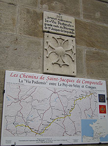
Via Podiensis
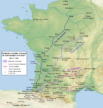
The Via Podiensis or the Le Puy Route is one of the four routes through France on the pilgrimage to the tomb of St. James the Great in Santiago de Compostela in Galicia in northwest Spain. It leaves from Le-Puy-en-Velay and crosses the countryside in stages to the basque village of Ostabat. Near there it merges with two of the other routes, the via Turonensis and the via Lemovicensis which merge a little earlier.
The three then become the Navarre Route, passing via the French town of Saint-Jean-Pied-de-Port and crossing the Pyrenees and the Spanish border by one path or another to Roncesvalles in the Spanish province of Navarre. Together they serve as the principal pilgrimage route across Spain, known as the Camino francés. The fourth French route, the via Tolosane, crosses the Pyrenees at a different point (Somport), becomes the Aragonese Way when it enters Spain, and joins the Camino frances further to the west.
Before le Puy, the via Gebennensis leaves from Geneva, gathering Swiss and German pilgrims and feeding into the via Podiensis. Though it bears a Latin name, the via Gebennensis is a modern route laid out in 1980-90, though the numerous hospitals it passes testify to the passage of pilgrims along this route in earlier ages.
From Geneva to the Pyrenees, the two routes (via Gebennensis and via Podiensis) are waymarked as one of the French major hiking routes, the GR 65, with a few local variations or detours, including GR 651 through the valley of Célé and GR 652 via Rocamadour.
History
According to the A Guide for the Traveller compiled by Aymeric Picaud in the 12th century, four routes lead to Santiago de Compostella:[1][2]
- the via Turonensis, leaving from Paris, passing through Tours
- the via Lemovicensis, leaving from Vézelay, passing through Limoges
- the via Podiensis, leaving from Puy-en-Velay, passing through Cahors and Moissac
- the via Tolosane, leaving from Arles, passing through Toulouse
In 950 or 951, Godescalc, bishop of Le Puy-en-Velay, set off on a pilgrimage to Santiago de Compostella. He was the first non-Hispanic to undertake the pilgrimage, leading a large caravan that included members of the clergy, their staff and servants, various nobles and gentlemen, their retainers and men at arms.[3][4]
The modern route


- In Haute-Loire
The route leaves Le Puy-en-Velay and passes Vals-près-le-Puy, Saint-Christophe-sur-Dolaison, Bains, Saint-Privat-d'Allier, Monistrol-d'Allier, Saugues, and Chanaleilles.
- In Lozère
The route passes Saint-Alban-sur-Limagnole, Aumont-Aubrac, Malbouzon, Rieutort-d'Aubrac, Marchastel, and Nasbinals.
- In Aveyron
The route passes Aubrac, Saint-Chély-d'Aubrac, Saint-Côme-d'Olt, Espalion, Bessuéjouls, Estaing, Golinhac, Espeyrac, Sénergues, Conques, Noailhac, Decazeville, and Livinhac-le-Haut.
- In Lot
The route passes through Montredon, Saint-Félix, Figeac, and Béduer.
A variant route follows the valley of the river Lot, passing Gréalou, Cajarc, and Varaire. A second variation passes through the valley of the Célé, Espagnac-Sainte-Eulalie, Marcilhac-sur-Célé, Sauliac-sur-Célé, Cabrerets, Saint-Cirq-Lapopie. The two variants converge and pass through Cahors, Labastide-Marnhac, Lhospitalet, Lascabanes, Montcuq. A third variant running north of the route passes through Rocamadour.
The route passes Lauzerte, Moissac, and Auvillar.
- In Gers
The route passes Saint-Antoine-sur-l'Arrats, Flamarens, Miradoux, Lectoure, La Romieu, Condom, Valence-sur-Baïse, Larressingle, Beaumont sur l'Osse, the Abbaye de Flaran (off the route), Montréal-du-Gers, Lauraët, Lagraulet-du-Gers, Eauze, Manciet, Nogaro, Barcelonne-du-Gers.
- In Landes
The route passes Aire-sur-l'Adour, after which hikers and pilgrims can pass by either Pécorade and Geaune or by Miramont-Sensacq. Those two routes converge once more at Pimbo.
- In the Pyrénées-Atlantiques

The route passes Arzacq-Arraziguet, Vignes, Louvigny, Uzan, Pomps, Arthez-de-Béarn, Sauvelade, Navarrenx, Charre, Aroue, Saint-Palais, or Garris, Ostabat, Larceveau-Arros-Cibits, Saint-Jean-le-Vieux, Saint-Jean-Pied-de-Port. The final stage passes via the Roncevaux Pass (elevation 1057 m.) to reach the village of Roncesvalles.
The distance from Roncesvalles to Santiago de Compostela is 738 kilometers (459 miles).
Gallery
-
 The Cathedral of Our Lady of the Annunciation in Le-Puy-en-Velay.
 -
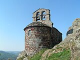 Perched chapel near Saint-Private-d’Allier.
 -
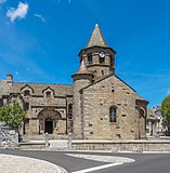 Saint Mary’s Church in Nasbinals.
 -
 Arch way in Conques.
 -
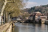 Célé River in Figeac.
 -
 Saint Peter’s Abbey, Moissac.
 -
 Arcades in Montreal-du-Gers.
 -
 Collegial of Saint Barthélémy in Pimbo.
 -
 Saint-Jean-Pied-de-Port.


References
- ^ J. van Herwaarden and Wendie Shaffer, Between Saint James and Erasmus (Gunter Narr Verlag, 2003), ISBN 90-04-12984-7, 356-9
- ^ Parsons, Nicholas (2007). Worth the Detour: A History of the Guidebook. Sutton. p. 78.
- ^ Conant, Kenneth J. (1978). Carolingian and Romanesque Architecture: 800 to 1200, 4th ed. Yale University Press. p. 158.
- ^ Chabaud, Marie-France (1997). Les Chemins de Saint-Jacques-de-Compostelle en France. Nouvelles Editions Latines. p. 30. ISBN 978-2723320146.
External links
- Hiking map and Gps track 4UMaps
- v
- t
- e
Via Turonensis
- Cathedral of Notre-Dame (Amiens)
- Church of Saint-Pierre (Aulnay)
- Cathedral of Sainte-Marie (Bayonne)
- Basilica of Saint-Seurin (Bordeaux)
- Basilica of Saint-Michel (Bordeaux)
- Cathedral of Saint-André (Bordeaux)
- Parochial church of Saint-Jacques (Compiègne)
- Church of Saint-Jacques-Le-Majeur et Saint-Jean-Baptiste (Folleville)
- Church of Saint-Hilaire (Melle)
- Bell tower of the old church (Mimizan)
- Mont-Saint-Michel
- Tour Saint-Jacques (Paris)
- Church of Saint-Hilaire le Grand (Poitiers)
- Former pilgrims hospital (Pons)
- Royal abbey of Saint-Jean-Baptiste (Saint-Jean-d'Angély)
- Church of Saint-Eutrope (Saintes)
- Abbey of Saint-Jean (Sorde-l'Abbaye)
- Church of Notre-Dame-de-la-Fin-des-Terres (Soulac-sur-Mer)
Via Lemovicensis
- Church of Saint-Jacques d’Asquins (Asquins)
- Former cathedral of Saint-Jean-Baptiste (Bazas)
- Cathedral of Saint-Etienne (Bourges)
- Church of Notre-Dame-en-Vaux (Châlons-en-Champagne)
- Priory church of Sainte-Croix-Notre-Dame (La Charité-sur-Loire)
- Basilica of Notre-Dame (L'Épine)
- Collegial church of Saint-Étienne (Neuvy-Saint-Sépulchre)
- Cathedral of Saint-Front (Périgueux)
- Church of Saint-Léonard (Saint-Léonard-de-Noblat)
- Abbey (Saint-Sever)
- Former abbey of Notre-Dame de la Sauve Majeure (La Sauve)
- Church of Saint-Pierre (La Sauve)
- Basilica of Sainte-Madeleine (Vézelay)
Via Podiensis
| Monuments |
|
|---|---|
| Sections |
|
Via Tolasana
- Pont du Diable (Aniane)
- Hospice of the Plan and chapel of Notre-Dame-de-l'Assomption (Aragnouet)
- Church of St Honorat (Arles)
- Cathedral of Sainte-Marie (Auch)
- Church of Notre-Dame de Tramesaygues (Audressein)
- Parochial church of Saint-Jean-Baptiste (Gavarnie-Gèdre)
- Church of Saint-Jacques (Gazost)
- Church of Saint-Laurent (Jézeau)
- Church of Sainte-Marie (Oloron-Sainte-Marie)
- Church of Notre-Dame-du-Bourg (Rabastens)
- Former cathedral of Notre-Dame (Saint-Bertrand-de-Comminges)
- Early Christian basilica, Chapel of Saint-Julien (Saint-Bertrand-de-Comminges)
- Former abbatial church (Saint-Gilles)
- Former abbey of Gellone (Saint-Guilhem-le-Désert)
- Former cathedral and cloister, cathedral of Notre-Dame-de-la-Sède, episcopal palace, rempart (Saint-Lizier)
- Basilica of Saint-Sernin (Toulouse)
- Hospital of Saint-Jacques (Toulouse)
- Basilica of Saint-Just (Valcabrère)
| ||||||||||||||||||
|---|---|---|---|---|---|---|---|---|---|---|---|---|---|---|---|---|---|---|
| Routes |
|  | ||||||||||||||||
| Related | ||||||||||||||||||
| ||||||||||||||||||


