Westerland, Netherlands
Village in North Holland, Netherlands
52°54′N 4°56′E / 52.900°N 4.933°E / 52.900; 4.933 (2021)[1]
1778[1]
Westerland is a village in the Dutch province of North Holland. It is a part of the municipality of Hollands Kroon, and lies about 13 km southeast of Den Helder.
The village was first mentioned in 1343 or 1344 as "van Westenlande", and means "western land". It was located on the former island of Wieringen. Wester (western) has been added to distinguish from Oosterland.[3]
The Dutch Reformed church is a single aisled church. The tower dates from around 1500. The current roof was probably added during the 1913 restoration.[4]
Gallery
-
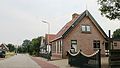 Street view
 -
 Villa in Westerland


References
- ^ a b c "Kerncijfers wijken en buurten 2021". Central Bureau of Statistics. Retrieved 30 April 2022.
two entries
- ^ "Postcodetool for 1778JE". Actueel Hoogtebestand Nederland (in Dutch). Het Waterschapshuis. Retrieved 30 April 2022.
- ^ "Westerland - (geografische naam)". Etymologiebank (in Dutch). Retrieved 30 April 2022.
- ^ Ronald Stenvert & Saskia van Ginkel-Meester (2006). "Westerland" (in Dutch). Zwolle: Waanders. Retrieved 30 April 2022.
 | This North Holland location article is a stub. You can help Wikipedia by expanding it. |
- v
- t
- e


