Weurt
Village in Gelderland, Netherlands
51°51′N 5°49′E / 51.850°N 5.817°E / 51.850; 5.817 (2021)[1]
6551
Weurt is a village in the Dutch province of Gelderland. It is a part of the municipality of Beuningen, and lies about 0.1 km West of Nijmegen.
Weurt was a separate municipality until 1818, when it was merged with Beuningen.[3]
It was first mentioned in 1148 as Vurdene, and means "land near water".[4] Weurt developed along the Waal River.[5] In 1840, it was home to 451 people.[6]
A large brickworks resulted in a population increase. The 1837 church became too small,[6] and was replaced by the St Andrews Church which was completed in 1898.[5] After World War II, the village was extended southwards, and now borders the industrial area of Nijmegen.[5]
Gallery
-
 House in Weurt
 -
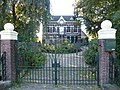 Villa Buitenhof
 -
 Femmeke by Ad Merx


References
- ^ a b "Kerncijfers wijken en buurten 2021". Central Bureau of Statistics. Retrieved 20 March 2022.
two entries
- ^ "Postcodetool for 6551AA". Actueel Hoogtebestand Nederland (in Dutch). Het Waterschapshuis. Retrieved 20 March 2022.
- ^ Ad van der Meer and Onno Boonstra, Repertorium van Nederlandse gemeenten, KNAW, 2011.
- ^ "Weurt - (geografische naam)". Etymologiebank (in Dutch). Retrieved 20 March 2022.
Authenticity of 1076 document is in doubt
- ^ a b c Ronald Stenvert & Sabine Broekhoven (2000). "Weurt" (in Dutch). Zwolle: Waanders. ISBN 90 400 9406 3. Retrieved 20 March 2022.
- ^ a b "Weurt". Plaatsengids (in Dutch). Retrieved 20 March 2022.
| Authority control databases |
|
|---|
 | This Gelderland location article is a stub. You can help Wikipedia by expanding it. |
- v
- t
- e


