Wham, Louisiana
Unincorporated community in Louisiana, United States
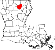
32°37′35″N 91°55′24″W / 32.62639°N 91.92333°W / 32.62639; -91.92333Wham (also Lieber) is an unincorporated community located in Ouachita Parish, Louisiana, United States.
History
Little is known about the early history of the community, but it is believed that people have been living in the local area since the 1840s.
The community sits on a body of water known as Wham Brake. It has served as a poplular hunting and fishing spot for outdoorsmen since the 1940s. The land is now owned and managed by the Louisiana Department of Wildlife and Fisheries. The Wham Brake Project was a habitat restoration project that tended to areas of natural flooding and caused an "increase [in] waterfowl forage production."[2] It was completed in 2017.
An abandoned Texaco from the 1980's sits abandoned at the intersection of LA-134 and LA-139.
References
- ^ "Wham". Geographic Names Information System. United States Geological Survey, United States Department of the Interior.
- ^ "WHAM BREAK PROJECT". LOUISIANA WILDLIFE & FISHERIES FOUNDATION. LOUISIANA WILDLIFE & FISHERIES FOUNDATION. 2017. Retrieved May 16, 2024.
- v
- t
- e
Municipalities and communities of Ouachita Parish, Louisiana, United States
Parish seat: Monroe
unincorporated
communities
- Bosco
- Fairbanks
- Pine Grove
- Wham
- Louisiana portal
- United States portal
 | This Louisiana state location article is a stub. You can help Wikipedia by expanding it. |
- v
- t
- e


