Ngwathe
Gemeente in Zuid-Afrika  | |||
|---|---|---|---|
  | |||
 | |||
| Situering | |||
| Provincie | Vrijstaat | ||
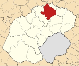
| District | Fezile Dabi | ||
| Coördinaten | 26° 54′ ZB, 27° 28′ OL | ||
| Algemeen | |||
| Oppervlakte | 7055 km² | ||
| Inwoners (2011) | 120.520 (17 inw./km²) | ||
| Etniciteit[1] | 86% Zwart 3% Kleurling 10% Blank | ||
| Talen[1] | 13% Afrikaans 2% Engels 8% Xhosa 3% Zoeloe 68% Zuid-Sotho 1% Tswana | ||
| Burgemeester | Joey Mochela | ||
| Website | ngwathe.fs.gov.za | ||
| |||

Ngwathe (officieel Ngwathe Local Municipality) is een gemeente in het Zuid-Afrikaanse district Fezile Dabi. Ngwathe ligt in de provincie Vrijstaat en telt 120.520 inwoners[1]. Het gemeentebestuur is gevestigd in de plaats Parys.
Hoofdplaatsen
Het nationaal instituut voor de statistiek, Stats SA, deelt sinds de census 2011 deze gemeente in in 14 zogenaamde hoofdplaatsen (main place)[1]:
Edenville • Heilbron • Koppies • Kwakwatsi • Mokwallo • Ngwathe • Ngwathe NU • Parys • Phiritona • Sandersville • Schonkenville • Tumahole • Voorspoed Diamantmyn • Vredefort.
Externe links
- Yes Media, The Local Government Handbook – South Africa, Ngwathe.
Bronnen, noten en/of referenties
|


