Malad City
| Malad City | |
| city | |
 Malad City Hall | |
| Land |  USA USA |
|---|---|
| Delstat | Idaho |
| County | Oneida County |
| Koordinater | 42°11′27″N 112°14′58″V / 42.19083°N 112.24944°V / 42.19083; -112.24944 |
| Yta | 4,3 km² (2010)[1] |
| - land | 4,3 km² |
| - vatten | 0 km² |
| Folkmängd | 2 061 (2011)[2] |
| Befolkningstäthet | 479 invånare/km² |
| Tidszon | MST (UTC-7) |
| - sommartid | MDT (UTC-6) |
| ZIP-kod | 83252[3] |
| FIPS | 1650140 |
| Geonames | 5600035 |
  Ortens läge i Idaho | |
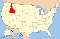 Idahos läge i USA | |
| Webbplats: http://www.maladidaho.org/ | |
Malad City är administrativ huvudort i Oneida County i den amerikanska delstaten Idaho. Malad City är administrativ huvudort (county seat) i Oneida County. I Malad City firas årligen de walesiska invandrare som kom till den omkringliggande dalen på 1860-talet i Malad Valley Welsh Festival.[4]
Kända personer från Malad City
- John V. Evans, politiker, guvernör i Idaho 1977–1987
Noter
- ^ ”2010 Census Gazetteer Files”. US Census Bureau. Arkiverad från originalet den 14 juli 2012. https://www.webcitation.org/699nOulzi?url=http://www.census.gov/geo/www/gazetteer/files/Gaz_places_national.txt. Läst 14 juli 2012.
- ^ ”Annual Estimates of the Resident Population for Incorporated Places: April 1, 2010 to July 1, 2011”. Arkiverad från originalet den 24 juli 2012. https://www.webcitation.org/69P3Dm4vD?url=http://www.census.gov/popest/data/cities/totals/2011/tables/SUB-EST2011-03-16.csv. Läst 24 juli 2012.
- ^ ”2010 ZIP Code Tabulation Area (ZCTA) Relationship Files”. U.S. Census Bureau. 30 juni 2010. Arkiverad från originalet den 25 augusti 2012. https://www.webcitation.org/6ABdwXxbq?url=http://www.census.gov/geo/www/2010census/zcta_rel/zcta_place_rel_10.txt. Läst 25 augusti 2012.
- ^ Malad Valley Welsh Festival. Malad City, Idaho. Läst 19 december 2011.
Externa länkar
- Officiell webbplats


