Bouïra Province
Province of Algeria
You can help expand this article with text translated from the corresponding article in Arabic. (March 2024) Click [show] for important translation instructions.
- Machine translation, like DeepL or Google Translate, is a useful starting point for translations, but translators must revise errors as necessary and confirm that the translation is accurate, rather than simply copy-pasting machine-translated text into the English Wikipedia.
- Do not translate text that appears unreliable or low-quality. If possible, verify the text with references provided in the foreign-language article.
- You must provide copyright attribution in the edit summary accompanying your translation by providing an interlanguage link to the source of your translation. A model attribution edit summary is
Content in this edit is translated from the existing Arabic Wikipedia article at [[:ar:ولاية البويرة]]; see its history for attribution. - You may also add the template
{{Translated|ar|ولاية البويرة}}to the talk page. - For more guidance, see Wikipedia:Translation.
Province in Algeria
Bouïra Province ولاية البويرة | |
|---|---|
Province | |
 Olive trees growing in Bouïra Province | |
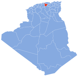 Map of Algeria highlighting Bouïra | |
| Coordinates: 36°23′N 3°54′E / 36.383°N 3.900°E / 36.383; 3.900 | |
| Country |  Algeria Algeria |
| Founded | 1974 |
| Capital | Bouïra |
| Government | |
| • Wāli | Mouloud Cherifi |
| Area | |
| • Total | 4,439 km2 (1,714 sq mi) |
| Population (2008)[1] | |
| • Total | 694,750 |
| • Density | 160/km2 (410/sq mi) |
| Time zone | UTC+01 (CET) |
| Area Code | +213 (0) 26 |
| ISO 3166 code | DZ-10 |
| Districts | 12 |
| Municipalities | 45 |
Bouïra (Arabic: ولاية البويرة, French: Wilaya de Bouira) is a province (wilaya) in the Kabylie region (also known as Tazwawa) in Algeria.
History
The province was created from parts of Médéa (département) and Tizi-Ouzou department in 1974.
Administrative divisions
It is made up of 12 districts and 45 communes or municipalities.
Districts
Communes
- Aïn Bessem
- Ahnif
- Aghbalou
- Aïn El Hadjar
- Ahl El Ksar
- Ain Laloui
- Ath Mansour Taourirt
- Aomar
- Aïn Turk (Ain el Turc)
- Ait Laziz
- Bouderbala
- Bechloul
- Bir Ghbalou
- Bouiche
- Boukram
- Bordj Okhriss
- Bouira
- Dechmia
- Dirrah
- Djebahia
- El Asnam
- El Hakimia
- El Hachimia
- El Adjiba
- El Khabouzia
- El Mokrani
- Guerrouma
- Haizer
- Hadjera Zerga
- Kadiria
- Lakhdaria
- M'Chedallah
- Mezdour
- Maala
- Maamora
- Oued El Berdi
- Ouled Rached
- Raouraoua
- Ridane
- Saharidj
- Sour El Ghouzlane
- Souk El Khemis
- Taguedit
- Taghzout
- Zbarbar
Notable people
- Mohamed Aïchaoui, journalist, militant and martyr
References
 Algeria portal

- ^ Office National des Statistiques, Recensement General de la Population et de l’Habitat 2008 Archived July 24, 2008, at the Wayback Machine Preliminary results of the 2008 population census. Accessed on 2008-07-02.
External links
- (in French) Official website
- v
- t
- e
Bouïra ProvinceCapital: Bouïra

- Aïn Bessem
- Ahnif
- Aghbalou
- Aïn El Hadjar
- Ahl El Ksar
- Aïn Laloui
- Aïn Turk
- Aït Laziz
- Ath Mansour Taourirt
- Aomar
- Bouderbala
- Bechloul
- Bir Ghbalou
- Boukram
- Bordj Okhriss
- Bouira
- Chorfa
- Dechmia
- Dirrah
- Djebahia
- El Hakimia
- El Hachimia
- El Adjiba
- El Khabouzia
- El Mokrani
- El Asnam
- Guerrouma
- Haizer
- Hadjera Zerga
- Kadiria
- Lakhdaria
- M'Chedallah
- Mezdour
- Maala
- Maamora
- Oued El Berdi
- Ouled Rached
- Raouraoua
- Ridane
- Saharidj
- Sour El Ghouzlane
- Souk El Khemis
- Taguedit
- Taghzout
- Zbarbar
| ||
|---|---|---|
|  | |
Authority control databases | |
|---|---|
| International |
|
| National |
|
| Geographic |
|
| Other |
|
 | This article about a location in Bouïra Province is a stub. You can help Wikipedia by expanding it. |
- v
- t
- e


