Little Sisters
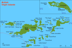
The Little Sisters is an informal name for a group of some of the smaller islands of the British Virgin Islands, south of Tortola and southwest of Virgin Gorda. These islands are also called the Southern Islands.
- Norman Island
- Pelican Island
- Peter Island
- Salt Island
- Cooper Island
- Ginger Island
- Carvel Rock
- Dead Chest Island
Also included in the group are several smaller rocky outcroppings.
The closest thing to a formal endorsement of the term occurs in the Labour Code, 2010[1] (a British Virgin Islands statute) which includes a reference and statutory definition for the "Sister Islands", which the Code defines as meaning 'the islands of the Virgin Islands other than Tortola'.[2]
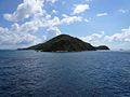
Gallery
-
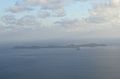 Norman Island
 -
 Pelican Island
 -
 Peter Island
 -
 Salt Island
 -
 Cooper Island
 -
 Ginger Island
 -
 Carvel Rock
 -
 Dead Chest Island


Footnotes
- v
- t
- e
British Virgin Islands articles
- Dutch Virgin Islands
- St. Phillip's Church
- Slavery
- Piracy
- Colonial leaders
- United States Virgin Islands
- British Leeward Islands
- West Indies Federation
- Effects of Hurricane Irma

- Anegada
- Beef Island
- Bellamy Cay
- Buck Island
- Carvel Rock
- Cockroach Island
- Cooper Island
- Dead Chest Island
- Diamond Cay
- Dog Islands
- East Seal Dog Island
- Eustatia
- Fallen Jerusalem Island
- Frenchman's Cay
- George Dog Island
- Ginger Island
- Great Camanoe
- Great Dog Island
- Great Thatch
- Great Tobago Island
- Green Cay
- Guana Island
- The Indians
- Jost Van Dyke
- Little Camanoe
- Little Cay
- Little Jost Van Dyke
- Little Thatch
- Little Tobago
- Little Wickams Cay
- Marina Cay
- Mosquito Island
- Nanny Cay
- Necker Island
- Norman Island
- Old Jerusalem Island
- Pelican Island
- Peter Island
- Prickly Pear
- Round Rock
- Saba Rock
- Salt Island
- Sandy Cay
- Sandy Spit
- Scrub Island
- Tortola
- Virgin Gorda
- West Dog Island
- Wickams Cay
|
- Cooper Bay ruin
- Cooten Bay ruin
- Copper Mine
- Fort Burt
- Fort Charlotte
- Fort George
- Fort Purcell ("the Dungeon")
- Fort Recovery
- Great Thatch ruin
- Hunthum's Ghut ruin
- Johnson's Ghut ruin
- Larmer Bay ruin
- Mount Healthy windmill
- Road Town Fort
- St Phillip's Church ("the African Church")
- Trunk Bay ruin
- Whelk Point Fort
- Terrance B. Lettsome International Airport
- Queen Elizabeth II Bridge
- Category
18°21′35″N 64°32′26″W / 18.35972°N 64.54056°W / 18.35972; -64.54056
 | This British Virgin Islands location article is a stub. You can help Wikipedia by expanding it. |
- v
- t
- e


