Zoelmond
Village in Gelderland, Netherlands
51°57′N 5°19′E / 51.950°N 5.317°E / 51.950; 5.317 (2021)[1]
4111 & 4112[1]
Zoelmond is a village in the Dutch province of Gelderland. It is a part of the municipality of Buren, and lies about 10 km northwest of Tiel.
It was first mentioned in 1214 as Zolemunde, and means "mouth of the river Zoel".[3] The village developed into a stretched out esdorp along the former river. A chapel was built in 1404 which was expanded into a church around 1447. The tower dates from 1911.[4] In 1840, it was home to 536 people.[5] A grist mill was built in 1714, but it burned down in 1917 and the remainder was demolished in 1987.[6]
Gallery
-
 Church of Zoelmond
 -
 Farm in Zoelmond
 -
 Villa "Het Klooster"
 -
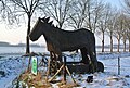 Wooden horse in the pasture


References
- ^ a b c "Kerncijfers wijken en buurten 2021". Central Bureau of Statistics. Retrieved 21 March 2022.
two entries contains part of Beusichem
- ^ "Postcodetool for 4111KP". Actueel Hoogtebestand Nederland (in Dutch). Het Waterschapshuis. Retrieved 21 March 2022.
- ^ "Zoelmond - (geografische naam)". Etymologiebank (in Dutch). Retrieved 21 March 2022.
- ^ Ronald Stenvert & Sabine Broekhoven (2000). "Zoelmond" (in Dutch). Zwolle: Waanders. p. 353. ISBN 90 400 9406 3. Retrieved 21 March 2022.
- ^ "Zoelmond". Plaatsengids (in Dutch). Retrieved 21 March 2022.
- ^ "(korenmolen), Zoelmond". Molen database.org (in Dutch). Retrieved 21 March 2022.
 | This Gelderland location article is a stub. You can help Wikipedia by expanding it. |
- v
- t
- e


