Zovaber, Gegharkunik
Place in Gegharkunik, Armenia
Zovaber Զովաբեր | |
|---|---|
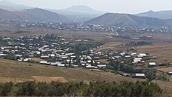 A view of Zovaber | |
40°34′02″N 44°47′22″E / 40.56722°N 44.78944°E / 40.56722; 44.78944 | |
| Country | Armenia |
| Province | Gegharkunik |
| Municipality | Sevan |
| Founded | 1830 |
| Area | |
| • Total | 1.20 km2 (0.46 sq mi) |
| Elevation | 1,773 m (5,817 ft) |
| Population (2011)[1] | |
| • Total | 1,683 |
| • Density | 1,400/km2 (3,600/sq mi) |
| Time zone | UTC+4 (AMT) |
| Postal code | 1509 |
| Zovaber, Gegharkunik at GEOnet Names Server | |
Zovaber (Armenian: Զովաբեր) is a village in the Sevan Municipality of the Gegharkunik Province of Armenia.
Toponymy
The village was previously known as Yaydzhi or Yayji.
History
The village was founded in 1830 by emigrants from Maku. The village has a church of St. Stepanos, built in 1860.[2]
Gallery
-
 St. Stepanos Church
 -
 Monument in Zovaber
 -
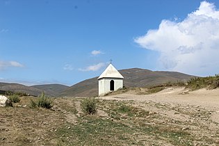 Chapel in Zovaber
 -
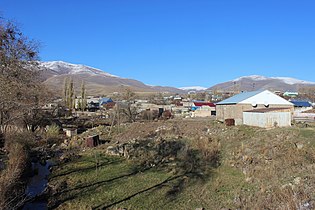 A view of Zovaber, November 2014
 -
 Tukh Manuk in Zovaber


References
- ^ Statistical Committee of Armenia. "The results of the 2011 Population Census of Armenia" (PDF).
- ^ Kiesling, Brady; Kojian, Raffi (2005). Rediscovering Armenia: Guide (2nd ed.). Yerevan: Matit Graphic Design Studio. p. 75. ISBN 99941-0-121-8.
External links
Wikimedia Commons has media related to Zovaber.
- Report of the results of the 2001 Armenian Census, Statistical Committee of Armenia
- Kiesling, Brady (June 2000). Rediscovering Armenia: An Archaeological/Touristic Gazetteer and Map Set for the Historical Monuments of Armenia (PDF). Archived (PDF) from the original on 6 November 2021.
- v
- t
- e
 Gegharkunik Province
Capital: Gavar

- Akhpradzor
- Akunk
- Areguni
- Arpunk
- Avazan
- Ayrk
- Azat
- Daranak
- Geghakar
- Geghamabak
- Geghamasar
- Jaghatsadzor
- Kakhakn
- Karchaghbyur
- Khachaghbyur
- Kut
- Kutakan
- Lchavan
- Lusakunk
- Makenis
- Mets Masrik
- Nerkin Shorzha
- Norabak
- Norakert
- Pambak
- Pokr Masrik
- Shatjrek
- Shatvan
- Sotk
- Torfavan
- Tretuk
- Tsovak
- Vanevan
- Verin Shorzha
- Zariver
Portal:
 Geography

 | This article about a location in Gegharkunik Province, Armenia is a stub. You can help Wikipedia by expanding it. |
- v
- t
- e


