South Lakeland
| dystrykt niemetropolitalny | |||
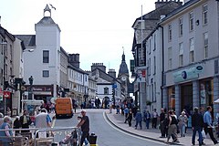 Kendal | |||
| Państwo |
| ||
|---|---|---|---|
| Kraj |
| ||
| Region | North West England | ||
| Hrabstwo | Kumbria | ||
| Siedziba | Kendal | ||
| Powierzchnia | 1534 km² | ||
| Populacja (2016) • liczba ludności |
| ||
| • gęstość | 67 os./km² | ||
Położenie na mapie Kumbrii | |||
| |||
| Strona internetowa | |||


South Lakeland – dawny dystrykt niemetropolitalny w hrabstwie Kumbria w Anglii[2]. Utworzony został 1 kwietnia 1974, a zlikwidowany 1 kwietnia 2023; włączony do nowo utworzonej jednostki typu unitary authority Westmoreland and Furness[3].
Miasta
- Ambleside
- Bowness-on-Windermere
- Broughton in Furness
- Grange-over-Sands
- Kendal
- Kirkby Lonsdale
- Milnthorpe
- Sedbergh
- Ulverston
- Windermere
Inne miejscowości
Ackenthwaite, Aldingham, Allithwaite, Arnside, Ayside, Backbarrow, Barbon, Baycliff, Beetham, Brigsteer, Burneside, Burton-in-Kendal, Cark, Cartmel, Casterton, Clappersgate, Clawthorpe, Colton, Coniston, Cowgill, Crook, Crosscrake, Dent, Elterwater, Finsthwaite, Firbank, Grasmere, Grayrigg, Greenodd, Haverthwaite, Hawkshead, Heversham, High Newton, Holme, Hutton Roof, Ings, Kentmere, Kents Bank, Killington, Kirkby-in-Furness, Leece, Levens, Lowick, Lupton, Mansergh, Mansriggs, Meathop, Middleshaw, Middleton, Natland, New Hutton, Oxenholme, Roger Ground, Scales, Seathwaite, Sedgwick, Stainton, Staveley, Staveley-in-Cartmel, Swarthmoor, Underbarrow.
Przypisy
- ↑ Population Estimates for UK, England and Wales, Scotland and Northern Ireland - Office for National Statistics [online], ons.gov.uk [dostęp 2017-10-21] (ang.).
- ↑ Ordnance Survey linked data
- ↑ What is LGR?. Local Government Reorganisation – Delivering Two New Councils For Cumbria. [dostęp 2023-04-01]. (ang.).
- p
- d
- e
Miejscowości dystryktu South Lakeland (1974–2023)
Kontrola autorytatywna (dystrykt niemetropolitalny):
- VIAF: 153864662
- Britannica: place/South-Lakeland


