List of mountain peaks of Nevada

This article comprises three sortable tables of major mountain peaks[Notes 1] of the U.S. State of Nevada.
The summit of a mountain or hill may be measured in three principal ways:
- The topographic elevation of a summit measures the height of the summit above a geodetic sea level.[Notes 2][Notes 3] The first table below ranks the 50 highest major summits of Nevada by elevation.
- The topographic prominence of a summit is a measure of how high the summit rises above its surroundings.[Notes 4][Notes 3] The second table below ranks the 52 most prominent summits of Nevada.
- The topographic isolation (or radius of dominance) of a summit measures how far the summit lies from its nearest point of equal elevation.[Notes 5] The third table below ranks the 50 most isolated major summits of Nevada.
Highest major summits
Map this section's coordinates using OpenStreetMap
Download coordinates as:
- KML
- GPX (all coordinates)
- GPX (primary coordinates)
- GPX (secondary coordinates)
Of the highest major summits of Nevada, eight peaks exceed 3500 meters (11,483 feet) elevation and 38 peaks exceed 3000 meters (9843 feet) elevation.
| Rank | Mountain peak | Mountain range | Elevation | Prominence | Isolation | Location |
|---|---|---|---|---|---|---|
| 1 | Boundary Peak[1][2][3][a] | White Mountains | 13,146 ft 4007 m | 253 ft 77 m | 0.53 mi 0.86 km | 37°50′46″N 118°21′05″W / 37.8461111°N 118.3513889°W / 37.8461111; -118.3513889 (Boundary Peak) |
| 2 | Wheeler Peak[4][5][6][7][b] | Snake Range | 13,065 ft 3982.3 m | 7,568 ft 2307 m | 232 mi 373 km | 38°59′09″N 114°18′50″W / 38.9858°N 114.3139°W / 38.9858; -114.3139 (Wheeler Peak) |
| 3 | Mount Moriah[8][9][10][11] | Snake Range | 12,072 ft 3679.6 m | 4,909 ft 1496 m | 20.3 mi 32.7 km | 39°16′24″N 114°11′56″W / 39.2732°N 114.1988°W / 39.2732; -114.1988 (Mount Moriah) |
| 4 | Mount Jefferson[12][13][c][d] | Toquima Range | 11,946 ft 3641 m | 5,871 ft 1789 m | 98.6 mi 158.7 km | 38°45′07″N 116°55′36″W / 38.7519°N 116.9267°W / 38.7519; -116.9267 (Mount Jefferson) |
| 5 | Charleston Peak[14][15][16][17][e] (Mount Charleston) | Spring Mountains | 11,916 ft 3632 m | 8,258 ft 2517 m | 135.1 mi 218 km | 36°16′18″N 115°41′44″W / 36.2716°N 115.6956°W / 36.2716; -115.6956 (Charleston Peak) |
| 6 | North Schell Peak[18][19][20][21][f] | Schell Creek Range | 11,895 ft 3625.6 m | 5,413 ft 1650 m | 23.5 mi 37.9 km | 39°24′48″N 114°35′59″W / 39.4132°N 114.5997°W / 39.4132; -114.5997 (North Schell Peak) |
| 7 | Arc Dome[22][23][24][g][h] | Toiyabe Range | 11,778 ft 3590 m | 5,233 ft 1595 m | 23.1 mi 37.2 km | 38°49′58″N 117°21′11″W / 38.8327°N 117.3531°W / 38.8327; -117.3531 (Arc Dome) |
| 8 | Currant Mountain[25][26][27][28][i] | White Pine Range | 11,518 ft 3510.7 m | 4,575 ft 1394 m | 52.8 mi 85 km | 38°54′35″N 115°25′29″W / 38.9097°N 115.4246°W / 38.9097; -115.4246 (Currant Mountain) |
| 9 | Bunker Hill[29][30] | Toiyabe Range | 11,477 ft 3498.3 m | 2,813 ft 857 m | 31.3 mi 50.3 km | 39°15′10″N 117°07′34″W / 39.2529°N 117.1261°W / 39.2529; -117.1261 (Bunker Hill) |
| 10 | Ruby Dome[31][32][33][34][j][k] | Ruby Mountains | 11,392 ft 3472 m | 4,810 ft 1466 m | 94.7 mi 152.5 km | 40°37′18″N 115°28′31″W / 40.6217°N 115.4754°W / 40.6217; -115.4754 (Ruby Dome) |
| 11 | Toiyabe Dome[35][36][37][l] | Toiyabe Range | 11,366 ft 3464 m | 2,101 ft 640 m | 5.95 mi 9.58 km | 38°47′56″N 117°15′06″W / 38.7989°N 117.2516°W / 38.7989; -117.2516 (Toiyabe Dome) |
| 12 | Hole in the Mountain Peak[38][39][40][m][n] | East Humboldt Range | 11,311 ft 3448 m | 4,849 ft 1478 m | 26.6 mi 42.8 km | 40°57′03″N 115°07′21″W / 40.9508°N 115.1224°W / 40.9508; -115.1224 (Hole in the Mountain Peak) |
| 13 | Mount Grant[41][42][o][p] | Wassuk Range | 11,305 ft 3446 m | 3,960 ft 1207 m | 28.1 mi 45.2 km | 38°34′07″N 118°47′28″W / 38.5685°N 118.7911°W / 38.5685; -118.7911 (Mount Grant) |
| 14 | Troy Peak[43][44][45][46][q] | Grant Range | 11,302 ft 3445 m | 4,790 ft 1460 m | 40 mi 64.3 km | 38°19′10″N 115°30′07″W / 38.3194°N 115.5019°W / 38.3194; -115.5019 (Troy Peak) |
| 15 | Aiken Peak[47][48][r] | Toiyabe Range | 11,090 ft 3380 m | 2,025 ft 617 m | 7.34 mi 11.82 km | 39°09′11″N 117°10′26″W / 39.1531°N 117.1740°W / 39.1531; -117.1740 (Aiken Peak) |
| 16 | Mount Grafton[49][50][51] | Schell Creek Range | 10,997 ft 3351.8 m | 3,257 ft 993 m | 26.8 mi 43.2 km | 38°41′32″N 114°44′33″W / 38.6922°N 114.7424°W / 38.6922; -114.7424 (Mount Grafton) |
| 17 | Ward Mountain[52][53][54][55][s] | Egan Range | 10,941 ft 3334.8 m | 3,676 ft 1120 m | 18.41 mi 29.6 km | 39°06′01″N 114°55′14″W / 39.1002°N 114.9206°W / 39.1002; -114.9206 (Ward Mountain) |
| 18 | Shoshone Mountain[56][57][58][t] | Toquima Range | 10,912 ft 3326 m | 2,167 ft 661 m | 6 mi 9.65 km | 38°40′12″N 116°57′48″W / 38.6699°N 116.9634°W / 38.6699; -116.9634 (Shoshone Mountain) |
| 19 | Table Mountain[59][60][61][u] | Monitor Range | 10,894 ft 3320.5 m | 3,668 ft 1118 m | 17.4 mi 28 km | 38°48′42″N 116°35′18″W / 38.8118°N 116.5883°W / 38.8118; -116.5883 (Table Mountain) |
| 20 | Pearl Peak[62][63][64][65] | Ruby Mountains | 10,852 ft 3307.6 m | 3,628 ft 1106 m | 13.37 mi 21.5 km | 40°14′07″N 115°32′27″W / 40.2352°N 115.5407°W / 40.2352; -115.5407 (Pearl Peak) |
| 21 | Matterhorn[66][67][68][v][w] | Jarbidge Mountains | 10,843 ft 3305 m | 4,688 ft 1429 m | 60.4 mi 97.2 km | 41°48′39″N 115°22′28″W / 41.8107°N 115.3745°W / 41.8107; -115.3745 (Matterhorn) |
| 22 | Mount Rose[69][70][71] | Carson Range | 10,785 ft 3287.2 m | 3,630 ft 1106 m | 33.2 mi 53.5 km | 39°20′38″N 119°55′04″W / 39.3438°N 119.9179°W / 39.3438; -119.9179 (Mount Rose) |
| 23 | Pilot Peak[72][73][74][75][x] | Pilot Range | 10,720 ft 3267.6 m | 5,731 ft 1747 m | 53.7 mi 86.4 km | 41°01′16″N 114°04′39″W / 41.0211°N 114.0774°W / 41.0211; -114.0774 (Pilot Peak) |
| 24 | Diamond Peak[76][77][78][y] | Diamond Mountains | 10,631 ft 3240.3 m | 3,604 ft 1099 m | 27.9 mi 44.9 km | 39°35′06″N 115°49′07″W / 39.5849°N 115.8187°W / 39.5849; -115.8187 (Diamond Peak) |
| 25 | Cherry Creek Benchmark[79][80][z] | Cherry Creek Range | 10,527 ft 3208.5 m | 3,734 ft 1138 m | 34.3 mi 55.3 km | 39°57′58″N 114°53′45″W / 39.9662°N 114.8958°W / 39.9662; -114.8958 (Cherry Creek Benchmark) |
| 26 | Summit Mountain[81][82][83] | Monitor Range | 10,468 ft 3190.7 m | 2,721 ft 829 m | 29.2 mi 47 km | 39°22′36″N 116°27′43″W / 39.3767°N 116.4620°W / 39.3767; -116.4620 (Summit Mountain) |
| 27 | McAfee Peak[84][85][86][aa][ab] | Independence Mountains | 10,442 ft 3182.8 m | 4,168 ft 1270 m | 35.6 mi 57.3 km | 41°31′18″N 115°58′24″W / 41.5217°N 115.9734°W / 41.5217; -115.9734 (McAfee Peak) |
| 28 | Sherman Mountain[87][88][89][90] | Ruby Mountains | 10,324 ft 3146.9 m | 1,740 ft 530 m | 5.85 mi 9.41 km | 40°07′09″N 115°35′11″W / 40.1191°N 115.5865°W / 40.1191; -115.5865 (Sherman Mountain) |
| 29 | North Shoshone Peak[91][92][93][94][ac] | Shoshone Mountains | 10,318 ft 3144.9 m | 2,853 ft 870 m | 14.93 mi 24 km | 39°09′01″N 117°28′48″W / 39.1504°N 117.4800°W / 39.1504; -117.4800 (North Shoshone Peak) |
| 30 | Spruce Mountain[95][96][97][ad] | Pequop Mountains | 10,267 ft 3129.3 m | 3,939 ft 1201 m | 27.1 mi 43.6 km | 40°33′08″N 114°49′18″W / 40.5521°N 114.8217°W / 40.5521; -114.8217 (Spruce Mountain) |
| 31 | Morey Peak[98][99][100][101][ae] | Hot Creek Range | 10,251 ft 3124.4 m | 2,586 ft 788 m | 20.6 mi 33.2 km | 38°37′39″N 116°17′17″W / 38.6276°N 116.2880°W / 38.6276; -116.2880 (Morey Peak) |
| 32 | Mount Callaghan[102][103][104][105] | Toiyabe Range | 10,195 ft 3107.4 m | 3,047 ft 929 m | 24.5 mi 39.4 km | 39°42′34″N 116°57′03″W / 39.7094°N 116.9508°W / 39.7094; -116.9508 (Mount Callaghan) |
| 33 | Quinn Canyon Range high point[106][af] | Quinn Canyon Range | 10,193 ft 3107 m | 2,606 ft 794 m | 15.55 mi 25 km | 38°07′20″N 115°42′31″W / 38.1223°N 115.7086°W / 38.1223; -115.7086 (Quinn Canyon Range high point) |
| 34 | Roberts Creek Mountain[107][108][109] | Roberts Mountains | 10,132 ft 3088.1 m | 3,584 ft 1092 m | 32.3 mi 52.1 km | 39°52′12″N 116°18′38″W / 39.8699°N 116.3106°W / 39.8699; -116.3106 (Roberts Creek Mountain) |
| 35 | Becky Peak[110][111][ag] | Schell Creek Range | 10,027 ft 3056 m | 2,434 ft 742 m | 15.56 mi 25 km | 39°58′18″N 114°36′10″W / 39.9718°N 114.6029°W / 39.9718; -114.6029 (Becky Peak) |
| 36 | Desatoya Peak[112][113][114][115][ah] | Desatoya Mountains | 9,979 ft 3041.69 m | 3,545 ft 1081 m | 21.1 mi 33.9 km | 39°21′55″N 117°45′33″W / 39.3652°N 117.7591°W / 39.3652; -117.7591 (Desatoya Peak) |
| 37 | Mount Augusta[116][117][118][119][ai] | Clan Alpine Mountains | 9,970 ft 3038.9 m | 4,386 ft 1337 m | 14.8 mi 23.8 km | 39°32′24″N 117°55′10″W / 39.5399°N 117.9195°W / 39.5399; -117.9195 (Mount Augusta) |
| 38 | Hayford Peak[120][121][122][123][aj] | Sheep Range | 9,924 ft 3024.9 m | 5,412 ft 1650 m | 33.8 mi 54.3 km | 36°39′28″N 115°12′03″W / 36.6577°N 115.2008°W / 36.6577; -115.2008 (Hayford Peak) |
| 39 | Star Peak[124][125][126][127][ak] | Humboldt Range | 9,840 ft 2999.1 m | 5,400 ft 1646 m | 69 mi 111.1 km | 40°31′21″N 118°10′15″W / 40.5224°N 118.1708°W / 40.5224; -118.1708 (Star Peak) |
| 40 | Mount Tobin[128][129][130][131][al] | Tobin Range | 9,778 ft 2980.4 m | 4,851 ft 1479 m | 35.4 mi 57 km | 40°22′35″N 117°31′34″W / 40.3765°N 117.5261°W / 40.3765; -117.5261 (Mount Tobin) |
| 41 | Granite Peak[132][133][134][135][am] | Santa Rosa Range | 9,732 ft 2966.3 m | 4,400 ft 1341 m | 82.4 mi 132.6 km | 41°40′05″N 117°35′20″W / 41.6681°N 117.5889°W / 41.6681; -117.5889 (Granite Peak) |
| 42 | Mount Lewis[136][137][138][139][an] | Shoshone Range | 9,679 ft 2950.1 m | 4,290 ft 1308 m | 34.9 mi 56.2 km | 40°24′12″N 116°51′41″W / 40.4034°N 116.8615°W / 40.4034; -116.8615 (Mount Lewis) |
| 43 | Goshute Peak[140][141][142][143][ao] | Goshute Range | 9,615 ft 2930.7 m | 3,700 ft 1128 m | 27.7 mi 44.5 km | 40°29′58″N 114°17′44″W / 40.4995°N 114.2955°W / 40.4995; -114.2955 (Goshute Peak) |
| 44 | Mount Siegel[144][145][146][147] | Pine Nut Mountains | 9,456 ft 2882.1 m | 3,477 ft 1060 m | 19.49 mi 31.4 km | 38°53′23″N 119°30′08″W / 38.8896°N 119.5022°W / 38.8896; -119.5022 (Mount Siegel) |
| 45 | Piper Peak[148][149][150][151][ap] | Silver Peak Range | 9,451 ft 2880.7 m | 4,083 ft 1245 m | 16.13 mi 26 km | 37°42′15″N 117°54′32″W / 37.7043°N 117.9088°W / 37.7043; -117.9088 (Piper Peak) |
| 46 | Duffer Peak[152][153][154][aq][ar] | Pine Forest Range | 9,432 ft 2875 m | 4,139 ft 1262 m | 55.1 mi 88.7 km | 41°39′27″N 118°43′56″W / 41.6574°N 118.7322°W / 41.6574; -118.7322 (Duffer Peak) |
| 47 | Kawich Peak[155][156][157][158][as] | Kawich Range | 9,406 ft 2867 m | 3,101 ft 945 m | 39.4 mi 63.5 km | 37°57′42″N 116°27′42″W / 37.9616°N 116.4617°W / 37.9616; -116.4617 (Kawich Peak) |
| 48 | Sonoma Peak[159][160][161][162][at] | Sonoma Range | 9,401 ft 2865.3 m | 3,906 ft 1191 m | 32.7 mi 52.6 km | 40°51′38″N 117°36′26″W / 40.8605°N 117.6071°W / 40.8605; -117.6071 (Sonoma Peak) |
| 49 | Highland Peak[163][164][165][au] | Highland Range | 9,399 ft 2864.7 m | 3,285 ft 1001 m | 43.8 mi 70.4 km | 37°53′38″N 114°34′43″W / 37.8938°N 114.5787°W / 37.8938; -114.5787 (Highland Peak) |
| 50 | Bald Mountain[166][167][168][169][av] | Groom Range | 9,352 ft 2850.5 m | 3,758 ft 1145 m | 43 mi 69.2 km | 37°26′58″N 115°44′01″W / 37.4495°N 115.7337°W / 37.4495; -115.7337 (Bald Mountain) |
| 51 | Pilot Peak[170][171][172][aw] | Pilot Mountains | 9,188 ft 2800.5 m | 3,212 ft 979 m | 33.6 mi 54.1 km | 38°20′35″N 117°58′27″W / 38.3430°N 117.9741°W / 38.3430; -117.9741 (Pilot Peak) |
Most prominent summits
Map this section's coordinates using OpenStreetMap
Download coordinates as:
- KML
- GPX (all coordinates)
- GPX (primary coordinates)
- GPX (secondary coordinates)
Of the most prominent summits of Nevada, Charleston Peak and Wheeler Peak exceed 2000 meters (6562 feet) of topographic prominence, eight peaks are ultra-prominent summits with more than 1500 meters (4921 feet) of topographic prominence, and the following 52 peaks exceed 1400 meters (4593 feet).
| Rank | Mountain peak | Mountain range | Elevation | Prominence | Isolation | Location |
|---|---|---|---|---|---|---|
| 1 | Charleston Peak[14][15][16][17][e] (Mount Charleston) | Spring Mountains | 11,916 ft 3632 m | 8,258 ft 2517 m | 135.1 mi 218 km | 36°16′18″N 115°41′44″W / 36.2716°N 115.6956°W / 36.2716; -115.6956 (Charleston Peak) |
| 2 | Wheeler Peak[4][5][6][7][b] | Snake Range | 13,065 ft 3982.3 m | 7,568 ft 2307 m | 232 mi 373 km | 38°59′09″N 114°18′50″W / 38.9858°N 114.3139°W / 38.9858; -114.3139 (Wheeler Peak) |
| 3 | Mount Jefferson[12][13][c][d] | Toquima Range | 11,946 ft 3641 m | 5,871 ft 1789 m | 98.6 mi 158.7 km | 38°45′07″N 116°55′36″W / 38.7519°N 116.9267°W / 38.7519; -116.9267 (Mount Jefferson) |
| 4 | Pilot Peak[72][73][74][75][x] | Pilot Range | 10,720 ft 3267.6 m | 5,731 ft 1747 m | 53.7 mi 86.4 km | 41°01′16″N 114°04′39″W / 41.0211°N 114.0774°W / 41.0211; -114.0774 (Pilot Peak) |
| 5 | North Schell Peak[18][19][20][21][f] | Schell Creek Range | 11,895 ft 3625.6 m | 5,413 ft 1650 m | 23.5 mi 37.9 km | 39°24′48″N 114°35′59″W / 39.4132°N 114.5997°W / 39.4132; -114.5997 (North Schell Peak) |
| 6 | Hayford Peak[120][121][122][123][aj] | Sheep Range | 9,924 ft 3024.9 m | 5,412 ft 1650 m | 33.8 mi 54.3 km | 36°39′28″N 115°12′03″W / 36.6577°N 115.2008°W / 36.6577; -115.2008 (Hayford Peak) |
| 7 | Star Peak[124][125][126][127][ak] | Humboldt Range | 9,840 ft 2999.1 m | 5,400 ft 1646 m | 69 mi 111.1 km | 40°31′21″N 118°10′15″W / 40.5224°N 118.1708°W / 40.5224; -118.1708 (Star Peak) |
| 8 | Arc Dome[22][23][24][g][h] | Toiyabe Range | 11,778 ft 3590 m | 5,233 ft 1595 m | 23.1 mi 37.2 km | 38°49′58″N 117°21′11″W / 38.8327°N 117.3531°W / 38.8327; -117.3531 (Arc Dome) |
| 9 | Mount Moriah[8][9][10][11] | Snake Range | 12,072 ft 3679.6 m | 4,909 ft 1496 m | 20.3 mi 32.7 km | 39°16′24″N 114°11′56″W / 39.2732°N 114.1988°W / 39.2732; -114.1988 (Mount Moriah) |
| 10 | Jackson Mountain[173][174][ax][ay] | Black Rock Desert | 9,099 ft 2773 m | 4,879 ft 1487 m | 29.2 mi 46.9 km | 41°18′12″N 118°24′59″W / 41.3033°N 118.4163°W / 41.3033; -118.4163 (Jackson Mountain) |
| 11 | Mount Tobin[128][129][130][131][al] | Tobin Range | 9,778 ft 2980.4 m | 4,851 ft 1479 m | 35.4 mi 57 km | 40°22′35″N 117°31′34″W / 40.3765°N 117.5261°W / 40.3765; -117.5261 (Mount Tobin) |
| 12 | Hole in the Mountain Peak[38][39][40][m][n] | East Humboldt Range | 11,311 ft 3448 m | 4,849 ft 1478 m | 26.6 mi 42.8 km | 40°57′03″N 115°07′21″W / 40.9508°N 115.1224°W / 40.9508; -115.1224 (Hole in the Mountain Peak) |
| 13 | Ruby Dome[31][32][33][34][j][k] | Ruby Mountains | 11,392 ft 3472 m | 4,810 ft 1466 m | 94.7 mi 152.5 km | 40°37′18″N 115°28′31″W / 40.6217°N 115.4754°W / 40.6217; -115.4754 (Ruby Dome) |
| 14 | Troy Peak[43][44][45][46][q] | Grant Range | 11,302 ft 3445 m | 4,790 ft 1460 m | 40 mi 64.3 km | 38°19′10″N 115°30′07″W / 38.3194°N 115.5019°W / 38.3194; -115.5019 (Troy Peak) |
| 15 | Matterhorn[66][67][68][v][w] | Jarbidge Mountains | 10,843 ft 3305 m | 4,688 ft 1429 m | 60.4 mi 97.2 km | 41°48′39″N 115°22′28″W / 41.8107°N 115.3745°W / 41.8107; -115.3745 (Matterhorn) |
| 16 | Currant Mountain[25][26][27][28][i] | White Pine Range | 11,518 ft 3510.7 m | 4,575 ft 1394 m | 52.8 mi 85 km | 38°54′35″N 115°25′29″W / 38.9097°N 115.4246°W / 38.9097; -115.4246 (Currant Mountain) |
| 17 | Granite Peak[132][133][134][135][am] | Santa Rosa Range | 9,732 ft 2966.3 m | 4,400 ft 1341 m | 82.4 mi 132.6 km | 41°40′05″N 117°35′20″W / 41.6681°N 117.5889°W / 41.6681; -117.5889 (Granite Peak) |
| 18 | Mount Augusta[116][117][118][119][ai] | Clan Alpine Mountains | 9,970 ft 3038.9 m | 4,386 ft 1337 m | 14.8 mi 23.8 km | 39°32′24″N 117°55′10″W / 39.5399°N 117.9195°W / 39.5399; -117.9195 (Mount Augusta) |
| 19 | Mount Lewis[136][137][138][139][an] | Shoshone Range | 9,679 ft 2950.1 m | 4,290 ft 1308 m | 34.9 mi 56.2 km | 40°24′12″N 116°51′41″W / 40.4034°N 116.8615°W / 40.4034; -116.8615 (Mount Lewis) |
| 20 | McAfee Peak[84][85][86][aa][ab] | Independence Mountains | 10,442 ft 3182.8 m | 4,168 ft 1270 m | 35.6 mi 57.3 km | 41°31′18″N 115°58′24″W / 41.5217°N 115.9734°W / 41.5217; -115.9734 (McAfee Peak) |
| 21 | Duffer Peak[152][153][154][aq][ar] | Pine Forest Range | 9,432 ft 2875 m | 4,139 ft 1262 m | 55.1 mi 88.7 km | 41°39′27″N 118°43′56″W / 41.6574°N 118.7322°W / 41.6574; -118.7322 (Duffer Peak) |
| 22 | Piper Peak[148][149][150][151][ap] | Silver Peak Range | 9,451 ft 2880.7 m | 4,083 ft 1245 m | 16.13 mi 26 km | 37°42′15″N 117°54′32″W / 37.7043°N 117.9088°W / 37.7043; -117.9088 (Piper Peak) |
| 23 | Mormon Peak[175][176][177][178] | Mormon Mountains | 7,414 ft 2259.7 m | 4,034 ft 1230 m | 27.6 mi 44.4 km | 36°58′27″N 114°30′02″W / 36.9741°N 114.5006°W / 36.9741; -114.5006 (Mormon Peak) |
| 24 | Mount Grant[41][42][o][p] | Wassuk Range | 11,305 ft 3446 m | 3,960 ft 1207 m | 28.1 mi 45.2 km | 38°34′07″N 118°47′28″W / 38.5685°N 118.7911°W / 38.5685; -118.7911 (Mount Grant) |
| 25 | Spruce Mountain[95][96][97][ad] | Pequop Mountains | 10,267 ft 3129.3 m | 3,939 ft 1201 m | 27.1 mi 43.6 km | 40°33′08″N 114°49′18″W / 40.5521°N 114.8217°W / 40.5521; -114.8217 (Spruce Mountain) |
| 26 | Job Peak[179][180][181][az] | Stillwater Range | 8,785 ft 2678 m | 3,915 ft 1193 m | 17.13 mi 27.6 km | 39°35′00″N 118°14′08″W / 39.5832°N 118.2355°W / 39.5832; -118.2355 (Job Peak) |
| 27 | Sonoma Peak[159][160][161][162][at] | Sonoma Range | 9,401 ft 2865.3 m | 3,906 ft 1191 m | 32.7 mi 52.6 km | 40°51′38″N 117°36′26″W / 40.8605°N 117.6071°W / 40.8605; -117.6071 (Sonoma Peak) |
| 28 | Lone Mountain[182][183][184][185] | Lone Mountain | 9,112 ft 2777.3 m | 3,818 ft 1164 m | 25.1 mi 40.4 km | 38°01′28″N 117°29′40″W / 38.0244°N 117.4944°W / 38.0244; -117.4944 (Lone Mountain) |
| 29 | Bald Mountain[166][167][168][169][av] | Groom Range | 9,352 ft 2850.5 m | 3,758 ft 1145 m | 43 mi 69.2 km | 37°26′58″N 115°44′01″W / 37.4495°N 115.7337°W / 37.4495; -115.7337 (Bald Mountain) |
| 30 | Cherry Creek Benchmark[79][80][z] | Cherry Creek Range | 10,527 ft 3208.5 m | 3,734 ft 1138 m | 34.3 mi 55.3 km | 39°57′58″N 114°53′45″W / 39.9662°N 114.8958°W / 39.9662; -114.8958 (Cherry Creek Benchmark) |
| 31 | Goshute Peak[140][141][142][143][ao] | Goshute Range | 9,615 ft 2930.7 m | 3,700 ft 1128 m | 27.7 mi 44.5 km | 40°29′58″N 114°17′44″W / 40.4995°N 114.2955°W / 40.4995; -114.2955 (Goshute Peak) |
| 32 | Kumiva Peak[186][187][188][189][ba] | Selenite Range | 8,241 ft 2511.8 m | 3,686 ft 1123 m | 25.6 mi 41.2 km | 40°24′22″N 119°15′48″W / 40.4061°N 119.2632°W / 40.4061; -119.2632 (Kumiva Peak) |
| 33 | Ward Mountain[52][53][54][55][s] | Egan Range | 10,941 ft 3334.8 m | 3,676 ft 1120 m | 18.41 mi 29.6 km | 39°06′01″N 114°55′14″W / 39.1002°N 114.9206°W / 39.1002; -114.9206 (Ward Mountain) |
| 34 | Table Mountain[59][60][61][u] | Monitor Range | 10,894 ft 3320.5 m | 3,668 ft 1118 m | 17.4 mi 28 km | 38°48′42″N 116°35′18″W / 38.8118°N 116.5883°W / 38.8118; -116.5883 (Table Mountain) |
| 35 | Virginia Peak[190][191][192][193][bb] | Pah Rah Range | 8,302 ft 2530.4 m | 3,658 ft 1115 m | 21.4 mi 34.4 km | 39°45′14″N 119°27′44″W / 39.7540°N 119.4621°W / 39.7540; -119.4621 (Virginia Peak) |
| 36 | Mount Rose[69][70][71] | Carson Range | 10,785 ft 3287.2 m | 3,630 ft 1106 m | 33.2 mi 53.5 km | 39°20′38″N 119°55′04″W / 39.3438°N 119.9179°W / 39.3438; -119.9179 (Mount Rose) |
| 37 | Pearl Peak[62][63][64][65] | Ruby Mountains | 10,852 ft 3307.6 m | 3,628 ft 1106 m | 13.37 mi 21.5 km | 40°14′07″N 115°32′27″W / 40.2352°N 115.5407°W / 40.2352; -115.5407 (Pearl Peak) |
| 38 | Diamond Peak[76][77][78][y] | Diamond Mountains | 10,631 ft 3240.3 m | 3,604 ft 1099 m | 27.9 mi 44.9 km | 39°35′06″N 115°49′07″W / 39.5849°N 115.8187°W / 39.5849; -115.8187 (Diamond Peak) |
| 39 | Roberts Creek Mountain[107][108][109] | Roberts Mountains | 10,132 ft 3088.1 m | 3,584 ft 1092 m | 32.3 mi 52.1 km | 39°52′12″N 116°18′38″W / 39.8699°N 116.3106°W / 39.8699; -116.3106 (Roberts Creek Mountain) |
| 40 | Adam Peak[194][195][196][197][bc] | Osgood Mountains | 8,681 ft 2646 m | 3,568 ft 1088 m | 24.7 mi 39.8 km | 41°09′39″N 117°18′20″W / 41.1607°N 117.3055°W / 41.1607; -117.3055 (Adam Peak) |
| 41 | Orevada View Benchmark[198][199][bd] | Trout Creek Mountains | 8,510 ft 2593.8 m | 3,548 ft 1081 m | 23.5 mi 37.8 km | 41°58′45″N 118°13′23″W / 41.9793°N 118.2230°W / 41.9793; -118.2230 (Orevada View Benchmark) |
| 42 | Mount Moses[200][201][202][203][be] | Fish Creek Mountains | 8,649 ft 2636.3 m | 3,546 ft 1081 m | 16.88 mi 27.2 km | 40°08′50″N 117°24′55″W / 40.1472°N 117.4154°W / 40.1472; -117.4154 (Mount Moses) |
| 43 | Desatoya Peak[112][113][114][115][ah] | Desatoya Mountains | 9,979 ft 3041.69 m | 3,545 ft 1081 m | 21.1 mi 33.9 km | 39°21′55″N 117°45′33″W / 39.3652°N 117.7591°W / 39.3652; -117.7591 (Desatoya Peak) |
| 44 | Tohakum Peak[204][205][206][bf][bg] | Lake Range | 8,186 ft 2495 m | 3,509 ft 1070 m | 18.64 mi 30 km | 40°10′46″N 119°27′18″W / 40.1794°N 119.4551°W / 40.1794; -119.4551 (Tohakum Peak) |
| 45 | Mount Siegel[144][145][146][147] | Pine Nut Mountains | 9,456 ft 2882.1 m | 3,477 ft 1060 m | 19.49 mi 31.4 km | 38°53′23″N 119°30′08″W / 38.8896°N 119.5022°W / 38.8896; -119.5022 (Mount Siegel) |
| 46 | Granite Peak[207][208][209][bh][bi] | Granite Range | 8,984 ft 2738 m | 3,470 ft 1058 m | 49.1 mi 79 km | 40°47′28″N 119°26′00″W / 40.7911°N 119.4333°W / 40.7911; -119.4333 (Granite Peak) |
| 47 | Tule Peak[210][211][212][213][bj] | Virginia Mountains | 8,726 ft 2659.7 m | 3,425 ft 1044 m | 32.1 mi 51.7 km | 39°58′34″N 119°44′39″W / 39.9760°N 119.7441°W / 39.9760; -119.7441 (Tule Peak) |
| 48 | North Peak[214][215][216][217][bk] | Battle Mountain | 8,554 ft 2607.2 m | 3,340 ft 1018 m | 22.2 mi 35.8 km | 40°40′30″N 117°07′57″W / 40.6750°N 117.1325°W / 40.6750; -117.1325 (North Peak) |
| 49 | Seaman Range high point[218][219][bl] | Seaman Range | 8,610 ft 2624 m | 3,336 ft 1017 m | 27 mi 43.5 km | 37°58′51″N 115°06′05″W / 37.9807°N 115.1015°W / 37.9807; -115.1015 (Seaman Range high point) |
| 50 | Eugene Mountains high point[220][221][bm] | Eugene Mountains | 7,586 ft 2312 m | 3,325 ft 1013 m | 19.24 mi 31 km | 40°50′09″N 118°11′07″W / 40.8359°N 118.1852°W / 40.8359; -118.1852 (Eugene Mountains high point) |
| 51 | Jumbo Peak[222][223][224][bn] | Virgin Mountains | 5,763 ft 1757 m | 3,317 ft 1011 m | 20.1 mi 32.4 km | 36°12′23″N 114°10′51″W / 36.2065°N 114.1809°W / 36.2065; -114.1809 (Jumbo Peak) |
| 52 | Highland Peak[163][164][165][au] | Highland Range | 9,399 ft 2864.7 m | 3,285 ft 1001 m | 43.8 mi 70.4 km | 37°53′38″N 114°34′43″W / 37.8938°N 114.5787°W / 37.8938; -114.5787 (Highland Peak) |
Most isolated major summits
Map this section's coordinates using OpenStreetMap
Download coordinates as:
- KML
- GPX (all coordinates)
- GPX (primary coordinates)
- GPX (secondary coordinates)
Of the most isolated major summits of Nevada, Wheeler Peak and Charleston Peak exceed 200 kilometers (124.3 miles) of topographic isolation and six peaks exceed 100 kilometers (62.14 miles) of topographic isolation.
| Rank | Mountain peak | Mountain range | Elevation | Prominence | ||
|---|---|---|---|---|---|---|
| 1 | Wheeler Peak[4][5][6][7][b] | Snake Range | 13,065 ft 3982.3 m | 7,568 ft 2307 m | 232 mi 373 km | 38°59′09″N 114°18′50″W / 38.9858°N 114.3139°W / 38.9858; -114.3139 (Wheeler Peak) |
| 2 | Charleston Peak[14][15][16][17][e] (Mount Charleston) | Spring Mountains | 11,916 ft 3632 m | 8,258 ft 2517 m | 135.1 mi 218 km | 36°16′18″N 115°41′44″W / 36.2716°N 115.6956°W / 36.2716; -115.6956 (Charleston Peak) |
| 3 | Mount Jefferson[12][13][c][d] | Toquima Range | 11,946 ft 3641 m | 5,871 ft 1789 m | 98.6 mi 158.7 km | 38°45′07″N 116°55′36″W / 38.7519°N 116.9267°W / 38.7519; -116.9267 (Mount Jefferson) |
| 4 | Ruby Dome[31][32][33][34][j][k] | Ruby Mountains | 11,392 ft 3472 m | 4,810 ft 1466 m | 94.7 mi 152.5 km | 40°37′18″N 115°28′31″W / 40.6217°N 115.4754°W / 40.6217; -115.4754 (Ruby Dome) |
| 5 | Granite Peak[132][133][134][135][am] | Santa Rosa Range | 9,732 ft 2966.3 m | 4,400 ft 1341 m | 82.4 mi 132.6 km | 41°40′05″N 117°35′20″W / 41.6681°N 117.5889°W / 41.6681; -117.5889 (Granite Peak) |
| 6 | Star Peak[124][125][126][127][ak] | Humboldt Range | 9,840 ft 2999.1 m | 5,400 ft 1646 m | 69 mi 111.1 km | 40°31′21″N 118°10′15″W / 40.5224°N 118.1708°W / 40.5224; -118.1708 (Star Peak) |
| 7 | Matterhorn[66][67][68][v][w] | Jarbidge Mountains | 10,843 ft 3305 m | 4,688 ft 1429 m | 60.4 mi 97.2 km | 41°48′39″N 115°22′28″W / 41.8107°N 115.3745°W / 41.8107; -115.3745 (Matterhorn) |
| 8 | Virgin Peak[225][226][227][bo][bp] | Virgin Mountains | 8,090 ft 2466 m | 3,215 ft 980 m | 56.8 mi 91.5 km | 36°36′10″N 114°06′44″W / 36.6027°N 114.1123°W / 36.6027; -114.1123 (Virgin Peak) |
| 9 | Duffer Peak[152][153][154][aq][ar] | Pine Forest Range | 9,432 ft 2875 m | 4,139 ft 1262 m | 55.1 mi 88.7 km | 41°39′27″N 118°43′56″W / 41.6574°N 118.7322°W / 41.6574; -118.7322 (Duffer Peak) |
| 10 | Pilot Peak[72][73][74][75][x] | Pilot Range | 10,720 ft 3267.6 m | 5,731 ft 1747 m | 53.7 mi 86.4 km | 41°01′16″N 114°04′39″W / 41.0211°N 114.0774°W / 41.0211; -114.0774 (Pilot Peak) |
| 11 | Currant Mountain[25][26][27][28][i] | White Pine Range | 11,518 ft 3510.7 m | 4,575 ft 1394 m | 52.8 mi 85 km | 38°54′35″N 115°25′29″W / 38.9097°N 115.4246°W / 38.9097; -115.4246 (Currant Mountain) |
| 12 | Granite Peak[207][208][209][bh][bi] | Granite Range | 8,984 ft 2738 m | 3,470 ft 1058 m | 49.1 mi 79 km | 40°47′28″N 119°26′00″W / 40.7911°N 119.4333°W / 40.7911; -119.4333 (Granite Peak) |
| 13 | Highland Peak[163][164][165][au] | Highland Range | 9,399 ft 2864.7 m | 3,285 ft 1001 m | 43.8 mi 70.4 km | 37°53′38″N 114°34′43″W / 37.8938°N 114.5787°W / 37.8938; -114.5787 (Highland Peak) |
| 14 | Bald Mountain[166][167][168][169][av] | Groom Range | 9,352 ft 2850.5 m | 3,758 ft 1145 m | 43 mi 69.2 km | 37°26′58″N 115°44′01″W / 37.4495°N 115.7337°W / 37.4495; -115.7337 (Bald Mountain) |
| 15 | Troy Peak[43][44][45][46][q] | Grant Range | 11,302 ft 3445 m | 4,790 ft 1460 m | 40 mi 64.3 km | 38°19′10″N 115°30′07″W / 38.3194°N 115.5019°W / 38.3194; -115.5019 (Troy Peak) |
| 16 | Kawich Peak[155][156][157][158][as] | Kawich Range | 9,406 ft 2867 m | 3,101 ft 945 m | 39.4 mi 63.5 km | 37°57′42″N 116°27′42″W / 37.9616°N 116.4617°W / 37.9616; -116.4617 (Kawich Peak) |
| 17 | McAfee Peak[84][85][86][aa][ab] | Independence Mountains | 10,442 ft 3182.8 m | 4,168 ft 1270 m | 35.6 mi 57.3 km | 41°31′18″N 115°58′24″W / 41.5217°N 115.9734°W / 41.5217; -115.9734 (McAfee Peak) |
| 18 | Mount Tobin[128][129][130][131][al] | Tobin Range | 9,778 ft 2980.4 m | 4,851 ft 1479 m | 35.4 mi 57 km | 40°22′35″N 117°31′34″W / 40.3765°N 117.5261°W / 40.3765; -117.5261 (Mount Tobin) |
| 19 | Mount Lewis[136][137][138][139][an] | Shoshone Range | 9,679 ft 2950.1 m | 4,290 ft 1308 m | 34.9 mi 56.2 km | 40°24′12″N 116°51′41″W / 40.4034°N 116.8615°W / 40.4034; -116.8615 (Mount Lewis) |
| 20 | Cherry Creek Benchmark[79][80][z] | Cherry Creek Range | 10,527 ft 3208.5 m | 3,734 ft 1138 m | 34.3 mi 55.3 km | 39°57′58″N 114°53′45″W / 39.9662°N 114.8958°W / 39.9662; -114.8958 (Cherry Creek Benchmark) |
| 21 | Hayford Peak[120][121][122][123][aj] | Sheep Range | 9,924 ft 3024.9 m | 5,412 ft 1650 m | 33.8 mi 54.3 km | 36°39′28″N 115°12′03″W / 36.6577°N 115.2008°W / 36.6577; -115.2008 (Hayford Peak) |
| 22 | Pilot Peak[170][171][172][aw] | Pilot Mountains | 9,188 ft 2800.5 m | 3,212 ft 979 m | 33.6 mi 54.1 km | 38°20′35″N 117°58′27″W / 38.3430°N 117.9741°W / 38.3430; -117.9741 (Pilot Peak) |
| 23 | Mount Rose[69][70][71] | Carson Range | 10,785 ft 3287.2 m | 3,630 ft 1106 m | 33.2 mi 53.5 km | 39°20′38″N 119°55′04″W / 39.3438°N 119.9179°W / 39.3438; -119.9179 (Mount Rose) |
| 24 | Sonoma Peak[159][160][161][162][at] | Sonoma Range | 9,401 ft 2865.3 m | 3,906 ft 1191 m | 32.7 mi 52.6 km | 40°51′38″N 117°36′26″W / 40.8605°N 117.6071°W / 40.8605; -117.6071 (Sonoma Peak) |
| 25 | Roberts Creek Mountain[107][108][109] | Roberts Mountains | 10,132 ft 3088.1 m | 3,584 ft 1092 m | 32.3 mi 52.1 km | 39°52′12″N 116°18′38″W / 39.8699°N 116.3106°W / 39.8699; -116.3106 (Roberts Creek Mountain) |
| 26 | Tule Peak[210][211][212][213][bj] | Virginia Mountains | 8,726 ft 2659.7 m | 3,425 ft 1044 m | 32.1 mi 51.7 km | 39°58′34″N 119°44′39″W / 39.9760°N 119.7441°W / 39.9760; -119.7441 (Tule Peak) |
| 27 | Bunker Hill[29][30] | Toiyabe Range | 11,477 ft 3498.3 m | 2,813 ft 857 m | 31.3 mi 50.3 km | 39°15′10″N 117°07′34″W / 39.2529°N 117.1261°W / 39.2529; -117.1261 (Bunker Hill) |
| 28 | Summit Mountain[81][82][83] | Monitor Range | 10,468 ft 3190.7 m | 2,721 ft 829 m | 29.2 mi 47 km | 39°22′36″N 116°27′43″W / 39.3767°N 116.4620°W / 39.3767; -116.4620 (Summit Mountain) |
| 29 | Jackson Mountain[173][174][ax][ay] | Black Rock Desert | 9,099 ft 2773 m | 4,879 ft 1487 m | 29.2 mi 46.9 km | 41°18′12″N 118°24′59″W / 41.3033°N 118.4163°W / 41.3033; -118.4163 (Jackson Mountain) |
| 30 | Mount Grant[41][42][o][p] | Wassuk Range | 11,305 ft 3446 m | 3,960 ft 1207 m | 28.1 mi 45.2 km | 38°34′07″N 118°47′28″W / 38.5685°N 118.7911°W / 38.5685; -118.7911 (Mount Grant) |
| 31 | Diamond Peak[76][77][78][y] | Diamond Mountains | 10,631 ft 3240.3 m | 3,604 ft 1099 m | 27.9 mi 44.9 km | 39°35′06″N 115°49′07″W / 39.5849°N 115.8187°W / 39.5849; -115.8187 (Diamond Peak) |
| 32 | Goshute Peak[140][141][142][143][ao] | Goshute Range | 9,615 ft 2930.7 m | 3,700 ft 1128 m | 27.7 mi 44.5 km | 40°29′58″N 114°17′44″W / 40.4995°N 114.2955°W / 40.4995; -114.2955 (Goshute Peak) |
| 33 | Mormon Peak[175][176][177][178] | Mormon Mountains | 7,414 ft 2259.7 m | 4,034 ft 1230 m | 27.6 mi 44.4 km | 36°58′27″N 114°30′02″W / 36.9741°N 114.5006°W / 36.9741; -114.5006 (Mormon Peak) |
| 34 | Spruce Mountain[95][96][97][ad] | Pequop Mountains | 10,267 ft 3129.3 m | 3,939 ft 1201 m | 27.1 mi 43.6 km | 40°33′08″N 114°49′18″W / 40.5521°N 114.8217°W / 40.5521; -114.8217 (Spruce Mountain) |
| 35 | Seaman Range high point[218][219][bl] | Seaman Range | 8,610 ft 2624 m | 3,336 ft 1017 m | 27 mi 43.5 km | 37°58′51″N 115°06′05″W / 37.9807°N 115.1015°W / 37.9807; -115.1015 (Seaman Range high point) |
| 36 | Mount Grafton[49][50][51] | Schell Creek Range | 10,997 ft 3351.8 m | 3,257 ft 993 m | 26.8 mi 43.2 km | 38°41′32″N 114°44′33″W / 38.6922°N 114.7424°W / 38.6922; -114.7424 (Mount Grafton) |
| 37 | Hole in the Mountain Peak[38][39][40][m][n] | East Humboldt Range | 11,311 ft 3448 m | 4,849 ft 1478 m | 26.6 mi 42.8 km | 40°57′03″N 115°07′21″W / 40.9508°N 115.1224°W / 40.9508; -115.1224 (Hole in the Mountain Peak) |
| 38 | Kumiva Peak[186][187][188][189][ba] | Selenite Range | 8,241 ft 2511.8 m | 3,686 ft 1123 m | 25.6 mi 41.2 km | 40°24′22″N 119°15′48″W / 40.4061°N 119.2632°W / 40.4061; -119.2632 (Kumiva Peak) |
| 39 | Lone Mountain[228][229][230][231] | Lone Mountain | 9,112 ft 2777.3 m | 3,818 ft 1164 m | 25.1 mi 40.4 km | 38°01′28″N 117°29′40″W / 38.0244°N 117.4944°W / 38.0244; -117.4944 (Lone Mountain) |
| 40 | Adam Peak[194][195][196][197][bc] | Osgood Mountains | 8,681 ft 2646 m | 3,568 ft 1088 m | 24.7 mi 39.8 km | 41°09′39″N 117°18′20″W / 41.1607°N 117.3055°W / 41.1607; -117.3055 (Adam Peak) |
| 41 | Mount Callaghan[102][103][104][105] | Toiyabe Range | 10,195 ft 3107.4 m | 3,047 ft 929 m | 24.5 mi 39.4 km | 39°42′34″N 116°57′03″W / 39.7094°N 116.9508°W / 39.7094; -116.9508 (Mount Callaghan) |
| 42 | North Schell Peak[18][19][20][21][f] | Schell Creek Range | 11,895 ft 3625.6 m | 5,413 ft 1650 m | 23.5 mi 37.9 km | 39°24′48″N 114°35′59″W / 39.4132°N 114.5997°W / 39.4132; -114.5997 (North Schell Peak) |
| 43 | Orevada View Benchmark[198][199][bd] | Trout Creek Mountains | 8,510 ft 2593.8 m | 3,548 ft 1081 m | 23.5 mi 37.8 km | 41°58′45″N 118°13′23″W / 41.9793°N 118.2230°W / 41.9793; -118.2230 (Orevada View Benchmark) |
| 44 | Arc Dome[22][23][24][g][h] | Toiyabe Range | 11,778 ft 3590 m | 5,233 ft 1595 m | 23.1 mi 37.2 km | 38°49′58″N 117°21′11″W / 38.8327°N 117.3531°W / 38.8327; -117.3531 (Arc Dome) |
| 45 | North Peak[214][215][216][217][bk] | Battle Mountain | 8,554 ft 2607.2 m | 3,340 ft 1018 m | 22.2 mi 35.8 km | 40°40′30″N 117°07′57″W / 40.6750°N 117.1325°W / 40.6750; -117.1325 (North Peak) |
| 46 | Virginia Peak[190][191][192][193][bb] | Pah Rah Range | 8,302 ft 2530.4 m | 3,658 ft 1115 m | 21.4 mi 34.4 km | 39°45′14″N 119°27′44″W / 39.7540°N 119.4621°W / 39.7540; -119.4621 (Virginia Peak) |
| 47 | Desatoya Peak[112][113][114][115][ah] | Desatoya Mountains | 9,979 ft 3041.69 m | 3,545 ft 1081 m | 21.1 mi 33.9 km | 39°21′55″N 117°45′33″W / 39.3652°N 117.7591°W / 39.3652; -117.7591 (Desatoya Peak) |
| 48 | Morey Peak[98][99][100][101][ae] | Hot Creek Range | 10,251 ft 3124.4 m | 2,586 ft 788 m | 20.6 mi 33.2 km | 38°37′39″N 116°17′17″W / 38.6276°N 116.2880°W / 38.6276; -116.2880 (Morey Peak) |
| 49 | Mount Moriah[8][9][10][11] | Snake Range | 12,072 ft 3679.6 m | 4,909 ft 1496 m | 20.3 mi 32.7 km | 39°16′24″N 114°11′56″W / 39.2732°N 114.1988°W / 39.2732; -114.1988 (Mount Moriah) |
| 50 | Jumbo Peak[222][223][224][bn] | Virgin Mountains | 5,763 ft 1757 m | 3,317 ft 1011 m | 20.1 mi 32.4 km | 36°12′23″N 114°10′51″W / 36.2065°N 114.1809°W / 36.2065; -114.1809 (Jumbo Peak) |
Gallery
-
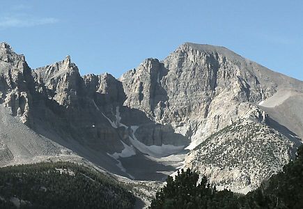 Wheeler Peak
 -
 Mount Moriah
 -

-

-

-
 Bunker Hill
 -

-


See also
 Geography portal
 North America portal
 United States portal
 Mountains portal


- List of mountain peaks of North America
- List of mountain peaks of Greenland
- List of mountain peaks of Canada
- List of mountain peaks of the Rocky Mountains
- List of mountain peaks of the United States
- List of mountain peaks of Alaska
- List of mountain peaks of Arizona
- List of mountain peaks of California
- List of mountain peaks of Colorado
- List of mountain peaks of Hawaiʻi
- List of mountain peaks of Idaho
- List of mountain peaks of Montana
- List of mountain peaks of Nevada
- List of mountain peaks of New Mexico
- List of mountain peaks of Oregon
- List of mountain peaks of Utah
- List of mountain peaks of Washington (state)
- List of mountain peaks of Wyoming
- List of mountain peaks of México
- List of mountain peaks of Central America
- List of mountain peaks of the Caribbean
- Nevada
- Geography of Nevada
- Category:Mountains of Nevada
- commons:Category:Mountains of Nevada
- Category:Mountains of Nevada
- Geography of Nevada
- Physical geography
Notes
- ^ This article defines a significant summit as a summit with at least 100 meters (328.1 feet) of topographic prominence, and a major summit as a summit with at least 500 meters (1640 feet) of topographic prominence. All summits in this article have at least 500 meters of topographic prominence. An ultra-prominent summit is a summit with at least 1500 meters (4921 feet) of topographic prominence.
- ^ All elevations in this article include an elevation adjustment from the National Geodetic Vertical Datum of 1929 (NGVD 29) to the North American Vertical Datum of 1988 (NAVD 88). For further information, please see this United States National Geodetic Survey note.
- ^ a b If the elevation or prominence of a summit is calculated as a range of values, the arithmetic mean is shown.
- ^ The topographic prominence of a summit is the topographic elevation difference between the summit and its highest or key col to a higher summit. The summit may be near its key col or quite far away. The key col for Denali in Alaska is the Isthmus of Rivas in Nicaragua, 7642 kilometers (4749 miles) away.
- ^ The topographic isolation of a summit is the great-circle distance to its nearest point of equal elevation.
Notes
- ^ The summit of Boundary Peak is the highest point of the Snake Range.
- ^ a b c The summit of Wheeler Peak is the highest point of the Snake Range.
- ^ a b c The summit of Mount Jefferson is the highest point of the Toquima Range.
- ^ a b c The elevation of Mount Jefferson includes an adjustment of +1.666 m (5.47 ft) from NGVD 29 to NAVD 88.
- ^ a b c The summit of Charleston Peak is the highest point of the Spring Mountains.
- ^ a b c The summit of North Schell Peak is the highest point of the Schell Creek Range.
- ^ a b c The summit of Arc Dome is the highest point of the Toiyabe Range.
- ^ a b c The elevation of Arc Dome includes an adjustment of +1.665 m (5.46 ft) from NGVD 29 to NAVD 88.
- ^ a b c The summit of Currant Mountain is the highest point of the White Pine Range.
- ^ a b c The summit of Ruby Dome is the highest point of the Ruby Mountains.
- ^ a b c The elevation of Ruby Dome includes an adjustment of +1.429 m (4.69 ft) from NGVD 29 to NAVD 88.
- ^ The elevation of Toiyabe Dome includes an adjustment of +1.579 m (5.18 ft) from NGVD 29 to NAVD 88.
- ^ a b c The summit of Hole in the Mountain Peak is the highest point of the eastern Humboldt Range.
- ^ a b c The elevation of Hole in the Mountain Peak includes an adjustment of +1.457 m (4.78 ft) from NGVD 29 to NAVD 88.
- ^ a b c The summit of Mount Grant is the highest point of the Wassuk Range.
- ^ a b c The elevation of Mount Grant includes an adjustment of +1.456 m (4.78 ft) from NGVD 29 to NAVD 88.
- ^ a b c The summit of Troy Peak is the highest point of the Grant Range.
- ^ The elevation of Aiken Peak includes an adjustment of +1.483 m (4.87 ft) from NGVD 29 to NAVD 88.
- ^ a b The summit of Ward Mountain is the highest point of the Egan Range.
- ^ The elevation of Shoshone Mountain includes an adjustment of +1.521 m (4.99 ft) from NGVD 29 to NAVD 88.
- ^ a b The summit of Table Mountain is the highest point of the Monitor Range.
- ^ a b c The summit of Matterhorn is the highest point of the Jarbidge Mountains.
- ^ a b c The elevation of Matterhorn includes an adjustment of +1.429 m (4.69 ft) from NGVD 29 to NAVD 88.
- ^ a b c The summit of Pilot Peak is the highest point of the Pilot Range.
- ^ a b c The summit of Diamond Peak is the highest point of the Diamond Mountains.
- ^ a b c The summit of Cherry Creek Benchmark is the highest point of the Cherry Creek Range.
- ^ a b c The summit of McAfee Peak is the highest point of the Independence Mountains.
- ^ a b c The summit elevation of McAfee Peak includes a vertical offset of +0.03 m (0.1 ft) from the station benchmark.
- ^ The summit of North Shoshone Peak is the highest point of the Shoshone Mountains.
- ^ a b c The summit of Spruce Mountain is the highest point of the Pequop Mountains.
- ^ a b The summit of Morey Peak is the highest point of the Hot Creek Range.
- ^ The elevation of Quinn Canyon Range high point includes an adjustment of +1.292 m (4.24 ft) from NGVD 29 to NAVD 88.
- ^ The elevation of Becky Peak includes an adjustment of +1.306 m (4.28 ft) from NGVD 29 to NAVD 88.
- ^ a b c The summit of Desatoya Peak is the highest point of the Desatoya Mountains.
- ^ a b The summit of Mount Augusta is the highest point of the Clan Alpine Mountains.
- ^ a b c The summit of Hayford Peak is the highest point of the Sheep Range.
- ^ a b c The summit of Star Peak is the highest point of the Humboldt Range.
- ^ a b c The summit of Mount Tobin is the highest point of the Tobin Range.
- ^ a b c The summit of Granite Peak is the highest point of the Santa Rosa Range.
- ^ a b c The summit elevation of Mount Lewis includes a vertical offset of +0.305 m (1 ft) from the station benchmark.
- ^ a b c The summit of Goshute Peak is the highest point of the Goshute Range.
- ^ a b The summit of Piper Peak is the highest point of the Silver Peak Range.
- ^ a b c The summit of Duffer Peak is the highest point of the Pine Forest Range.
- ^ a b c The elevation of Duffer Peak includes an adjustment of +1.337 m (4.39 ft) from NGVD 29 to NAVD 88.
- ^ a b The summit of Kawich Peak is the highest point of the Kawich Range.
- ^ a b c The summit of Sonoma Peak is the highest point of the Sonoma Range.
- ^ a b c The summit of Highland Peak is the highest point of the Highland Range.
- ^ a b c The summit of Bald Mountain is the highest point of the Groom Range.
- ^ a b The summit of Pilot Peak is the highest point of the Pilot Mountains.
- ^ a b The summit of Jackson Mountain is the highest point of the Jackson Mountains.
- ^ a b The elevation of Jackson Mountain includes an adjustment of +1.275 m (4.18 ft) from NGVD 29 to NAVD 88.
- ^ The summit of Job Peak is the highest point of the Stillwater Range.
- ^ a b The summit of Kumiva Peak is the highest point of the Selenite Range.
- ^ a b The summit of Virginia Peak is the highest point of the Pah Rah Range.
- ^ a b The summit of Adam Peak is the highest point of the Osgood Mountains.
- ^ a b The summit of Orevada View Benchmark is the highest point of the Trout Creek Mountains.
- ^ The summit of Mount Moses is the highest point of the Fish Creek Mountains.
- ^ The summit of Tohakum Peak is the highest point of the Lake Range.
- ^ The elevation of Tohakum Peak includes an adjustment of +1.111 m (3.65 ft) from NGVD 29 to NAVD 88.
- ^ a b The summit of Granite Peak is the highest point of the Granite Range.
- ^ a b The elevation of Granite Peak includes an adjustment of +1.167 m (3.83 ft) from NGVD 29 to NAVD 88.
- ^ a b The summit of Tule Peak is the highest point of the Virginia Mountains.
- ^ a b The summit of North Peak is the highest point of Battle Mountain.
- ^ a b The elevation of Seaman Range high point includes an adjustment of +1.175 m (3.85 ft) from NGVD 29 to NAVD 88.
- ^ The elevation of Eugene Mountains high point includes an adjustment of +1.107 m (3.63 ft) from NGVD 29 to NAVD 88.
- ^ a b The elevation of Jumbo Peak includes an adjustment of +0.726 m (2.38 ft) from NGVD 29 to NAVD 88.
- ^ The summit of Virgin Peak is the highest point of the Virgin Mountains.
- ^ The elevation of Virgin Peak includes an adjustment of +0.888 m (2.91 ft) from NGVD 29 to NAVD 88.
References
- ^ "BOUNDARY PEAK". Datasheet for NGS Station HR2576. U.S. National Geodetic Survey. Retrieved 30 December 2018.
- ^ "Boundary Peak". Geographic Names Information System. United States Geological Survey, United States Department of the Interior.
- ^ "Boundary Peak". Peakbagger.com. Retrieved 30 December 2018.
- ^ a b c "WHEELER PEAK". Datasheet for NGS Station JP0339. U.S. National Geodetic Survey. Retrieved 14 June 2016.
- ^ a b c "Wheeler Peak". Geographic Names Information System. United States Geological Survey, United States Department of the Interior.
- ^ a b c "Wheeler Peak". Peakbagger.com. Retrieved 14 June 2016.
- ^ a b c "Wheeler Peak". Bivouac.com. Retrieved 14 June 2016.
- ^ a b c "MT MORIAH". Datasheet for NGS Station KP0314. U.S. National Geodetic Survey. Retrieved 14 June 2016.
- ^ a b c "Mount Moriah". Geographic Names Information System. United States Geological Survey, United States Department of the Interior.
- ^ a b c "Mount Moriah". Peakbagger.com. Retrieved 14 June 2016.
- ^ a b c "Mount Moriah". Bivouac.com. Retrieved 14 June 2016.
- ^ a b c "Mount Jefferson". Peakbagger.com. Retrieved 14 June 2016.
- ^ a b c "Mount Jefferson". Bivouac.com. Retrieved 14 June 2016.
- ^ a b c "CHARLESTON". Datasheet for NGS Station GR1965. U.S. National Geodetic Survey. Retrieved 14 June 2016.
- ^ a b c "Charleston Peak". Geographic Names Information System. United States Geological Survey, United States Department of the Interior.
- ^ a b c "Charleston Peak". Peakbagger.com. Retrieved 14 June 2016.
- ^ a b c "Charleston Peak". Bivouac.com. Retrieved 14 June 2016.
- ^ a b c "NORTH SHELL". Datasheet for NGS Station KP0332. U.S. National Geodetic Survey. Retrieved 14 June 2016.
- ^ a b c "North Schell Peak". Geographic Names Information System. United States Geological Survey, United States Department of the Interior.
- ^ a b c "North Schell Peak". Peakbagger.com. Retrieved 14 June 2016.
- ^ a b c "North Schell Peak". Bivouac.com. Retrieved 14 June 2016.
- ^ a b c "Arc Dome". Geographic Names Information System. United States Geological Survey, United States Department of the Interior.
- ^ a b c "Arc Dome". Peakbagger.com. Retrieved 14 June 2016.
- ^ a b c "Arc Dome". Bivouac.com. Retrieved 14 June 2016.
- ^ a b c "CURRANT MT". Datasheet for NGS Station JP0700. U.S. National Geodetic Survey. Retrieved 14 June 2016.
- ^ a b c "Currant Mountain". Geographic Names Information System. United States Geological Survey, United States Department of the Interior.
- ^ a b c "Currant Mountain". Peakbagger.com. Retrieved 14 June 2016.
- ^ a b c "Currant Mountain". Bivouac.com. Retrieved 14 June 2016.
- ^ a b "BUNKER HILL". Datasheet for NGS Station KQ0445. U.S. National Geodetic Survey. Retrieved 14 June 2016.
- ^ a b "Bunker Hill". Peakbagger.com. Retrieved 14 June 2016.
- ^ a b c "RUBY DOME CAIRN". Datasheet for NGS Station LQ0693. U.S. National Geodetic Survey. Retrieved 14 June 2016.
- ^ a b c "Ruby Dome". Geographic Names Information System. United States Geological Survey, United States Department of the Interior.
- ^ a b c "Ruby Dome". Peakbagger.com. Retrieved 14 June 2016.
- ^ a b c "Ruby Dome". Bivouac.com. Retrieved 14 June 2016.
- ^ "Toiyabe Dome". Geographic Names Information System. United States Geological Survey, United States Department of the Interior.
- ^ "Toiyabe Dome". Peakbagger.com. Retrieved 14 June 2016.
- ^ "Toiyabe Dome". Bivouac.com. Retrieved 14 June 2016.
- ^ a b c "Hole in the Mountain Peak". Geographic Names Information System. United States Geological Survey, United States Department of the Interior.
- ^ a b c "Hole in the Mountain Peak". Peakbagger.com. Retrieved 14 June 2016.
- ^ a b c "Hole in the Mountain Peak". Bivouac.com. Retrieved 14 June 2016.
- ^ a b c "Mount Grant". Geographic Names Information System. United States Geological Survey, United States Department of the Interior.
- ^ a b c "Mount Grant". Peakbagger.com. Retrieved 14 June 2016.
- ^ a b c "WHITE PINE RESET". Datasheet for NGS Station JP0387. U.S. National Geodetic Survey. Retrieved 14 June 2016.
- ^ a b c "Troy Peak". Geographic Names Information System. United States Geological Survey, United States Department of the Interior.
- ^ a b c "Troy Peak". Peakbagger.com. Retrieved 14 June 2016.
- ^ a b c "Troy Peak". Bivouac.com. Retrieved 14 June 2016.
- ^ "Aiken Peak". Peakbagger.com. Retrieved 14 June 2016.
- ^ "Aiken Peak". Bivouac.com. Retrieved 14 June 2016.
- ^ a b "MOUNT GRAFTON". Datasheet for NGS Station JP0380. U.S. National Geodetic Survey. Retrieved 14 June 2016.
- ^ a b "Mount Grafton". Geographic Names Information System. United States Geological Survey, United States Department of the Interior.
- ^ a b "Mount Grafton". Peakbagger.com. Retrieved 14 June 2016.
- ^ a b "WARD SMALL CAIRN 2". Datasheet for NGS Station KP0471. U.S. National Geodetic Survey. Retrieved 14 June 2016.
- ^ a b "Ward Mountain". Geographic Names Information System. United States Geological Survey, United States Department of the Interior.
- ^ a b "Ward Mountain". Peakbagger.com. Retrieved 14 June 2016.
- ^ a b "Ward Mountain". Bivouac.com. Retrieved 14 June 2016.
- ^ "Shoshone Mountain". Geographic Names Information System. United States Geological Survey, United States Department of the Interior.
- ^ "Shoshone Mountain". Peakbagger.com. Retrieved 14 June 2016.
- ^ "Shoshone Mountain". Bivouac.com. Retrieved 14 June 2016.
- ^ a b "DANVILLE". Datasheet for NGS Station JQ0582. U.S. National Geodetic Survey. Retrieved 14 June 2016.
- ^ a b "Table Mountain". Peakbagger.com. Retrieved 14 June 2016.
- ^ a b "Table Mountain". Bivouac.com. Retrieved 14 June 2016.
- ^ a b "PEARL PEAK". Datasheet for NGS Station LQ0715. U.S. National Geodetic Survey. Retrieved 14 June 2016.
- ^ a b "Pearl Peak". Geographic Names Information System. United States Geological Survey, United States Department of the Interior.
- ^ a b "Pearl Peak". Peakbagger.com. Retrieved 14 June 2016.
- ^ a b "Pearl Peak". Bivouac.com. Retrieved 14 June 2016.
- ^ a b c "Matterhorn". Geographic Names Information System. United States Geological Survey, United States Department of the Interior.
- ^ a b c "Matterhorn". Peakbagger.com. Retrieved 14 June 2016.
- ^ a b c "Matterhorn". Bivouac.com. Retrieved 14 June 2016.
- ^ a b c "MOUNT ROSE RESET". Datasheet for NGS Station KR1728. U.S. National Geodetic Survey. Retrieved 14 June 2016.
- ^ a b c "Mount Rose". Geographic Names Information System. United States Geological Survey, United States Department of the Interior.
- ^ a b c "Mount Rose". Peakbagger.com. Retrieved 14 June 2016.
- ^ a b c "PILOT PEAK". Datasheet for NGS Station MT0738. U.S. National Geodetic Survey. Retrieved 14 June 2016.
- ^ a b c "Pilot Peak". Geographic Names Information System. United States Geological Survey, United States Department of the Interior.
- ^ a b c "Pilot Peak". Peakbagger.com. Retrieved 14 June 2016.
- ^ a b c "Pilot Peak". Bivouac.com. Retrieved 14 June 2016.
- ^ a b c "DIAMOND PEAK". Datasheet for NGS Station KP0435. U.S. National Geodetic Survey. Retrieved 14 June 2016.
- ^ a b c "Diamond Peak". Geographic Names Information System. United States Geological Survey, United States Department of the Interior.
- ^ a b c "Diamond Peak". Peakbagger.com. Retrieved 14 June 2016.
- ^ a b c "CHERRY CREEK". Datasheet for NGS Station KP0369. U.S. National Geodetic Survey. Retrieved 14 June 2016.
- ^ a b c "Cherry Creek Benchmark". Peakbagger.com. Retrieved 14 June 2016.
- ^ a b "BROKEN BACK 2". Datasheet for NGS Station KQ0513. U.S. National Geodetic Survey. Retrieved 14 June 2016.
- ^ a b "Summit Mountain". Geographic Names Information System. United States Geological Survey, United States Department of the Interior.
- ^ a b "Summit Mountain". Peakbagger.com. Retrieved 14 June 2016.
- ^ a b c "JACKS". Datasheet for NGS Station MT0876. U.S. National Geodetic Survey. Retrieved 14 June 2016.
- ^ a b c "McAfee Peak". Geographic Names Information System. United States Geological Survey, United States Department of the Interior.
- ^ a b c "McAfee Peak". Peakbagger.com. Retrieved 14 June 2016.
- ^ "10319". Datasheet for NGS Station LQ0716. U.S. National Geodetic Survey. Retrieved 14 June 2016.
- ^ "Sherman Mountain". Geographic Names Information System. United States Geological Survey, United States Department of the Interior.
- ^ "Sherman Mountain". Peakbagger.com. Retrieved 14 June 2016.
- ^ "Sherman Mountain". Bivouac.com. Retrieved 14 June 2016.
- ^ "NORTH SHOSHONE". Datasheet for NGS Station KQ0454. U.S. National Geodetic Survey. Retrieved 14 June 2016.
- ^ "North Shoshone Peak". Geographic Names Information System. United States Geological Survey, United States Department of the Interior.
- ^ "North Shoshone Peak". Peakbagger.com. Retrieved 14 June 2016.
- ^ "North Shoshone Peak". Bivouac.com. Retrieved 14 June 2016.
- ^ a b c "SPRUCE MTN". Datasheet for NGS Station LQ0670. U.S. National Geodetic Survey. Retrieved 14 June 2016.
- ^ a b c "Spruce Mountain". Geographic Names Information System. United States Geological Survey, United States Department of the Interior.
- ^ a b c "Spruce Mountain". Peakbagger.com. Retrieved 14 June 2016.
- ^ a b "MOREY". Datasheet for NGS Station JQ0561. U.S. National Geodetic Survey. Retrieved 14 June 2016.
- ^ a b "Morey Peak". Geographic Names Information System. United States Geological Survey, United States Department of the Interior.
- ^ a b "Morey Peak". Peakbagger.com. Retrieved 14 June 2016.
- ^ a b "Morey Peak". Bivouac.com. Retrieved 14 June 2016.
- ^ a b "MOUNT CALLAHAN". Datasheet for NGS Station KQ0544. U.S. National Geodetic Survey. Retrieved 14 June 2016.
- ^ a b "Mount Callaghan". Geographic Names Information System. United States Geological Survey, United States Department of the Interior.
- ^ a b "Mount Callaghan". Peakbagger.com. Retrieved 14 June 2016.
- ^ a b "Mount Callaghan". Bivouac.com. Retrieved 14 June 2016.
- ^ "Quinn Canyon Range high point". Peakbagger.com. Retrieved 14 June 2016.
- ^ a b c "ROBERTS CREEK". Datasheet for NGS Station AH8054. U.S. National Geodetic Survey. Retrieved 14 June 2016.
- ^ a b c "Roberts Creek Mountain". Geographic Names Information System. United States Geological Survey, United States Department of the Interior.
- ^ a b c "Roberts Creek Mountain". Peakbagger.com. Retrieved 14 June 2016.
- ^ "Becky Peak". Geographic Names Information System. United States Geological Survey, United States Department of the Interior.
- ^ "Becky Peak". Peakbagger.com. Retrieved 14 June 2016.
- ^ a b c "TWIN". Datasheet for NGS Station KQ0479. U.S. National Geodetic Survey. Retrieved 14 June 2016.
- ^ a b c "Desatoya Peak". Geographic Names Information System. United States Geological Survey, United States Department of the Interior.
- ^ a b c "Desatoya Peak". Peakbagger.com. Retrieved 14 June 2016.
- ^ a b c "Desatoya Peak". Bivouac.com. Retrieved 14 June 2016.
- ^ a b "GRANT". Datasheet for NGS Station KQ0486. U.S. National Geodetic Survey. Retrieved 14 June 2016.
- ^ a b "Mount Augusta". Geographic Names Information System. United States Geological Survey, United States Department of the Interior.
- ^ a b "Mount Augusta". Peakbagger.com. Retrieved 14 June 2016.
- ^ a b "Mount Augusta". Bivouac.com. Retrieved 14 June 2016.
- ^ a b c "HAYFORD". Datasheet for NGS Station GR1917. U.S. National Geodetic Survey. Retrieved 14 June 2016.
- ^ a b c "Hayford Peak". Geographic Names Information System. United States Geological Survey, United States Department of the Interior.
- ^ a b c "Hayford Peak". Peakbagger.com. Retrieved 14 June 2016.
- ^ a b c "Hayford Peak". Bivouac.com. Retrieved 14 June 2016.
- ^ a b c "STAR PEAK RESET". Datasheet for NGS Station LS0554. U.S. National Geodetic Survey. Retrieved 14 June 2016.
- ^ a b c "Star Peak". Geographic Names Information System. United States Geological Survey, United States Department of the Interior.
- ^ a b c "Star Peak". Peakbagger.com. Retrieved 14 June 2016.
- ^ a b c "Star Peak". Bivouac.com. Retrieved 14 June 2016.
- ^ a b c "TOBIN". Datasheet for NGS Station LR0842. U.S. National Geodetic Survey. Retrieved 14 June 2016.
- ^ a b c "Mount Tobin". Geographic Names Information System. United States Geological Survey, United States Department of the Interior.
- ^ a b c "Mount Tobin". Peakbagger.com. Retrieved 14 June 2016.
- ^ a b c "Mount Tobin". Bivouac.com. Retrieved 14 June 2016.
- ^ a b c "SPRING BUTTE". Datasheet for NGS Station MU0442. U.S. National Geodetic Survey. Retrieved 14 June 2016.
- ^ a b c "Granite Peak". Geographic Names Information System. United States Geological Survey, United States Department of the Interior.
- ^ a b c "Granite Peak". Peakbagger.com. Retrieved 14 June 2016.
- ^ a b c "Granite Peak". Bivouac.com. Retrieved 14 June 2016.
- ^ a b c "MT LEWIS". Datasheet for NGS Station LR0905. U.S. National Geodetic Survey. Retrieved 14 June 2016.
- ^ a b c "Mount Lewis". Geographic Names Information System. United States Geological Survey, United States Department of the Interior.
- ^ a b c "Mount Lewis". Peakbagger.com. Retrieved 14 June 2016.
- ^ a b c "Mount Lewis". Bivouac.com. Retrieved 14 June 2016.
- ^ a b c "GOSHUTE". Datasheet for NGS Station LQ0645. U.S. National Geodetic Survey. Retrieved 14 June 2016.
- ^ a b c "Goshute Peak". Geographic Names Information System. United States Geological Survey, United States Department of the Interior.
- ^ a b c "Goshute Peak". Peakbagger.com. Retrieved 14 June 2016.
- ^ a b c "Goshute Peak". Bivouac.com. Retrieved 14 June 2016.
- ^ a b "GALENA SADDLE 2". Datasheet for NGS Station JR1302. U.S. National Geodetic Survey. Retrieved 14 June 2016.
- ^ a b "Mount Siegel". Geographic Names Information System. United States Geological Survey, United States Department of the Interior.
- ^ a b "Mount Siegel". Peakbagger.com. Retrieved 14 June 2016.
- ^ a b "Mount Siegel". Bivouac.com. Retrieved 14 June 2016.
- ^ a b "PIPER PEAK". Datasheet for NGS Station HQ0989. U.S. National Geodetic Survey. Retrieved 14 June 2016.
- ^ a b "Piper Peak". Geographic Names Information System. United States Geological Survey, United States Department of the Interior.
- ^ a b "Piper Peak". Peakbagger.com. Retrieved 14 June 2016.
- ^ a b "Piper Peak". Bivouac.com. Retrieved 14 June 2016.
- ^ a b c "Duffer Peak". Geographic Names Information System. United States Geological Survey, United States Department of the Interior.
- ^ a b c "Duffer Peak". Peakbagger.com. Retrieved 14 June 2016.
- ^ a b c "Duffer Peak". Bivouac.com. Retrieved 14 June 2016.
- ^ a b "KAWICH 2". Datasheet for NGS Station HQ1003. U.S. National Geodetic Survey. Retrieved 14 June 2016.
- ^ a b "Kawich Peak". Geographic Names Information System. United States Geological Survey, United States Department of the Interior.
- ^ a b "Kawich Peak". Peakbagger.com. Retrieved 14 June 2016.
- ^ a b "Kawich Peak". Bivouac.com. Retrieved 14 June 2016.
- ^ a b c "SONOMA". Datasheet for NGS Station LR0852. U.S. National Geodetic Survey. Retrieved 14 June 2016.
- ^ a b c "Sonoma Peak". Geographic Names Information System. United States Geological Survey, United States Department of the Interior.
- ^ a b c "Sonoma Peak". Peakbagger.com. Retrieved 14 June 2016.
- ^ a b c "Sonoma Peak". Bivouac.com. Retrieved 14 June 2016.
- ^ a b c "HIGHLAND". Datasheet for NGS Station HP0338. U.S. National Geodetic Survey. Retrieved 14 June 2016.
- ^ a b c "Highland Peak". Geographic Names Information System. United States Geological Survey, United States Department of the Interior.
- ^ a b c "Highland Peak". Peakbagger.com. Retrieved 14 June 2016.
- ^ a b c "BALD MOUNTAIN". Datasheet for NGS Station HP0383. U.S. National Geodetic Survey. Retrieved 14 June 2016.
- ^ a b c "Bald Mountain". Geographic Names Information System. United States Geological Survey, United States Department of the Interior.
- ^ a b c "Bald Mountain". Peakbagger.com. Retrieved 14 June 2016.
- ^ a b c "Bald Mountain". Bivouac.com. Retrieved 14 June 2016.
- ^ a b "PILOT PEAK". Datasheet for NGS Station JQ0551. U.S. National Geodetic Survey. Retrieved 14 June 2016.
- ^ a b "Pilot Peak". Geographic Names Information System. United States Geological Survey, United States Department of the Interior.
- ^ a b "Pilot Peak". Peakbagger.com. Retrieved 14 June 2016.
- ^ a b "Jackson Mountain". Peakbagger.com. Retrieved 14 June 2016.
- ^ a b "Jackson Mountain". Bivouac.com. Retrieved 14 June 2016.
- ^ a b "NORTH MORMON". Datasheet for NGS Station GR1833. U.S. National Geodetic Survey. Retrieved 14 June 2016.
- ^ a b "Mormon Peak". Geographic Names Information System. United States Geological Survey, United States Department of the Interior.
- ^ a b "Mormon Peak". Peakbagger.com. Retrieved 14 June 2016.
- ^ a b "Mormon Peak". Bivouac.com. Retrieved 14 June 2016.
- ^ "Job Peak". Geographic Names Information System. United States Geological Survey, United States Department of the Interior.
- ^ "Job Peak". Peakbagger.com. Retrieved 14 June 2016.
- ^ "Job Peak". Bivouac.com. Retrieved 14 June 2016.
- ^ "LONE MOUNTAIN". Datasheet for NGS Station JQ0538. U.S. National Geodetic Survey. Retrieved 14 June 2016.
- ^ "Lone Mountain". Geographic Names Information System. United States Geological Survey, United States Department of the Interior.
- ^ "Lone Mountain". Peakbagger.com. Retrieved 14 June 2016.
- ^ "Lone Mountain". Bivouac.com. Retrieved 14 June 2016.
- ^ a b "COWEL". Datasheet for NGS Station LS0665. U.S. National Geodetic Survey. Retrieved 14 June 2016.
- ^ a b "Kumiva Peak". Geographic Names Information System. United States Geological Survey, United States Department of the Interior.
- ^ a b "Kumiva Peak". Peakbagger.com. Retrieved 14 June 2016.
- ^ a b "Kumiva Peak". Bivouac.com. Retrieved 14 June 2016.
- ^ a b "VIRGIN". Datasheet for NGS Station KR1603. U.S. National Geodetic Survey. Retrieved 14 June 2016.
- ^ a b "Virginia Peak". Geographic Names Information System. United States Geological Survey, United States Department of the Interior.
- ^ a b "Virginia Peak". Peakbagger.com. Retrieved 14 June 2016.
- ^ a b "Virginia Peak". Bivouac.com. Retrieved 14 June 2016.
- ^ a b "ADAM". Datasheet for NGS Station MU0422. U.S. National Geodetic Survey. Retrieved 14 June 2016.
- ^ a b "Adam Peak". Geographic Names Information System. United States Geological Survey, United States Department of the Interior.
- ^ a b "Adam Peak". Peakbagger.com. Retrieved 14 June 2016.
- ^ a b "Adam Peak". Bivouac.com. Retrieved 14 June 2016.
- ^ a b "OREVADA VIEW". Datasheet for NGS Station MV0286. U.S. National Geodetic Survey. Retrieved 14 June 2016.
- ^ a b "Orevada View Benchmark". Peakbagger.com. Retrieved 14 June 2016.
- ^ "MOSES". Datasheet for NGS Station LR0839. U.S. National Geodetic Survey. Retrieved 14 June 2016.
- ^ "Mount Moses". Geographic Names Information System. United States Geological Survey, United States Department of the Interior.
- ^ "Mount Moses". Peakbagger.com. Retrieved 14 June 2016.
- ^ "Mount Moses". Bivouac.com. Retrieved 14 June 2016.
- ^ "Tohakum Peak". Geographic Names Information System. United States Geological Survey, United States Department of the Interior.
- ^ "Tohakum Peak". Peakbagger.com. Retrieved 14 June 2016.
- ^ "Tohakum Peak". Bivouac.com. Retrieved 14 June 2016.
- ^ a b "Granite Peak". Geographic Names Information System. United States Geological Survey, United States Department of the Interior.
- ^ a b "Granite Peak". Peakbagger.com. Retrieved 14 June 2016.
- ^ a b "Granite Peak". Bivouac.com. Retrieved 14 June 2016.
- ^ a b "TULE PEAK". Datasheet for NGS Station KR1879. U.S. National Geodetic Survey. Retrieved 14 June 2016.
- ^ a b "Tule Peak". Geographic Names Information System. United States Geological Survey, United States Department of the Interior.
- ^ a b "Tule Peak". Peakbagger.com. Retrieved 14 June 2016.
- ^ a b "Tule Peak". Bivouac.com. Retrieved 14 June 2016.
- ^ a b "BATTLE". Datasheet for NGS Station LR0816. U.S. National Geodetic Survey. Retrieved 14 June 2016.
- ^ a b "North Peak". Geographic Names Information System. United States Geological Survey, United States Department of the Interior.
- ^ a b "North Peak". Peakbagger.com. Retrieved 14 June 2016.
- ^ a b "North Peak". Bivouac.com. Retrieved 14 June 2016.
- ^ a b "Seaman Range high point". Peakbagger.com. Retrieved 14 June 2016.
- ^ a b "Seaman Range high point". Bivouac.com. Retrieved 14 June 2016.
- ^ "Eugene Mountains high point". Peakbagger.com. Retrieved 14 June 2016.
- ^ "Eugene Mountains high point". Bivouac.com. Retrieved 14 June 2016.
- ^ a b "Jumbo Peak". Geographic Names Information System. United States Geological Survey, United States Department of the Interior.
- ^ a b "Jumbo Peak". Peakbagger.com. Retrieved 14 June 2016.
- ^ a b "Jumbo Peak". Bivouac.com. Retrieved 14 June 2016.
- ^ "Virgin Peak". Geographic Names Information System. United States Geological Survey, United States Department of the Interior.
- ^ "Virgin Peak". Peakbagger.com. Retrieved 14 June 2016.
- ^ "Virgin Peak". Bivouac.com. Retrieved 14 June 2016.
- ^ "LONE MOUNTAIN". Datasheet for NGS Station JQ0538. U.S. National Geodetic Survey. Retrieved 14 June 2016.
- ^ "Lone Mountain". Geographic Names Information System. United States Geological Survey, United States Department of the Interior.
- ^ "Lone Mountain". Peakbagger.com. Retrieved 14 June 2016.
- ^ "Lone Mountain". Bivouac.com. Retrieved 14 June 2016.
External links
Mountains of Nevada at Wikipedia's sister projects
 Definitions from Wiktionary
 Media from Commons
 News from Wikinews
 Quotations from Wikiquote
 Texts from Wikisource
 Textbooks from Wikibooks
 Resources from Wikiversity
- United States Geological Survey (USGS)
- Geographic Names Information System @ USGS
- United States National Geodetic Survey (NGS)
- Geodetic Glossary @ NGS
- NGVD 29 to NAVD 88 online elevation converter @ NGS
- Survey Marks and Datasheets @ NGS
- Bivouac.com
- Peakbagger.com
- Peaklist.org
- Peakware.com
- Summitpost.org
- v
- t
- e
Carson City (capital)
- Index
- Geography
- Government
- History
- People
- Symbols
- Tourist attractions
- Transportation
- Fauna
communities
- Alamo
- Amargosa Valley
- Austin
- Baker
- Battle Mountain
- Beatty
- Boulder City
- Caliente
- Carlin
- Carson City
- Elko
- Ely
- Enterprise
- Eureka
- Fallon
- Fernley
- Gardnerville Ranchos
- Gerlach
- Goldfield
- Hawthorne
- Henderson
- Incline Village
- Las Vegas
- Laughlin
- Lovelock
- Mesquite
- Minden
- North Las Vegas
- Panaca
- Pahrump
- Paradise
- Pioche
- Primm
- Rachel
- Reno
- Spanish Springs
- Sparks
- Spring Creek
- Spring Valley
- Stateline
- Summerlin South
- Sun Valley
- Sunrise Manor
- Tonopah
- Virginia City
- West Wendover
- Winnemucca
- Whitney
- Winchester
- Yerington
 Nevada portal
38°59′09″N 114°18′50″W / 38.9858°N 114.3139°W / 38.9858; -114.3139 (Wheeler Peak)


