London Borough of Havering
| | Na tę stronę wskazuje przekierowanie z „Havering”. Zobacz też: Havering-atte-Bower. |
| London Borough of | |||
 Ratusz gminy | |||
| |||
| Państwo |
| ||
|---|---|---|---|
| Kraj |
| ||
| Region | Wielki Londyn | ||
| Burmistrz | Linda Van den Hende | ||
| Powierzchnia | 112,27 km² | ||
| Populacja (2016) • liczba ludności |
| ||
| • gęstość | 2252 os./km² | ||
| Kod pocztowy | RM1, RM2, RM3, RM4, RM5, RM7, RM9, RM11, RM12, RM13, RM14, RM15, CM14 | ||
Położenie na mapie Wielkiego Londynu | |||
| |||
| Strona internetowa | |||


London Borough of Havering – jedna z 32 gmin Wielkiego Londynu położona w jego wschodniej części. Wraz z 19 innymi gminami wchodzi w skład tzw. Londynu Zewnętrznego. Władzę stanowi Rada Gminy Havering (ang. Havering Council).
Historia
Gminę utworzono w 1965 na podstawie ustawy London Government Act 1963[2] z obszarów Romford (ang. Municipal Borough of Romford) utworzonego w 1937 roku[3] oraz Hornchurch (ang. Hornchurch Urban District) utworzonego w 1926 roku[4], które należały do hrabstwa Essex.
Geografia
Gmina Havering ma powierzchnię 112,27 km², graniczy od zachodu z Redbridge i Barking and Dagenham, od południa przez Tamizę z Bexley, zaś od północy i wschodu kolejno z dystryktami Epping Forest, Brentwood i Thurrock w hrabstwie Essex. Dzielnica charakteryzuje się głównie rozwojem podmiejskim z dużymi obszarami chronionej otwartej przestrzeni.
W skład gminy Havering wchodzą następujące obszary:
|
|
Gmina dzieli się na 18 okręgów wyborczych[5] które nie pokrywają się dokładnie z podziałem na obszary, zaś mieszczą się w trzech rejonach tzw. borough constituencies – Romford, Hornchurch and Upminster i Dagenham and Rainham[6].
|
|
Demografia
W 2011 roku gmina Havering miała 237 232 mieszkańców[7].
Podział mieszkańców według grup etnicznych na podstawie spisu powszechnego z 2011 roku[8]:
|
|
Podział mieszkańców według wyznania na podstawie spisu powszechnego z 2011 roku[9]:
- Chrześcijaństwo - 65,6%
- Islam – 2,0%
- Hinduizm – 1,2%
- Judaizm – 0,5%
- Buddyzm – 0,3%
- Sikhizm – 0,8%
- Pozostałe religie – 0,3%
- Bez religii – 22,6%
- Nie podana religia – 6,7%
Podział mieszkańców według miejsca urodzenia na podstawie spisu powszechnego z 2011 roku[10]:
|
|


Transport

Przez Havering przebiega jedna linia metra: District Line.
Stacje metra:
- Elm Park - District Line
- Hornchurch - District Line
- Upminster Bridge - District Line
- Upminster - District Line
Pasażerskie połączenia kolejowe na terenie Havering obsługują przewoźnicy c2c oraz National Express East Anglia.
Stacje kolejowe:
- Emerson Park
- Gidea Park
- Harold Wood
- Rainham
- Romford
- Upminster
Miejsca i muzea


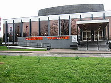
- Queen's Theatre Hornchurch[11]
- Upminster Windmill (wiatrak z 1803 roku)[12]
- Upminster Tithe Barn Museum of Nostalgia[13]
- Havering Museum[14]
- Hornchurch Fine Art[15]
- Rainham Hall[16]
- kościół St Helen and St Giles z XII wieku
- rzeźba The Diver[17]
- Romford Greyhound Stadium[18] (tory wyścigowe na których rozgrywane są wyścigi chartów)
- Romford Ice Arena[19]
- Top Meadow Golf Club[20]
- Cranham Golf Course[21]
- Upminster Golf Club[22]
- Risebridge Golf Centre[23]
- Maylands Golf Club[24]
- Damyns Hall Aerodrome[25]
Edukacja
- Centre for Engineering and Manufacturing Excellence (CEME)[26]
- Havering Sixth Form College[27]
- Havering Adult College[28]
- Havering College of Further and Higher Education[29]
- Colin's Performing Arts College[30]
- St. Edwards Church of England School[31]
- Coopers' Company and Coborn School[32]
Znane osoby
W Havering urodzili się m.in.
- Frank Lampard – piłkarz
- Cliff Williams - muzyk
- Graham Bond – wokalista, muzyk
- Ray Parlour - piłkarz
- Imogen Heap – multiinstrumentalistka, kompozytorka, piosenkarka,
- Tony Adams - piłkarz
- Luciano Bacheta – kierowca wyścigowy
- Tony Parsons – pisarz i dziennikarz
- Stuart Taylor - piłkarz
- Darren Emerson – DJ i były członek zespołu Underworld
- Johnny Herbert – kierowca wyścigowy
- Frankie Bridge - piosenkarka, prezenterka
- Nicky Shorey - piłkarz
Przypisy
- ↑ Population Estimates for UK, England and Wales, Scotland and Northern Ireland - Office for National Statistics [online], www.ons.gov.uk [dostęp 2017-10-16] (ang.).
- ↑ „ Legislation.gov.uk- London Government Act 1963”
- ↑ „visionofbritain.org.uk - unit history of Romford”
- ↑ „visionofbritain.org.uk - unit history of Hornchurch”
- ↑ „Havering Council – Election – results publication”. [dostęp 2011-11-17]. [zarchiwizowane z tego adresu (2012-04-25)].
- ↑ „ukpollingreport.co.uk-london”
- ↑ „ons.gov.uk – 2011 Census: KS102EW Age structure, local authorities in England and Wales”
- ↑ „ons.gov.uk – 2011 Census: KS201EW Ethnic group, local authorities in England and Wales”
- ↑ „ons.gov.uk – 2011 Census: KS209EW Religion, local authorities in England and Wales”
- ↑ „ons.gov.uk – 2011 Census: KS204EW Country of birth, local authorities in England and Wales”
- ↑ „queens-theatre.co.uk/ - Queen's Theatre Hornchurch”
- ↑ „upminsterwindmill.co.uk - Upminster Windmill”. [dostęp 2011-11-17]. [zarchiwizowane z tego adresu (2004-07-22)].
- ↑ „upminstertithebarn.co.uk - Upminster Tithe Barn Museum of Nostalgia”
- ↑ „haveringmuseum.org.uk - Havering Museum”
- ↑ „hornchurchfineart.co.uk - Hornchurch Fine Art”
- ↑ „nationaltrust.org.uk - Rainham Hall”
- ↑ „thediversculpture.com - The Diver”. [dostęp 2011-11-17]. [zarchiwizowane z tego adresu (2011-09-09)].
- ↑ „romfordgreyhoundstadium.co.uk - Romford Greyhound Stadium”
- ↑ „romfordicearena.co.uk - Romford Ice Arena”
- ↑ „topmeadow.co.uk - Top Meadow Golf Club”
- ↑ „haveringactive.co.uk - Cranham Golf Course”
- ↑ „upminstergolfclub.co.uk - Upminster Golf Club”
- ↑ „risebridgegolf.com - Risebridge Golf Centre”
- ↑ „maylandsgolf.com - Maylands Golf Club”
- ↑ „damynshall.co.uk - Damyns Hall Aerodrome”
- ↑ „ceme.co.uk - Centre for Engineering and Manufacturing Excellence”
- ↑ „havering-sfc.ac.uk - Havering Sixth Form College”
- ↑ „haveringadultcollege.co.uk - Havering Adult College”
- ↑ „havering-college.ac.uk - Havering College of Further and Higher Education”
- ↑ „cpastudios.co.uk - Colin's Performing Arts College”
- ↑ „steds.org.uk - St. Edwards Church of England School”
- ↑ „cooperscoborn.org.uk - Coopers' Company and Coborn School”
- p
- d
- e
Gminy Wielkiego Londynu (London boroughs)
Encyklopedia internetowa:
- Britannica: place/Romford, place/Havering
- SNL: Havering
- Catalana: 0032259


