Department in Zanzan, Ivory Coast
Doropo Department Département de Doropo |
|---|
|
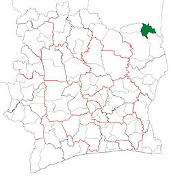 Location in Ivory Coast. Doropo Department has retained the same boundaries since its creation in 2011. |
| Country |  Ivory Coast Ivory Coast |
|---|
| District | Zanzan |
|---|
| Region | Bounkani |
|---|
| 2011 | Established via a division of Bouna Dept |
|---|
| Departmental seat | Doropo |
|---|
| Government |
|---|
| • Prefect | Yapi Konan |
|---|
| Area |
|---|
| • Total | 2,000 km2 (800 sq mi) |
|---|
| Population |
|---|
| • Total | 93,386 |
|---|
| • Density | 47/km2 (120/sq mi) |
|---|
| Time zone | UTC+0 (GMT) |
|---|
Doropo Department is a department of Bounkani Region in Zanzan District, Ivory Coast. In 2021, its population was 93,386 and its seat is the settlement of Doropo. The sub-prefectures of the department are Danoa, Doropo, Kalamon, and Niamoué.
History
Doropo Department was created in 2011 as part of the restructuring of the subdivisions of Ivory Coast, when departments were converted from the second-level administrative subdivisions of the country to the third-level subdivisions. It and Téhini Department were created by splitting Bouna Department into three departments and a fourth area in Comoé National Park that is not governed by a department.
Notes
- ^ "Préfets de Région et de Préfets de Département (Conseil des ministres du mercredi 26 septembre 2012)", abidjan.net, 2 October 2012.
- ^ Citypopulation.de Population of the regions and departments of Ivory Coast
9°49′N 3°21′W / 9.817°N 3.350°W / 9.817; -3.350
 | This Zanzan District location article is a stub. You can help Wikipedia by expanding it. |

 Ivory Coast


