Toulépleu Department
Department in Montagnes, Ivory Coast
Toulépleu Department Département de Toulépleu | |
|---|---|
 Location in Ivory Coast. Toulépleu Department has retained the same boundaries since its creation in 1998. | |
| Country |  Ivory Coast Ivory Coast |
| District | Montagnes |
| Region | Cavally |
| 1998 | Established as a second-level subdivision via a division of Guiglo Dept |
| 2000 | Transferred to the new Moyen-Cavally Region |
| 2011 | Converted to a third-level subdivision |
| Departmental seat | Toulépleu |
| Government | |
| • Prefect | Karim Diarra |
| Area | |
| • Total | 809 km2 (312 sq mi) |
| Population (2021 census)[3] | |
| • Total | 93,529 |
| • Density | 120/km2 (300/sq mi) |
| Time zone | UTC+0 (GMT) |
Toulépleu Department is a department of Cavally Region in Montagnes District, Ivory Coast. In 2021, its population was 93,529 and its seat is the settlement of Toulépleu. The sub-prefectures of the department are Bakoubli, Méo, Nézobly, Péhé, Tiobly, and Toulépleu. It is the westernmost department of Ivory Coast.
History
Toulépleu Department was created in 1998 as a second-level subdivision via a split-off from Guiglo Department.[4] At its creation, it was part of Dix-Huit Montagnes Region. In 2000, Toulépleu Department was transferred to the newly created Moyen-Cavally Region.
In 2011, districts were introduced as new first-level subdivisions of Ivory Coast. At the same time, regions were reorganised and became second-level subdivisions and all departments were converted into third-level subdivisions. At this time, Toulépleu Department became part of Cavally Region in Montagnes District.
Notes
- ^ "Préfets de Région et de Préfets de Département (Conseil des ministres du mercredi 26 septembre 2012)", abidjan.net, 2 October 2012.
- ^ "Présentation de la Région du Cavally", cavally.org, accessed 23 February 2016.
- ^ Citypopulation.de Population of the regions and departments of Ivory Coast
- ^ "Regions of Côte d'Ivoire (Ivory Coast)", statoids.com, accessed 16 February 2016.
- v
- t
- e
|

| Gbôklé Region | |
|---|---|
| Nawa Region | |
| San-Pédro Region |
| Indénié-Djuablin Region |
|
|---|---|
| Sud-Comoé Region |
|
| Folon Region | |
|---|---|
| Kabadougou Region |
|
| Gôh Region | |
|---|---|
| Lôh-Djiboua Region |
| Bélier Region | |
|---|---|
| Iffou Region |
|
| Moronou Region |
|
| N'Zi Region |
|
| Agnéby-Tiassa Region | |
|---|---|
| Grands-Ponts Region |
|
| La Mé Region |
|
| Cavally Region | |
|---|---|
| Guémon Region | |
| Tonkpi Region |
|
| Haut-Sassandra Region |
|
|---|---|
| Marahoué Region |
| Bagoué Region | |
|---|---|
| Poro Region |
|
| Tchologo Region |
|
| Gbêkê Region | |
|---|---|
| Hambol Region |
|
| Bafing Region | |
|---|---|
| Béré Region | |
| Worodougou Region |
|
| Bounkani Region | |
|---|---|
| Gontougo Region |
|
| ||
|---|---|---|
Regional seat: Guiglo | ||
| Bloléquin Department | 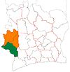 | |
| Guiglo Department | ||
| Taï Department | ||
| Toulépleu Department | ||
* also a commune | ||
Authority control databases | |
|---|---|
| International |
|
| National |
|
6°35′N 8°25′W / 6.583°N 8.417°W / 6.583; -8.417
 | This Montagnes District location article is a stub. You can help Wikipedia by expanding it. |
- v
- t
- e


