Department in Zanzan, Ivory Coast
Nassian Department Département de Nassian |
|---|
|
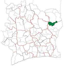 Location in Ivory Coast. Nassian Department has retained the same boundaries since its creation in 2005. |
| Country |  Ivory Coast Ivory Coast |
|---|
| District | Zanzan |
|---|
| Region | Bounkani |
|---|
| 2005 | Established as a second-level subdivision via a division of Bouna Dept |
|---|
| 2011 | Converted to a third-level subdivision |
|---|
| Departmental seat | Nassian |
|---|
| Government |
|---|
| • Prefect | Koné Sounan Jacques |
|---|
| Area |
|---|
| • Total | 2,810 km2 (1,080 sq mi) |
|---|
| Population |
|---|
| • Total | 71,724 |
|---|
| • Density | 26/km2 (66/sq mi) |
|---|
| Time zone | UTC+0 (GMT) |
|---|
Nassian Department is a department of Bounkani Region in Zanzan District, Ivory Coast. In 2021, its population was 71,724 and its seat is the settlement of Nassian. The sub-prefectures of the department are Bogofa, Kakpin, Koutouba, Nassian, and Sominassé.
History
Nassian Department was created in 2005 as a second-level subdivision via a split-off from Bouna Department.[3][4] At its creation, it was part of Zanzan Region.
In 2011, districts were introduced as new first-level subdivisions of Ivory Coast. At the same time, regions were reorganised and became second-level subdivisions, and all departments were converted into third-level subdivisions. At this time, Nassian Department became part of Bounkani Region in Zanzan District.
In 2014, the population of the sub-prefecture of Nassian was 19,971.[5]
Villages
The seventeen villages of the sub-prefecture of Nassian and their population in 2014 are:[5]
- Angobila (1 046)
- Anvéyo (314)
- Bondoyo (1 383)
- Kalabo (50)
- Landé (891)
- Longongara (2 118)
- Nassian (4 785)
- Parhadi (2 823)
- Poum (635)
- Sindé (364)
- Toungbo (264)
- Yaga (259)
- Bougoulaye (732)
- Dédi (554)
- Dépingo (808)
- Talahini (2 609)
- Tienguélé (336)
Notes
- ^ "Préfets de Région et de Préfets de Département (Conseil des ministres du mercredi 26 septembre 2012)", abidjan.net, 2 October 2012.
- ^ Citypopulation.de Population of the regions and departments of Ivory Coast
- ^ Decree 2005-251, 7 July 2005 cited by Decree 2008-97, 5 March 2008. Text of the decree in Sévérin Anouma. "Décentralisation sous Laurent Gbagbo : Une Côte d’Ivoire non exclusive."
- ^ "Regions of Côte d'Ivoire (Ivory Coast)", statoids.com, accessed 16 February 2016.
- ^ a b "RGPH 2014, Répertoire des localités, Région Bounkani" (PDF). ins.ci. Retrieved 5 August 2019.
8°27′N 3°28′W / 8.450°N 3.467°W / 8.450; -3.467
 | This Zanzan District location article is a stub. You can help Wikipedia by expanding it. |

 Ivory Coast


